Category:Spanish-language maps showing history of North America
Jump to navigation
Jump to search
Subcategories
This category has only the following subcategory.
Media in category "Spanish-language maps showing history of North America"
The following 17 files are in this category, out of 17 total.
-
 2 Imperio Mexico 1865.PNG 1,319 × 834; 71 KB
-
 Balboa Voyage 1513.PNG 581 × 316; 48 KB
-
 Colombia (Miranda) y Congreso de Panamá (Bolívar).svg 2,275 × 2,052; 957 KB
-
 Congreso de Panamá.png 7,583 × 6,834; 2.46 MB
-
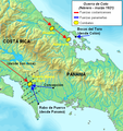 Coto.PNG 536 × 567; 471 KB
-
 Flujo minero en Nueva España.jpg 2,131 × 1,350; 181 KB
-
 Intendencia de yucatán.PNG 237 × 375; 28 KB
-
 Mapa del Ducado de Veragua.png 837 × 373; 89 KB
-
 Mayas.png 1,031 × 757; 1.03 MB
-
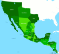 Mexico 1821.PNG 1,669 × 1,518; 38 KB
-
 Mixtecos.png 1,031 × 757; 1.01 MB
-
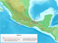
 México División Política-República Central.png 1,098 × 1,181; 319 KB
-
 Olmecas.png 1,031 × 757; 1.01 MB
-
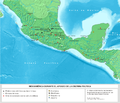
 Poblamiento de America - Teoría P Tardío.png 724 × 575; 387 KB
-
 Toltecas.png 1,033 × 889; 867 KB
-
 Zapotecos.png 1,031 × 757; 1 MB
-
 Área Nuclear Olmeca.png 846 × 909; 476 KB


_y_Congreso_de_Panam%C3%A1_(Bol%C3%ADvar).svg)


