Category:Spanish-language maps of North America
Jump to navigation
Jump to search
Subcategories
This category has the following 6 subcategories, out of 6 total.
C
H
M
P
U
Media in category "Spanish-language maps of North America"
The following 10 files are in this category, out of 10 total.
-
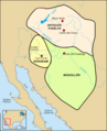 Culturas Hohokam, Antiguos, y Mogollón hacia 1350 d.C..png 720 × 887; 311 KB
-
 Las devastaciones de osorio Español.svg 2,238 × 1,289; 333 KB
-
 Mapa de Saint Domingue en español.svg 5,999 × 5,524; 152 KB
-
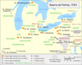 Pontiac's war es.png 969 × 773; 257 KB
-
 Terrirotio español bajo control frances (español).svg 1,545 × 1,165; 734 KB
-
 Tratado de Aranjuez Espanol.svg 7,186 × 3,464; 88 KB
-
 De Haro Nuevo Santander, Mexico c. 1770-1800 UTA.jpg 3,615 × 2,688; 1.71 MB
-
 Hondius-Jansson America Septentrionalis 1636 UTA.jpg 6,814 × 5,786; 18.94 MB
-
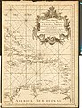
 Lopez & Cruz Cano Mapa Maritima del Golfo de Mexico e Islas de la America 1755 UTA (left).jpg 5,182 × 7,046; 18.14 MB
-


.svg)


.jpg)
.jpg)