Category:Spanish-language SVG maps showing history of Argentina
Jump to navigation
Jump to search
Media in category "Spanish-language SVG maps showing history of Argentina"
The following 21 files are in this category, out of 21 total.
-
 Capitanía General de Chile, 1775.svg 1,710 × 2,684; 4.53 MB
-
 Capitanía General de Chile, 1776.svg 1,710 × 2,684; 4.77 MB
-
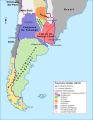
 Capitanía General de Chile, 1810 (Uti possidetis iuris).svg 1,710 × 2,684; 5.8 MB
-
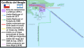 Conflicto del Beagle.svg 1,355 × 772; 1.9 MB
-
 Disputa de la Laguna del Desierto.svg 1,205 × 1,063; 2.62 MB
-

-
 Disputa limítrofe de Alto Palena.svg 1,772 × 2,776; 1.29 MB
-
 Establecimientos del Imperio español en la Patagonia atlántica.svg 570 × 958; 4.31 MB
-
 Laudo limítrofe entre Argentina y Chile de 1902.svg 1,430 × 1,720; 1.51 MB
-
 Liga federal.svg 1,187 × 1,543; 983 KB
-
 Litigio de la Puna de Atacama.svg 414 × 491; 677 KB
-
 Límites Campo de Hielo Patagónico Sur antes de 1994.svg 935 × 1,641; 2.62 MB
-
 Límites Campo de Hielo Patagónico Sur.svg 935 × 1,641; 2.73 MB
-
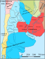
 Mapa ARGENTINA 1816.svg 1,266 × 1,645; 634 KB
-
 Mapa ARGENTINA 1821.svg 1,266 × 1,645; 637 KB
-
 Mapa ARGENTINA 1840 coalicion del norte.svg 1,187 × 1,543; 1.01 MB
-
 Mapa ARGENTINA 1840 expedicion de lavalle.svg 625 × 690; 1.42 MB
-
 Mapa de argentina en 1816.svg 1,003 × 1,297; 408 KB
-
 Protocolo de límites de 1893 entre Argentina y Chile.svg 694 × 589; 929 KB
-
 Puna de Atacama dispute.svg 414 × 491; 649 KB
-
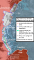
 Pérdidas territoriales de iure de la República de Chile.svg 1,800 × 2,808; 3.84 MB


.svg)


.svg)


