Category:Sowton
Jump to navigation
Jump to search
English: Sowton is a village and civil parish east of Exeter in East Devon, England. It has a population of 639.
village and civil parish in Devon, England, United Kingdom  | |||||
| Upload media | |||||
| Instance of | |||||
|---|---|---|---|---|---|
| Location | East Devon, Devon, South West England, England | ||||
| Population |
| ||||
| Area |
| ||||
 | |||||
Subcategories
This category has the following 7 subcategories, out of 7 total.
Media in category "Sowton"
The following 200 files are in this category, out of 266 total.
(previous page) (next page)-
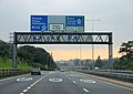
 A115 road junction - geograph.org.uk - 2479532.jpg 640 × 480; 74 KB
-
 A30 - Sowton Road Bridge - geograph.org.uk - 3016736.jpg 640 × 430; 38 KB
-
 A30 approaching Exeter - geograph.org.uk - 1001315.jpg 640 × 455; 68 KB
-
 A30 crossing Clyst Valley - geograph.org.uk - 136974.jpg 640 × 480; 86 KB
-
 A30 east of the M5 - geograph.org.uk - 3641284.jpg 1,849 × 1,188; 981 KB
-
 A30 heading west, nearing junction with M5 - geograph.org.uk - 6263013.jpg 1,024 × 684; 162 KB
-
 A30 heading west, nearing junction with M5 - geograph.org.uk - 6263024.jpg 1,024 × 684; 242 KB
-

-
 A30 in East Devon from the air - geograph.org.uk - 5687164.jpg 2,005 × 1,975; 806 KB
-
 A30 overbridge carries Sowton Lane - geograph.org.uk - 3876737.jpg 3,333 × 2,485; 1 MB
-
 A30 turning, M5 - geograph.org.uk - 2428066.jpg 640 × 457; 59 KB
-
 A30, eastbound - geograph.org.uk - 3016738.jpg 640 × 394; 39 KB
-
 A30, eastbound - geograph.org.uk - 4765484.jpg 640 × 337; 43 KB
-
 A30, westbound - geograph.org.uk - 3092456.jpg 640 × 385; 36 KB
-
 A30, westbound - geograph.org.uk - 4757322.jpg 640 × 284; 27 KB
-
 A3052 at Cat ^ Fiddle - geograph.org.uk - 5254022.jpg 640 × 426; 57 KB
-
 A3052 at Oil Mill Lane - geograph.org.uk - 4812091.jpg 2,943 × 1,832; 1.12 MB
-
 A3052 at Westpoint - geograph.org.uk - 4812081.jpg 1,920 × 1,258; 652 KB
-
 A3052 entering Clyst St Mary - geograph.org.uk - 5254024.jpg 640 × 426; 67 KB
-
 A3052, Cat and Fiddle - geograph.org.uk - 1370238.jpg 640 × 455; 102 KB
-
 An Oak tree in a field - geograph.org.uk - 3190138.jpg 1,024 × 768; 178 KB
-
 Approaching junction 29, A30 - geograph.org.uk - 3092387.jpg 640 × 416; 42 KB
-
 Approaching Junction 30, M5 - geograph.org.uk - 3092533.jpg 640 × 430; 37 KB
-
 Approaching M5, A30 - geograph.org.uk - 2788393.jpg 640 × 479; 42 KB
-
 Approaching M5, A30 - geograph.org.uk - 2788396.jpg 640 × 476; 49 KB
-
 Arable field near Westpoint - geograph.org.uk - 6176171.jpg 3,040 × 1,767; 1.33 MB
-
 Arable field near Westpoint - geograph.org.uk - 6176175.jpg 3,068 × 1,803; 1.03 MB
-
 Ash tree in the Clyst valley - geograph.org.uk - 4960260.jpg 1,890 × 1,240; 866 KB
-
 Barley by Bishop's Court Road - geograph.org.uk - 6176185.jpg 2,872 × 1,745; 702 KB
-
 Barley by Bishop's Court Road - geograph.org.uk - 6176192.jpg 2,221 × 1,281; 399 KB
-
 Barley by Bishop's Court Road - geograph.org.uk - 6176196.jpg 2,467 × 1,561; 645 KB
-
 Barn at Sowton Barton - geograph.org.uk - 5478565.jpg 1,600 × 1,200; 819 KB
-
 Barn in a field - geograph.org.uk - 3190077.jpg 1,024 × 768; 219 KB
-
 Barn, near Marsh Cottage, Sowton - geograph.org.uk - 1541296.jpg 640 × 480; 73 KB
-
 Bishop's Court - geograph.org.uk - 5478609.jpg 1,600 × 1,200; 744 KB
-
 Bishop's Court industrial estate - geograph.org.uk - 1081735.jpg 640 × 480; 173 KB
-
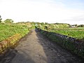
 Bishop's Court Lane - geograph.org.uk - 1156398.jpg 640 × 480; 129 KB
-
 Bishop's Court Lane - geograph.org.uk - 3987181.jpg 4,000 × 3,000; 4.04 MB
-
 Bishops Court Lane - geograph.org.uk - 2275437.jpg 800 × 600; 482 KB
-
 Bishops Court Lane - geograph.org.uk - 2275440.jpg 800 × 600; 465 KB
-

-

-
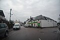
 Blackhorse , Honiton Road - geograph.org.uk - 3491153.jpg 4,288 × 2,848; 6.73 MB
-
 Blackhorse , The Black Horse Inn - geograph.org.uk - 3491152.jpg 4,288 × 2,848; 4.74 MB
-
 Blackhorse , The Black Horse Inn - geograph.org.uk - 3491154.jpg 4,288 × 2,848; 6.1 MB
-
 Blocked road adjacent to Taylor's Brake - geograph.org.uk - 5995996.jpg 640 × 480; 128 KB
-
 Bridge over drainage ditch, Sowton - geograph.org.uk - 5478595.jpg 1,200 × 1,600; 831 KB
-
 Bus company, Langdon's Business Park - geograph.org.uk - 1069239.jpg 640 × 480; 181 KB
-
 Bus stop on the A3052 - geograph.org.uk - 3190120.jpg 1,024 × 768; 251 KB
-
 Canada's finest - Devon County Show - geograph.org.uk - 2959819.jpg 480 × 640; 40 KB
-
 Car park for Cat and Fiddle Inn - geograph.org.uk - 2366576.jpg 800 × 600; 436 KB
-
 Cat and Fiddle park homes - geograph.org.uk - 2366573.jpg 800 × 600; 440 KB
-
 Cat, Sowton - geograph.org.uk - 4959512.jpg 1,920 × 1,286; 964 KB
-
 Cattle, Sowton - geograph.org.uk - 4959595.jpg 2,578 × 1,287; 643 KB
-
 Church tower, Sowton - geograph.org.uk - 3783192.jpg 1,536 × 2,048; 709 KB
-
 Clyst flood plain - geograph.org.uk - 4959932.jpg 1,920 × 966; 501 KB
-
 Clyst floodplain 1 - geograph.org.uk - 1605965.jpg 640 × 480; 246 KB
-
 Clyst floodplain 2 - geograph.org.uk - 1605967.jpg 640 × 480; 226 KB
-
 Clyst St Mary , Car Park - geograph.org.uk - 5708421.jpg 5,447 × 3,631; 5.62 MB
-
 Clyst St Mary , Frog Lane - geograph.org.uk - 5708418.jpg 5,547 × 3,698; 6.53 MB
-
 Clyst St Mary , Frog Lane - geograph.org.uk - 5708419.jpg 5,642 × 3,762; 6.96 MB
-
 Clyst St Mary , Frog Lane - geograph.org.uk - 5708420.jpg 5,563 × 3,708; 6.15 MB
-
 Clyst St Mary , Frog Lane - geograph.org.uk - 5708422.jpg 6,000 × 4,000; 7.66 MB
-
 Clyst St Mary , Frog Lane - geograph.org.uk - 5708423.jpg 5,275 × 3,517; 4.75 MB
-
 Clyst St Mary , The Willows - geograph.org.uk - 5708417.jpg 5,496 × 3,664; 5.77 MB
-
 Clyst St. Mary Bridge - geograph.org.uk - 3986862.jpg 4,000 × 3,000; 2.62 MB
-
 Clyst valley - geograph.org.uk - 4960339.jpg 1,920 × 891; 393 KB
-

-
 Court Lodge, Sowton - geograph.org.uk - 1541319.jpg 640 × 480; 92 KB
-
 Depot on Court Way Hill - geograph.org.uk - 5478642.jpg 1,600 × 1,200; 928 KB
-

-

-
 Devon County Show - crowd - geograph.org.uk - 2953156.jpg 640 × 480; 89 KB
-
 Devon County Show - geograph.org.uk - 2953375.jpg 640 × 480; 101 KB
-
 Devon County Show - livestock judging - geograph.org.uk - 2953366.jpg 640 × 480; 106 KB
-
 Devon County Show - main arena - geograph.org.uk - 2959824.jpg 640 × 480; 93 KB
-
 Devon County Show - parade of hounds - geograph.org.uk - 2953312.jpg 640 × 480; 74 KB
-

-

-
 Devon County Show - ride 'em^ - geograph.org.uk - 2953122.jpg 640 × 480; 90 KB
-
 Devon County Show - sawing by steam - geograph.org.uk - 2953209.jpg 640 × 480; 122 KB
-

-

-
 Devon County Show - threshing and baling - geograph.org.uk - 2958318.jpg 640 × 480; 108 KB
-
 Down hill on Bishop's Court Lane - geograph.org.uk - 3988484.jpg 4,000 × 3,000; 4.94 MB
-
 Drainage channels near Sowton - geograph.org.uk - 3090425.jpg 640 × 480; 95 KB
-
 Drive to business units, Bishop's Court - geograph.org.uk - 5478639.jpg 1,600 × 1,200; 799 KB
-
 Dymond's Bridge and Dymond's Farm - geograph.org.uk - 2275423.jpg 800 × 600; 483 KB
-
 East Devon , Bishop's Court Gardens Business Park - geograph.org.uk - 5708410.jpg 6,000 × 4,000; 5.27 MB
-
 East Devon , Bishop's Court Lane - geograph.org.uk - 5708406.jpg 5,711 × 3,807; 6.31 MB
-
 East Devon , Bishop's Court Lane - geograph.org.uk - 5708408.jpg 6,000 × 4,000; 6.55 MB
-
 East Devon , Bishop's Court Lane - geograph.org.uk - 5708409.jpg 5,059 × 3,372; 6.96 MB
-
 East Devon , Bishop's Court Lane - geograph.org.uk - 5708413.jpg 5,464 × 3,643; 6.8 MB
-
 East Devon , Bishop's Court Lane - geograph.org.uk - 5708414.jpg 6,000 × 4,000; 7.18 MB
-
 East Devon , Bishop's Court Road - geograph.org.uk - 5708415.jpg 5,467 × 3,644; 6.95 MB
-
 East Devon , Bishop's Court Road - geograph.org.uk - 5708416.jpg 6,000 × 4,000; 5.66 MB
-
 East Devon , Countryside ^ Pylons - geograph.org.uk - 3491150.jpg 4,288 × 2,848; 6.08 MB
-
 East Devon , Courtway Farm - geograph.org.uk - 5708412.jpg 5,240 × 3,493; 5.87 MB
-
 East Devon , Devon County Show - geograph.org.uk - 5796231.jpg 6,000 × 4,000; 6.65 MB
-
 East Devon , Devon County Show - geograph.org.uk - 5796232.jpg 4,000 × 6,000; 6.78 MB
-
 East Devon , Exeter Science Park - geograph.org.uk - 3491161.jpg 4,288 × 2,848; 6.16 MB
-
 East Devon , Field ^ Gate - geograph.org.uk - 3491167.jpg 4,288 × 2,848; 5.76 MB
-
 East Devon , Grassy Field ^ Pylons - geograph.org.uk - 3491148.jpg 4,288 × 2,848; 5.94 MB
-
 East Devon , Honiton Road - geograph.org.uk - 3491142.jpg 4,288 × 2,848; 4.53 MB
-
 East Devon , Honiton Road - geograph.org.uk - 3491146.jpg 4,288 × 2,848; 5.99 MB
-
 East Devon , Honiton Road - geograph.org.uk - 3491160.jpg 4,288 × 2,848; 4.85 MB
-
 East Devon , Honiton Road A30 - geograph.org.uk - 3491157.jpg 4,288 × 2,848; 5.5 MB
-
 East Devon , Honiton Road A30 - geograph.org.uk - 3491158.jpg 4,288 × 2,848; 5.04 MB
-
 East Devon , Honiton Road, A30 - geograph.org.uk - 1871350.jpg 3,264 × 2,448; 2.72 MB
-
 East Devon , Old Honiton Road - geograph.org.uk - 3491163.jpg 4,288 × 2,848; 5.29 MB
-
 East Devon , Old Honiton Road - geograph.org.uk - 3491166.jpg 4,288 × 2,848; 4.5 MB
-
 East Devon , Park Drive South - geograph.org.uk - 3491162.jpg 4,288 × 2,848; 5.24 MB
-
 East Devon , River Clyst - geograph.org.uk - 3491149.jpg 4,288 × 2,848; 6.32 MB
-
 East Devon , River Clyst - geograph.org.uk - 4625429.jpg 4,288 × 2,848; 6.43 MB
-
 East Devon , Sowton Lane - geograph.org.uk - 5708385.jpg 6,000 × 4,000; 5.14 MB
-
 East Devon , Westpoint - geograph.org.uk - 6184613.jpg 6,000 × 4,000; 4.64 MB
-
 East Devon , Westpoint - geograph.org.uk - 6184614.jpg 4,000 × 6,000; 4.57 MB
-
 East Devon , Westpoint - geograph.org.uk - 6184615.jpg 6,000 × 4,000; 4.79 MB
-
 East front of Bishop's Court and cedar tree - geograph.org.uk - 5478624.jpg 1,600 × 1,200; 766 KB
-
 East Lodge of Bishop's Court - geograph.org.uk - 2275439.jpg 800 × 600; 434 KB
-
 Entering Sowton - geograph.org.uk - 4959823.jpg 1,920 × 1,097; 393 KB
-

-
 Exeter , A30 Road Junction - geograph.org.uk - 3373924.jpg 4,082 × 2,494; 2.39 MB
-
 Exeter , M5 Junction 30 - geograph.org.uk - 3483611.jpg 3,582 × 2,367; 2.74 MB
-
 Exeter , M5 Motorway - geograph.org.uk - 2490759.jpg 4,278 × 2,834; 3.4 MB
-
 Exeter , M5 Motorway Junction 30 - geograph.org.uk - 3483630.jpg 4,254 × 2,798; 3.77 MB
-
 Exeter District , The M5 Motorway - geograph.org.uk - 3490958.jpg 4,288 × 2,848; 4.73 MB
-
 Exeter District , The M5 Motorway - geograph.org.uk - 5343215.jpg 6,000 × 4,000; 7.57 MB
-
 Exeter District , The M5 Motorway - geograph.org.uk - 5343218.jpg 5,738 × 3,826; 6.7 MB
-
 Exeter District , The M5 Motorway - geograph.org.uk - 5343219.jpg 5,738 × 3,826; 5.95 MB
-
 Falling down - geograph.org.uk - 3189997.jpg 1,024 × 768; 248 KB
-
 Farm buildings near Bishop's Court - geograph.org.uk - 5478614.jpg 1,600 × 1,200; 755 KB
-
 Farmland and trees, Clyst valley - geograph.org.uk - 4953177.jpg 1,262 × 690; 192 KB
-
 Farmland near Bishop's Court - geograph.org.uk - 4959063.jpg 2,837 × 1,338; 609 KB
-
 Field and plantation at Bishop's Court - geograph.org.uk - 2275441.jpg 800 × 600; 394 KB
-
 Field by Dymond's Bridge - geograph.org.uk - 4958888.jpg 1,920 × 1,280; 709 KB
-
 Field near Alder Croft - geograph.org.uk - 4959055.jpg 1,920 × 1,073; 394 KB
-
 Field near Clyst St Mary - geograph.org.uk - 1081749.jpg 640 × 480; 149 KB
-
 Field near Holbrook Farm - geograph.org.uk - 6176163.jpg 3,072 × 1,809; 980 KB
-
 Field next to Langdon's Business Park - geograph.org.uk - 1069237.jpg 640 × 480; 184 KB
-
 Field, Hill Barton - geograph.org.uk - 1370244.jpg 640 × 455; 90 KB
-
 Foot and cycle path beside A30 - geograph.org.uk - 2312854.jpg 800 × 600; 402 KB
-
 Footbridge north of Clyst St Mary - geograph.org.uk - 5478545.jpg 1,200 × 1,600; 858 KB
-
 Footbridge over the Grindle Brook - geograph.org.uk - 3295938.jpg 1,024 × 768; 302 KB
-
 Footpath crosses ploughed field - geograph.org.uk - 3987165.jpg 4,000 × 3,000; 3.37 MB
-
 Footpath to Bishop's Court Lane - geograph.org.uk - 3986929.jpg 4,000 × 3,000; 3.35 MB
-
 Footpath to Clyst St Mary - geograph.org.uk - 2275444.jpg 600 × 800; 473 KB
-
 Footpath to Clyst St Mary through overgrown hedge - geograph.org.uk - 5478647.jpg 1,600 × 1,200; 798 KB
-
 Footpath to Shepherds Farm - geograph.org.uk - 3190087.jpg 1,024 × 768; 227 KB
-
 Footpath to Sowton - geograph.org.uk - 1842829.jpg 640 × 480; 91 KB
-
 Footpath, Clyst St Mary - geograph.org.uk - 1149040.jpg 526 × 640; 96 KB
-
 Frog Lane - geograph.org.uk - 2275445.jpg 800 × 600; 392 KB
-
 Gantry, A30 - geograph.org.uk - 4757323.jpg 640 × 383; 39 KB
-
 Gateway to Bishop's Court - geograph.org.uk - 5996111.jpg 640 × 480; 99 KB
-

-
 Grassland by path to Sowton - geograph.org.uk - 5478620.jpg 1,600 × 1,200; 862 KB
-
 Green lane - geograph.org.uk - 1081746.jpg 640 × 480; 177 KB
-
 Honiton Road entering Exeter - geograph.org.uk - 5705204.jpg 2,048 × 1,536; 1.47 MB
-
 House and church, Sowton - geograph.org.uk - 5478566.jpg 1,600 × 1,200; 760 KB
-
 Houses in Sowton Lane - geograph.org.uk - 5478588.jpg 1,600 × 1,200; 779 KB
-

-

-

-
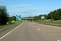
 Joining the M5, Junction 29 - geograph.org.uk - 3092371.jpg 640 × 374; 34 KB
-
 Junction on Honiton Road, Exeter - geograph.org.uk - 5705207.jpg 2,048 × 1,536; 1.48 MB
-
 Kathleen&SybilGarratt.jpg 2,582 × 3,977; 1.73 MB
-

-

-
 Lane through Court Way Hill Plantation - geograph.org.uk - 3988489.jpg 4,000 × 3,000; 4.92 MB
-
 Link road from westbound A30 to westbound M5 - geograph.org.uk - 6263027.jpg 1,024 × 684; 315 KB
-
 M5 approaching Junction 30 - geograph.org.uk - 3649308.jpg 1,750 × 1,093; 969 KB
-
 M5 at junction 30 - geograph.org.uk - 6263035.jpg 1,024 × 684; 214 KB
-
 M5 heading south - geograph.org.uk - 4148539.jpg 4,000 × 2,664; 1.89 MB
-
 M5 Motorway, Exeter - geograph.org.uk - 2006395.jpg 800 × 600; 185 KB
-
 M5 Motorway, Passing Junction 30 - geograph.org.uk - 2006403.jpg 800 × 600; 243 KB
-

-
 M5 to the west - geograph.org.uk - 6263032.jpg 1,024 × 684; 213 KB
-
 M5 warning signs for Junction 30 - geograph.org.uk - 3183548.jpg 3,285 × 2,438; 1.09 MB
-
 Man on sign, Oil Mill Lane - geograph.org.uk - 4812168.jpg 1,920 × 1,279; 846 KB
-
 Maple and oak, Clyst valley - geograph.org.uk - 4960353.jpg 2,749 × 1,998; 1.55 MB
-
 Meadow at Bishop's Court - geograph.org.uk - 1659991.jpg 640 × 480; 90 KB
-
 Meanders on the Clyst - geograph.org.uk - 3090612.jpg 640 × 464; 69 KB
-
 Minor road at Bishop's Court - geograph.org.uk - 1842824.jpg 640 × 480; 138 KB
-
 Minor road leaves Clyst St Mary - geograph.org.uk - 1842819.jpg 640 × 480; 76 KB
-
 Minor road near Clyst St Mary - geograph.org.uk - 1156005.jpg 640 × 480; 98 KB
-

-
 Old leat near Sowton - geograph.org.uk - 4959967.jpg 1,920 × 1,140; 704 KB
-
 Path to Clyst St Mary - geograph.org.uk - 3987154.jpg 640 × 480; 137 KB
-
 Path to Winslade Park Avenue - geograph.org.uk - 3988547.jpg 4,000 × 3,000; 2.98 MB
-
 Piglets at the milk bar - geograph.org.uk - 2953298.jpg 640 × 480; 109 KB
-
 Poles and pylons, Clyst valley - geograph.org.uk - 4960190.jpg 1,525 × 894; 347 KB
-
 Pot Holes in Bishop's Court Lane - geograph.org.uk - 3987183.jpg 4,000 × 3,000; 5.03 MB
-
 Power lines in the valley of the River Clyst - geograph.org.uk - 5478601.jpg 1,600 × 1,200; 664 KB
-
 Pylon by the M5 - geograph.org.uk - 5321573.jpg 640 × 426; 50 KB
-
 Pylon by the M5 - geograph.org.uk - 5356158.jpg 640 × 426; 34 KB
-
 Pylons in the Clyst valley - geograph.org.uk - 4953216.jpg 1,920 × 1,162; 646 KB
-
 River Clyst - geograph.org.uk - 1148883.jpg 640 × 480; 74 KB
-
 River Clyst - geograph.org.uk - 3275725.jpg 2,560 × 1,920; 3.83 MB
-
 River Clyst - geograph.org.uk - 5478603.jpg 1,200 × 1,600; 846 KB
-
 River Clyst and Clyst St Mary Bridge - geograph.org.uk - 2275447.jpg 800 × 600; 347 KB


