Category:Southville (ward)
Jump to navigation
Jump to search
electoral ward of the unitary authority of Bristol  | |||||
| Upload media | |||||
| Instance of |
| ||||
|---|---|---|---|---|---|
| Location | City of Bristol, South West England, England | ||||
| Different from | |||||
 | |||||
Subcategories
This category has the following 5 subcategories, out of 5 total.
A
- Ashton Avenue Bridge (25 F)
- Ashton Gate railway station (16 F)
C
- Clifton Bridge railway station (14 F)
G
- Greville Smyth Park (4 F)
Media in category "Southville (ward)"
The following 200 files are in this category, out of 242 total.
(previous page) (next page)-
 A big pair of eyes on the Co-op - geograph.org.uk - 6257998.jpg 3,296 × 2,472; 3.35 MB
-
 A busy junction approaching Bristol's south west entry - geograph.org.uk - 5906200.jpg 2,304 × 1,704; 1.7 MB
-
 A change of course - geograph.org.uk - 6274253.jpg 3,296 × 2,472; 3.44 MB
-
 A corner shop in North Street - geograph.org.uk - 6257062.jpg 3,296 × 2,472; 3.29 MB
-
 A gatehouse restored to use - geograph.org.uk - 5908164.jpg 2,304 × 1,704; 1.68 MB
-
 A gatehouse with glass and spikes - geograph.org.uk - 5908086.jpg 2,304 × 1,704; 1.61 MB
-
 A humble sink - geograph.org.uk - 5908174.jpg 1,704 × 2,304; 1.3 MB
-
 A lattice suspension - geograph.org.uk - 6189518.jpg 2,472 × 3,296; 3.13 MB
-
 A little patch of green in the suburbs - geograph.org.uk - 6258716.jpg 3,296 × 2,472; 3.33 MB
-
 A maze on a garage - geograph.org.uk - 6274138.jpg 3,296 × 2,472; 3.3 MB
-
 A new shape at the Gate - geograph.org.uk - 5906949.jpg 2,304 × 1,704; 1.31 MB
-
 A school asset - geograph.org.uk - 5908118.jpg 1,704 × 2,304; 1.66 MB
-
 A slippery road^ - geograph.org.uk - 6274261.jpg 3,296 × 2,472; 3.23 MB
-
 A thing for heights - geograph.org.uk - 5906867.jpg 2,304 × 1,704; 1.6 MB
-
 A370 Brunel Way - geograph.org.uk - 5818144.jpg 1,024 × 751; 117 KB
-
 Access Self Storage, Ashton Gate - geograph.org.uk - 6171945.jpg 1,920 × 1,280; 1.08 MB
-
 All manner of creations - geograph.org.uk - 5531970.jpg 2,304 × 1,704; 1.65 MB
-
 Allowing for some movement - geograph.org.uk - 6269391.jpg 2,472 × 3,296; 3.18 MB
-
 An owl and a very large pussycat - geograph.org.uk - 6257072.jpg 3,296 × 2,472; 3.29 MB
-

-
 Asda Bedminster car park - geograph.org.uk - 6274163.jpg 3,296 × 2,472; 3.41 MB
-
 Ashton Avenue Bridge - geograph.org.uk - 5699485.jpg 640 × 480; 69 KB
-
 Ashton busway.jpg 5,312 × 2,988; 4.67 MB
-
 Ashton Gate & Bridge.jpg 1,024 × 768; 49 KB
-
 Ashton Gate Football Stadium - geograph.org.uk - 5911332.jpg 4,000 × 3,000; 2.38 MB
-

-
 Ashton Gate Junior School - geograph.org.uk - 5699339.jpg 640 × 480; 71 KB
-
 Ashton Gate Primary School - geograph.org.uk - 5699026.jpg 640 × 480; 107 KB
-
 Ashton Gate Primary School - geograph.org.uk - 5699342.jpg 640 × 480; 76 KB
-
 Ashton Gate Toll House, North Street - geograph.org.uk - 6058932.jpg 1,024 × 633; 148 KB
-
 Ashton Gatehouse - geograph.org.uk - 5908079.jpg 1,704 × 2,304; 1.66 MB
-
 Ashton Road at the corner of Clift Road - geograph.org.uk - 6170157.jpg 1,920 × 1,280; 1.13 MB
-
 Ashton Road, Ashton Gate - geograph.org.uk - 6173164.jpg 1,920 × 1,280; 1.44 MB
-
 Ashton Road, Ashton Gate - geograph.org.uk - 6174161.jpg 1,920 × 1,280; 880 KB
-
 At the bottom of Greville Street - geograph.org.uk - 6263036.jpg 3,296 × 2,472; 3.38 MB
-
 Balfour Road's new homes - geograph.org.uk - 6263906.jpg 3,099 × 2,324; 1.99 MB
-
 Beauley Road, Bristol - geograph.org.uk - 5698953.jpg 640 × 480; 64 KB
-
 Bedminster identity parade - geograph.org.uk - 5531924.jpg 1,704 × 2,304; 1.57 MB
-
 Bedminster institutions - geograph.org.uk - 5532235.jpg 1,704 × 2,304; 1.39 MB
-
 Bedminster Parade in the sunlight - geograph.org.uk - 6274185.jpg 3,296 × 2,472; 3.29 MB
-
 Bedminster Parade, Bristol - geograph.org.uk - 6170895.jpg 1,848 × 1,162; 962 KB
-
 Bedminster Station - geograph.org.uk - 5994330.jpg 1,024 × 681; 192 KB
-
 Bedminster Station - geograph.org.uk - 5994380.jpg 1,024 × 681; 197 KB
-
 Bedminster Station - geograph.org.uk - 5994382.jpg 1,024 × 681; 209 KB
-
 Bedminsterroundabout.jpg 640 × 480; 91 KB
-
 Benchmark on Lime Street - geograph.org.uk - 6257063.jpg 3,296 × 2,472; 3.59 MB
-
 Biking outside the Hen and Chicken - geograph.org.uk - 6257077.jpg 3,296 × 2,472; 3.4 MB
-
 Bower Ashton Campus, UWE Bristol - geograph.org.uk - 5911294.jpg 4,000 × 3,000; 2.51 MB
-
 Bridge across the muddy Avon - geograph.org.uk - 6207401.jpg 1,024 × 576; 195 KB
-
 Bridge over the River Avon - geograph.org.uk - 5994390.jpg 1,024 × 570; 125 KB
-
 Bristol , Clift House Road - geograph.org.uk - 2392351.jpg 3,264 × 2,448; 2.6 MB
-
 Bristol Beer Factory - geograph.org.uk - 5699446.jpg 640 × 480; 74 KB
-
 Bristol Cumberland - Basin First 37609 (WX58JXT).jpg 1,024 × 768; 215 KB
-
 Bristol Cumberland Basin - First 36808 (YM17FKA).JPG 1,366 × 910; 299 KB
-
 Bristol Cumberland Basin - First 36836 (YP67XDL).JPG 1,366 × 910; 257 KB
-
 Bristol MMB V7 Cumberland Basin.jpg 2,304 × 1,728; 1.22 MB
-
 Bristol MMB V8 Cumberland Basin.jpg 2,304 × 1,728; 1.45 MB
-
 Bristol MMB W3 Cumberland Basin.jpg 2,304 × 1,728; 1.66 MB
-
 Bristol MMB W8 Cumberland Basin.jpg 1,681 × 1,727; 591 KB
-
 Bristol MMB «I2 Bristol to Exeter Line 220004.jpg 3,663 × 2,298; 2.8 MB
-
 Bristol MMB «I9 Windmill Hill.jpg 3,807 × 2,196; 2.97 MB
-
 Bristol MMB «J0 Bristol to Exeter Line.jpg 3,861 × 2,388; 3.75 MB
-
 Bristol MMB «J1 Bristol to Exeter Line.jpg 3,805 × 2,499; 4.52 MB
-
 Bristol South Baths entrance - geograph.org.uk - 6263879.jpg 2,472 × 3,296; 3.25 MB
-
 Bristol South swimming baths - geograph.org.uk - 6271829.jpg 2,472 × 3,296; 3.23 MB
-
 Bristol South Swimming Pool - geograph.org.uk - 5698356.jpg 640 × 480; 90 KB
-
 Bristol South Swimming Pool - geograph.org.uk - 609787.jpg 640 × 480; 74 KB
-
 Bristol southville.png 702 × 780; 148 KB
-
 Bristol sunset TF800ISO.jpg 3,069 × 1,965; 1.78 MB
-
 Bristol Temple Meads Station - geograph.org.uk - 5631468.jpg 640 × 426; 61 KB
-
 Brunel Way - geograph.org.uk - 5699481.jpg 640 × 480; 50 KB
-
 Brunel Way Pump Track - geograph.org.uk - 5634968.jpg 800 × 600; 171 KB
-
 Brunel Way, Ashton Gate - geograph.org.uk - 6171946.jpg 1,824 × 1,116; 1.15 MB
-
 Cameron Balloons premises, Bedminster, Bristol - geograph.org.uk - 5919605.jpg 996 × 1,024; 228 KB
-
 Catherine's House - geograph.org.uk - 6274260.jpg 3,296 × 2,472; 3.3 MB
-
 Celebrating Bristol in 3D - geograph.org.uk - 6269392.jpg 3,296 × 2,472; 3.49 MB
-
 Church Lane houses, Bedminster, Bristol - geograph.org.uk - 5912883.jpg 1,024 × 779; 193 KB
-
 Church Lane, Bedminster, Bristol - geograph.org.uk - 5912852.jpg 1,024 × 774; 209 KB
-
 Circular Cast Iron Urinal, Mill Lane, Bedminster - geograph.org.uk - 6060005.jpg 895 × 1,024; 156 KB
-
 Clarke Street, Bedminster - geograph.org.uk - 6274257.jpg 3,296 × 2,472; 3.4 MB
-
 Clifton Suspension Bridge 1935 - geograph.org.uk - 5815104.jpg 640 × 447; 70 KB
-
 Colourful art on a house on Catherine Mead Street - geograph.org.uk - 6258719.jpg 3,296 × 2,472; 2.46 MB
-
 Containers - geograph.org.uk - 5631463.jpg 640 × 425; 45 KB
-
 Coronation Cafe, Bristol - geograph.org.uk - 2136177.jpg 1,024 × 768; 170 KB
-
 Coronation Road, Bristol - geograph.org.uk - 5699515.jpg 640 × 480; 70 KB
-
 Coronation Road, Southville - geograph.org.uk - 6173159.jpg 1,920 × 1,280; 1.04 MB
-
 Creative mural - geograph.org.uk - 6263033.jpg 3,296 × 2,472; 3.21 MB
-
 Cut Mark, Bristol, The Tobacco Factory - geograph.org.uk - 5702341.jpg 960 × 1,280; 395 KB
-
-
 Dame Emily Park - geograph.org.uk - 5698369.jpg 640 × 480; 111 KB
-
 Dean Lane Park.jpg 116 × 240; 17 KB
-
 Edmundson Electrical, Bedminster, Bristol - geograph.org.uk - 5912705.jpg 1,024 × 785; 177 KB
-
 Entering Dame Emily Park - geograph.org.uk - 6271815.jpg 3,296 × 2,472; 3.5 MB
-
 Footbridge over Portishead Way - geograph.org.uk - 5906871.jpg 2,304 × 1,704; 1.79 MB
-

-
 Former Tobacco Factory, Bedminster - geograph.org.uk - 5698048.jpg 640 × 480; 82 KB
-
 From colour to comfort - geograph.org.uk - 5532123.jpg 2,304 × 1,704; 1.71 MB
-
 From Norfolk Place - geograph.org.uk - 5531934.jpg 1,704 × 2,304; 1.68 MB
-
 Gaol Ferry Bridge from below - geograph.org.uk - 6271877.jpg 3,296 × 2,472; 3.47 MB
-
 Gaol Ferry Bridge, Bristol - geograph.org.uk - 5699516.jpg 640 × 480; 105 KB
-
 Gaol Ferry Bridge, Bristol - geograph.org.uk - 5907916.jpg 1,024 × 750; 770 KB
-
 Gatehouse upper room - geograph.org.uk - 5908183.jpg 2,304 × 1,704; 1.27 MB
-
 Give us a ring - geograph.org.uk - 5532092.jpg 1,704 × 2,304; 1.35 MB
-
 Giving Bristol a higher profile - geograph.org.uk - 6268312.jpg 2,472 × 3,296; 2.98 MB
-
 GPS and EPC Direct, Bedminster, Bristol - geograph.org.uk - 6200579.jpg 1,600 × 958; 334 KB
-
 Graffiti on a Bedminster corner, Bristol - geograph.org.uk - 6200159.jpg 1,600 × 1,200; 532 KB
-
 Greville Smyth Community Bowls Club - geograph.org.uk - 5699456.jpg 640 × 480; 89 KB
-
 Greville Smyth Park by Ashton Road - geograph.org.uk - 6171944.jpg 1,920 × 1,280; 1.91 MB
-
 Greville Smyth Park on Clift House Road - geograph.org.uk - 2470383.jpg 1,500 × 1,000; 330 KB
-
 Greville Smyth Park, Ashton Gate - geograph.org.uk - 5699452.jpg 640 × 480; 115 KB
-
 Greville Smyth Park, Ashton Gate - geograph.org.uk - 6171942.jpg 1,920 × 1,280; 1.96 MB
-
 Hair, Beauty and colourful coral - geograph.org.uk - 6263021.jpg 3,296 × 2,472; 3.29 MB
-
 Handsome terrace houses on Coronation Road, Southville - geograph.org.uk - 2233630.jpg 3,788 × 2,841; 3.57 MB
-
 Helping the light - geograph.org.uk - 5532223.jpg 1,704 × 2,304; 1.56 MB
-
 Hereford Street signpost, Bedminster, Bristol - geograph.org.uk - 6200543.jpg 1,405 × 1,600; 572 KB
-
 Hereford Street, Bedminster, Bristol - geograph.org.uk - 6200550.jpg 1,600 × 1,189; 540 KB
-
 Hobbs House Bakery, - geograph.org.uk - 5698918.jpg 640 × 480; 78 KB
-
 Holy Cross Catholic Church - geograph.org.uk - 5698352.jpg 640 × 480; 76 KB
-
 Holy Trinity church, Dean Lane - geograph.org.uk - 6263887.jpg 3,296 × 2,472; 3.23 MB
-
 House with plaque, Raleigh Road - geograph.org.uk - 5698996.jpg 640 × 480; 59 KB
-
 Houses on St Luke's Crescent - geograph.org.uk - 6174635.jpg 1,673 × 1,150; 529 KB
-
 Hunters estate agents - geograph.org.uk - 6271810.jpg 2,472 × 3,296; 3.16 MB
-
 I'm tired of humans - geograph.org.uk - 5531938.jpg 2,304 × 1,704; 1.68 MB
-
 I've got my eye on you^ - geograph.org.uk - 5699450.jpg 640 × 480; 72 KB
-
 IMO Attended Car Wash, Bedminster, Bristol - geograph.org.uk - 5919596.jpg 1,024 × 799; 191 KB
-
 Iron rope - geograph.org.uk - 6274234.jpg 2,472 × 3,296; 3.05 MB
-
 It's all about the art - geograph.org.uk - 6258013.jpg 2,472 × 3,296; 3.44 MB
-
 Kwik Fit, Malago Road, Bedminster, Bristol - geograph.org.uk - 5912731.jpg 1,024 × 743; 156 KB
-
 Langton Park, Southville - geograph.org.uk - 6170159.jpg 1,920 × 1,280; 890 KB
-
 Leighton Road drops away - geograph.org.uk - 6257069.jpg 3,296 × 2,472; 3.22 MB
-
 Light and colour - geograph.org.uk - 5532163.jpg 1,704 × 2,304; 1.52 MB
-
 Little Paradise, Bedminster, Bristol BS3 - geograph.org.uk - 6200570.jpg 1,492 × 1,600; 459 KB
-
 Lots of teeth on the dentist's surgery - geograph.org.uk - 6263046.jpg 2,472 × 3,296; 3.26 MB
-
 Lucky Lane - geograph.org.uk - 6274131.jpg 3,296 × 2,472; 3.32 MB
-
 Malago Road flats, Bedminster, Bristol - geograph.org.uk - 5912840.jpg 1,024 × 747; 185 KB
-
 Malago sluice - geograph.org.uk - 6274239.jpg 2,472 × 3,296; 3.37 MB
-
 Modernity along North Street - geograph.org.uk - 6263910.jpg 3,296 × 2,472; 3.33 MB
-
 Monkey business at the Tap and Barrel - geograph.org.uk - 6258718.jpg 3,296 × 2,472; 3.33 MB
-
 More room on top - geograph.org.uk - 5531951.jpg 1,704 × 2,304; 1.68 MB
-
 Morph and alter-ego Chas - geograph.org.uk - 5699447.jpg 640 × 495; 74 KB
-
 Mr Clutch Autocentres, Bedminster, Bristol - geograph.org.uk - 5912773.jpg 1,024 × 655; 137 KB
-
 News at the bottom of Langton Park - geograph.org.uk - 6263040.jpg 3,296 × 2,472; 3.31 MB
-
 North Somerset , Bristol Scenery - geograph.org.uk - 5844529.jpg 6,000 × 4,000; 7.53 MB
-
 North Somerset , Bristol Scenery - geograph.org.uk - 5844537.jpg 6,000 × 4,000; 7.8 MB
-
 North Somerset , Bristol Scenery - geograph.org.uk - 5844540.jpg 6,000 × 4,000; 7.08 MB
-
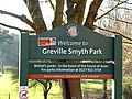 Noticeboard at the entrance to the park - geograph.org.uk - 2256671.jpg 4,000 × 3,000; 4.41 MB
-
 Old Police Station - geograph.org.uk - 5906811.jpg 1,918 × 1,437; 667 KB
-
 Open land in Lydstep Terrace - geograph.org.uk - 6268318.jpg 3,296 × 2,472; 3.53 MB
-
 Ordnance Survey Cut Mark - geograph.org.uk - 5641116.jpg 640 × 375; 89 KB
-
 Park life in Bedminster - geograph.org.uk - 6271826.jpg 3,296 × 2,472; 3.46 MB
-
 Park near Ashton Bridge, Bristol - geograph.org.uk - 2235596.jpg 4,000 × 3,000; 6.32 MB
-
 Parsons Bakery on Gathorne Road, Southville - geograph.org.uk - 6173261.jpg 1,868 × 1,196; 1.18 MB
-
 Path through Greville Smyth Park - geograph.org.uk - 5699483.jpg 640 × 360; 68 KB
-
 Plaque on Raleigh Road house - geograph.org.uk - 5698999.jpg 640 × 480; 60 KB
-
 Poets Corner - geograph.org.uk - 5698592.jpg 640 × 480; 75 KB
-
 Poets Corner 1882 - geograph.org.uk - 5698589.jpg 640 × 404; 58 KB
-
 Post box BS3 1062 (8386747688).jpg 3,000 × 4,000; 4.76 MB
-
 Pre-Worboys sign on Langton Park, Southville - geograph.org.uk - 6177652.jpg 1,920 × 1,280; 995 KB
-
 Premises on Spring Street, Bristol - geograph.org.uk - 6219357.jpg 2,837 × 1,385; 597 KB
-

-
 R Avon ^ Hotwells, Bristol - geograph.org.uk - 5637302.jpg 5,184 × 2,920; 5.71 MB
-
 Railway bridge on Bath Road, Bristol - geograph.org.uk - 6173253.jpg 1,904 × 1,256; 1.41 MB
-
 Railway test train in Temple Meads station - geograph.org.uk - 5579434.jpg 1,024 × 683; 160 KB
-
 Ready for the Metrobus - geograph.org.uk - 5531927.jpg 2,304 × 1,704; 1.58 MB
-
 Rear of an elegant terrace on Coronation Road, Southville - geograph.org.uk - 2229003.jpg 4,000 × 3,000; 3.74 MB
-
 Reusing rope - geograph.org.uk - 6274230.jpg 3,296 × 2,472; 3.48 MB
-
 Robinson's frieze - geograph.org.uk - 5532200.jpg 2,304 × 1,704; 1.37 MB
-
 Salvation Army Church, Dean Lane - geograph.org.uk - 5698595.jpg 640 × 427; 60 KB
-
 Sewage outfall into the Avon - geograph.org.uk - 5634971.jpg 1,024 × 768; 143 KB
-
 Shapes in Bedminster - geograph.org.uk - 6271838.jpg 2,472 × 3,296; 3.19 MB
-
 Shell petrol station on York Road, Bristol - geograph.org.uk - 6173259.jpg 1,866 × 1,194; 1.27 MB
-
 Shops on East Street, Bristol - geograph.org.uk - 5698046.jpg 640 × 480; 89 KB
-
 Slow down outside the school - geograph.org.uk - 6274114.jpg 3,296 × 2,472; 3.32 MB
-
 Some sort of reminder - geograph.org.uk - 5908048.jpg 1,704 × 2,304; 1.67 MB
-
 South Bristol Retail Park - geograph.org.uk - 5906954.jpg 2,304 × 1,704; 1.61 MB
-
 Southbank - geograph.org.uk - 5698343.jpg 640 × 427; 62 KB
-
 Southbank - geograph.org.uk - 5698347.jpg 640 × 480; 89 KB
-
 Southbank centre in Bedminster - geograph.org.uk - 6274106.jpg 3,296 × 2,472; 3.28 MB
-
 Southbank hall - geograph.org.uk - 6274121.jpg 3,296 × 2,472; 3.28 MB
-
 Southville Bristol UK ward map.svg 1,138 × 1,266; 709 KB
-
 Southville Centre, Beauley Street - geograph.org.uk - 5698971.jpg 640 × 480; 76 KB
-
 Southville Deli on North Street - geograph.org.uk - 6173262.jpg 1,920 × 1,280; 1.44 MB
-
 St Catherine's Place building site, Bedminster, Bristol - geograph.org.uk - 6200595.jpg 1,600 × 1,075; 310 KB
-
 St Francis Church, Ashton Gate - geograph.org.uk - 5699348.jpg 640 × 408; 49 KB
-
 St John's haunt - geograph.org.uk - 5532085.jpg 2,304 × 1,704; 1.72 MB
-
 St John's Road, Bedminster, Bristol - geograph.org.uk - 5912826.jpg 1,024 × 981; 201 KB
-
 St Paul's Church, Southville - geograph.org.uk - 5698325.jpg 640 × 480; 73 KB
-
-
 St Pauls, Coronation Road - geograph.org.uk - 6271854.jpg 2,472 × 3,296; 3.34 MB
-
 St Thomas Mar Thomas Church - geograph.org.uk - 5698964.jpg 640 × 480; 77 KB
-
 Stafford Street, Bedminster, Bristol - geograph.org.uk - 6200588.jpg 1,600 × 1,231; 391 KB
-
 Station canopy - geograph.org.uk - 6214865.jpg 1,024 × 768; 474 KB
-
 Statue, Ashton Gate Football Stadium - geograph.org.uk - 5911338.jpg 4,000 × 3,000; 2.52 MB
-
 Storage area - geograph.org.uk - 5631467.jpg 640 × 426; 67 KB
-
 Street art at the Hen and Chicken - geograph.org.uk - 5698927.jpg 640 × 480; 54 KB
-
 Street Art, Exmoor Street - geograph.org.uk - 5698818.jpg 640 × 432; 67 KB
-
 Street vent in New Charlotte Street - geograph.org.uk - 6274176.jpg 2,472 × 3,296; 3.41 MB
-
 Symbolic paths - geograph.org.uk - 5908056.jpg 2,304 × 1,704; 1.53 MB
-
 Telling porkie pies^ - geograph.org.uk - 6274171.jpg 3,296 × 2,472; 2.79 MB
-


.jpg)
.JPG)
.JPG)


.jpg)


&filefrom=The+Ashton%2C+Ashton+Road+-+geograph.org.uk+-+6053838.jpg#mw-category-media)