Category:Sonning Common
Jump to navigation
Jump to search
village and civil parish in Oxfordshire, UK | |||||
| Upload media | |||||
| Instance of | |||||
|---|---|---|---|---|---|
| Location | South Oxfordshire, Oxfordshire, South East England, England | ||||
| Area |
| ||||
| official website | |||||
 | |||||
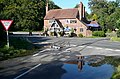
English: Sonning Common (not to be confused with nearby Sonning-on-Thames) is a village and civil parish the Chiltern Hills west of Henley-on-Thames in South Oxfordshire. It is on the B481 road between Reading to the south and Nettlebed to the north.
Media in category "Sonning Common"
The following 88 files are in this category, out of 88 total.
-

-
 Baskerville Road - geograph.org.uk - 2919802.jpg 3,648 × 2,617; 1.6 MB
-
 Bird in Hand - geograph.org.uk - 2578008.jpg 640 × 421; 185 KB
-
 Blackmore Lane - geograph.org.uk - 1713256.jpg 2,592 × 1,944; 2.43 MB
-
 Blount's Court Road - geograph.org.uk - 3495963.jpg 3,968 × 2,232; 2.05 MB
-
 Bluebells in Crosscroft Wood - geograph.org.uk - 3511173.jpg 1,600 × 900; 795 KB
-
 Chalkhouse Green - geograph.org.uk - 9200.jpg 640 × 418; 72 KB
-
 Christ the King, Sonning Common - geograph.org.uk - 3662760.jpg 3,648 × 2,261; 1.23 MB
-
 Church of Christ the King, Sonning Common - geograph.org.uk - 2670646.jpg 3,272 × 2,388; 1.26 MB
-
 Co-operative food store, Sonning Common - geograph.org.uk - 4610581.jpg 2,304 × 1,728; 1.05 MB
-
 Corner of Lambourne Rd. Sonning Common - geograph.org.uk - 2670900.jpg 3,648 × 2,736; 997 KB
-
 Crossroads at Birds Wood - geograph.org.uk - 4875946.jpg 640 × 480; 82 KB
-
 Duckingham Palace Sonning Common.jpg 6,000 × 4,000; 11.51 MB
-
 Duckingham Palace.jpg 3,126 × 1,920; 4.67 MB
-
 Edge of Sonning Common - geograph.org.uk - 1048798.jpg 640 × 427; 217 KB
-

-
 Farmland, Peppard - geograph.org.uk - 1776078.jpg 640 × 480; 169 KB
-
 Farmland, Peppard - geograph.org.uk - 1776088.jpg 640 × 480; 154 KB
-
 Farmland, Sonning Common - geograph.org.uk - 1059243.jpg 640 × 480; 173 KB
-
 Farmland, Sonning Common - geograph.org.uk - 1776077.jpg 640 × 480; 105 KB
-
 Farmland, Sonning Common - geograph.org.uk - 2123000.jpg 640 × 480; 136 KB
-
 Field and Footpath - geograph.org.uk - 3753073.jpg 1,024 × 768; 360 KB
-
 Fields and Woods near Sonning Common - geograph.org.uk - 3789023.jpg 1,600 × 1,122; 496 KB
-
 Fingerpost at The Bird in Hand - geograph.org.uk - 4070130.jpg 1,280 × 960; 286 KB
-
 Fingerpost near Sonning Common - geograph.org.uk - 4070122.jpg 960 × 1,280; 373 KB
-
 Footpath to Chalkhouse Green - geograph.org.uk - 2577999.jpg 640 × 427; 185 KB
-
 Footpath towards Peppard Road - geograph.org.uk - 2577984.jpg 640 × 426; 152 KB
-
 Gravel Hill, Sonning Common - geograph.org.uk - 4606601.jpg 2,304 × 1,728; 836 KB
-
 Home Farm Cottage - geograph.org.uk - 2671669.jpg 3,648 × 2,736; 1.17 MB
-
 House on Kennylands Road, Sonning Common - geograph.org.uk - 4460869.jpg 2,560 × 1,920; 1.48 MB
-
 Houses at Slades Wood - geograph.org.uk - 4879165.jpg 640 × 480; 80 KB
-
 Houses on Kennylands Road, Sonning Common - geograph.org.uk - 4458808.jpg 2,560 × 1,920; 1.99 MB
-
 Houses on Kidmore Lane, Sonning Common - geograph.org.uk - 4458460.jpg 2,560 × 1,920; 2.04 MB
-
 In New Copse - geograph.org.uk - 1048829.jpg 427 × 640; 217 KB
-
 Junction at Little College Wood - geograph.org.uk - 1166912.jpg 426 × 640; 209 KB
-
 Kennylands Road, Sonning Common - geograph.org.uk - 5512915.jpg 640 × 480; 139 KB
-
 Kidmore End War Memorial Hall - geograph.org.uk - 5935829.jpg 1,024 × 683; 1.05 MB
-
 Kidmore Lane at the junction of Reade's Lane - geograph.org.uk - 4458474.jpg 2,560 × 1,920; 1.94 MB
-
 Kidmore Lane at the junction of Reade's Lane - geograph.org.uk - 4606539.jpg 2,304 × 1,728; 813 KB
-
 Millennium Monument, Sonning Common - geograph.org.uk - 3719570.jpg 1,600 × 1,200; 423 KB
-
 Murco garage in Sonning Common - geograph.org.uk - 4606599.jpg 2,304 × 1,728; 858 KB
-
 Newfield Road - geograph.org.uk - 1048792.jpg 640 × 427; 192 KB
-

-

-
 Old Copse, Sonning Common - geograph.org.uk - 2229941.jpg 640 × 480; 180 KB
-
 Old Plough at the Herb Farm - geograph.org.uk - 4130726.jpg 3,968 × 2,232; 1.74 MB
-
 Orchard Avenue - geograph.org.uk - 1048789.jpg 640 × 427; 186 KB
-
 Orchard Avenue, Sonning Common - geograph.org.uk - 2230027.jpg 640 × 480; 117 KB
-
 Outside The Butchers Arms - geograph.org.uk - 2671682.jpg 3,516 × 2,632; 1.99 MB
-
 Pasture and woodland, Sonning Common - geograph.org.uk - 1059566.jpg 640 × 480; 172 KB
-
 Peppard Road in Sonning Common - geograph.org.uk - 4780290.jpg 1,500 × 1,125; 157 KB
-
 Peppard Road in Sonning Common - geograph.org.uk - 4780291.jpg 1,500 × 1,116; 175 KB
-
 Peppard Road in Sonning Common - geograph.org.uk - 4780292.jpg 1,500 × 1,125; 163 KB
-
 Peppard Road passes the Bird in Hand - geograph.org.uk - 4780294.jpg 1,500 × 1,110; 272 KB
-
 Permissive path to Horsepond Road - geograph.org.uk - 1048809.jpg 427 × 640; 197 KB
-
 Pinhole.jpg 800 × 533; 285 KB
-
 Read's Lane, Sonning Common - geograph.org.uk - 4611735.jpg 2,304 × 1,728; 820 KB
-
 Reade's Lane, Sonning Common - geograph.org.uk - 4606541.jpg 2,304 × 1,728; 819 KB
-
 Scania AlexanderDennis Enviro300SG YN14 MYA SonningCommon.jpg 1,280 × 719; 529 KB
-
 Seasonal Colours, Rudgings Plantation - geograph.org.uk - 2670721.jpg 5,417 × 2,592; 2.27 MB
-
 Signpost opposite Bird in Hand - geograph.org.uk - 2578013.jpg 618 × 640; 358 KB
-
 Some gregarious bugs - geograph.org.uk - 3836003.jpg 640 × 480; 351 KB
-

-
 Sonning Common - geograph.org.uk - 9147.jpg 640 × 418; 81 KB
-
 Sonning Common - geograph.org.uk - 9151.jpg 640 × 418; 94 KB
-
 Sonning Common - geograph.org.uk - 9157.jpg 640 × 419; 108 KB
-
 Sonning Common Free Church - geograph.org.uk - 2670677.jpg 3,380 × 2,536; 949 KB
-
 Sonning Common Free Church - geograph.org.uk - 3662768.jpg 3,340 × 2,386; 1.17 MB
-
 Sonning Common Garage - geograph.org.uk - 4879981.jpg 640 × 480; 58 KB
-
 Sonning Common Police Station - geograph.org.uk - 2670703.jpg 640 × 466; 84 KB
-
 Spring fields in Shiplake Bottom - geograph.org.uk - 1841262.jpg 1,024 × 683; 165 KB
-

-

-
 Supermarket and Village Hall, Wood Lane - geograph.org.uk - 1366398.jpg 640 × 480; 273 KB
-
 Telephone Exchange, Sonning Common - geograph.org.uk - 1525120.jpg 640 × 480; 88 KB
-
 The Bird in Hand - geograph.org.uk - 4879139.jpg 640 × 480; 60 KB
-
 The Bird in Hand - geograph.org.uk - 5512899.jpg 640 × 428; 134 KB
-
 The Bird In Hand, Sonning Common - geograph.org.uk - 1841242.jpg 1,024 × 683; 213 KB
-
 The Bird in Hand, Sonning Common - geograph.org.uk - 4070127.jpg 1,280 × 861; 192 KB
-
 The Butcher's Arms - geograph.org.uk - 2919770.jpg 3,648 × 2,736; 2.13 MB
-
 The Butcher's Arms, Sonning Common - geograph.org.uk - 1366395.jpg 640 × 458; 240 KB
-
 The Edge of Morgan's Wood - geograph.org.uk - 5295370.jpg 3,264 × 2,448; 2.04 MB
-
 The Fox at Cane End - geograph.org.uk - 348561.jpg 640 × 477; 85 KB
-
 The Hare and Hounds - geograph.org.uk - 2919784.jpg 3,357 × 2,358; 1.26 MB
-
 Timber stack in New Copse - geograph.org.uk - 1048824.jpg 640 × 427; 222 KB
-
 Trees and Logs, Crowsley Park - geograph.org.uk - 3503407.jpg 2,232 × 3,968; 2.08 MB
-
 Widmore Pond, Sonning Common - geograph.org.uk - 1366397.jpg 640 × 481; 325 KB
-
 Field NE of Sonning Common - geograph.org.uk - 34885.jpg 640 × 480; 69 KB


