Category:Somerville Community Path
Jump to navigation
Jump to search
Rail trail in Somerville, Massachusetts  | |||||
| Upload media | |||||
| Instance of | |||||
|---|---|---|---|---|---|
| Location | Massachusetts | ||||
 | |||||
Subcategories
This category has only the following subcategory.
Media in category "Somerville Community Path"
The following 45 files are in this category, out of 45 total.
-
 Attorney George W Spartichino Park, North Cambridge MA.jpg 4,032 × 3,024; 5.52 MB
-
 East end of SCP at Cedar Street, October 2011.jpg 4,000 × 3,000; 4.58 MB
-
 Fitchburg Cutoff modern status map.svg 1,850 × 1,150; 39 KB
-
 GLX construction southeast of Lowell Street, July 2019.JPG 5,184 × 3,888; 3.75 MB
-
 Rail Trail Community Garden 2.jpg 4,000 × 3,000; 5.52 MB
-
 Rail Trail Community Path Sign with History.jpg 3,000 × 4,000; 5.43 MB
-
 Rail Trail Community Path Sign.jpg 3,000 × 4,000; 2.67 MB
-
 Rail Trail Housing Construction.jpg 3,995 × 2,351; 3.14 MB
-
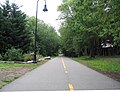 Somerville bike path.jpg 2,011 × 1,542; 2.53 MB
-
 Somerville Community Path construction east of Cedar Street, May 2012.JPG 4,320 × 3,240; 3.38 MB
-

-
 Somerville Community Path from Lowell Street bridge, December 2021.JPG 5,184 × 3,888; 8.6 MB
-
 Somerville Community Path near Lowell Street, July 2019.JPG 5,184 × 3,888; 4.31 MB
-
 Somerville Community Path under Lowell Street, July 2019.JPG 5,184 × 3,888; 3.31 MB
-
 Somerville Community Path, May 2012.JPG 3,774 × 2,902; 3.03 MB
-
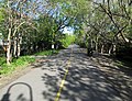
 Somerville Community Path, Somerville MA.jpg 4,032 × 3,024; 5.26 MB
-
 Somerville Community Path. 01.jpg 675 × 900; 144 KB
-
 Somerville Community Path. 02.jpg 675 × 900; 157 KB
-
 Somerville Community Path. 03.jpg 1,200 × 900; 329 KB
-
 Somerville Community Path. 04.jpg 675 × 900; 215 KB
-
 Somerville Community Path. 05.jpg 1,200 × 900; 243 KB
-
 Somerville Community Path. 06.jpg 1,200 × 900; 203 KB
-
 Somerville Community Path. 07.jpg 675 × 900; 123 KB
-
 Somerville Community Path. 08.jpg 675 × 900; 105 KB
-
 Somerville Community Path. 09.jpg 675 × 900; 186 KB
-
 Somerville Community Path. 10.jpg 675 × 900; 165 KB
-
 Somerville Community Path. 11.jpg 1,200 × 900; 218 KB
-
 Somerville Community Path. 12.jpg 1,200 × 900; 214 KB
-
 Somerville Community Path. 13.jpg 1,200 × 900; 230 KB
-
 Somerville Community Path. 14.jpg 1,200 × 900; 248 KB
-
 Somerville Community Path. 15.jpg 1,200 × 900; 217 KB
-
 Somerville Community Path. 16.jpg 1,200 × 900; 293 KB
-
 Somerville Community Path. 17.jpg 1,200 × 900; 270 KB
-
 Somerville Community Path. 18.jpg 1,200 × 900; 275 KB
-
 Somerville Community Path. 19.jpg 1,200 × 900; 243 KB
-
 Somerville Community Path. 20.jpg 1,200 × 900; 187 KB
-
 Somerville, MA - Contaminated Soil Along Bike Path (4520386143).jpg 1,600 × 1,200; 426 KB
-
 Somerville, MA - Contaminated Soil Along Bike Path (4520386345).jpg 2,816 × 2,112; 1.19 MB
-
 Somerville, MA - Contaminated Soil Along Bike Path (4520387995).jpg 2,816 × 2,112; 1.16 MB
-
 Somerville, MA - Contaminated Soil Along Bike Path (4520388141).jpg 1,600 × 1,200; 398 KB
-
 Somerville, MA - Contaminated Soil Along Bike Path (4520388581).jpg 1,200 × 1,600; 328 KB
-
 Somerville, MA - Contaminated Soil Along Bike Path (4520389029).jpg 1,600 × 1,200; 405 KB
-
 Somerville, MA - Contaminated Soil Along Bike Path (4521022562).jpg 1,600 × 1,200; 428 KB
-
 Somerville, MA - Contaminated Soil Along Bike Path (4521025286).jpg 1,600 × 1,200; 418 KB
-
 Somerville, MA - Contaminated Soil Along Bike Path (4521025374).jpg 1,600 × 1,200; 410 KB


.jpg)


.jpg)
.jpg)
.jpg)
.jpg)
.jpg)
.jpg)
.jpg)
.jpg)
.jpg)