Category:Soil science
Soil science is the study of soil as a natural resource on the surface of the earth including soil formation, classification and mapping; physical, chemical, biological, and fertility properties of soils; and these properties in relation to the use and management of soils. [1]
It should be distinguished from Soil mechanics: Soil mechanics is a discipline that applies principles of engineering mechanics to predict the mechanical behavior of soils. Foundations, embankments, retaining walls, earthworks and underground openings are all designed in part with theories from soil mechanics. [2] see in Category:Geotechnics

study of soil as a natural resource on the surface of the earth  | |||||
| Upload media | |||||
| Instance of | |||||
|---|---|---|---|---|---|
| Subclass of | |||||
| Part of | |||||
| Different from | |||||
| |||||
Subcategories
This category has the following 66 subcategories, out of 66 total.
#
*
+
A
C
- Caliche (38 F)
D
- Darcy's Law (17 F)
- DART (47 F)
E
F
G
- Ground stabilization (13 F)
H
- Histosols (2 F)
I
- Soil science icons (6 F)
K
- Krotovina (5 F)
L
M
- Soil moisture sensors (5 F)
P
- Paleopedology (6 F)
- Pedons (1 F)
R
S
- Sediment controls (17 F)
- Soil stabilization (2 F)
- Soil steam sterilization (10 F)
T
- Tensiometer (soil science) (2 F)
U
Pages in category "Soil science"
The following 2 pages are in this category, out of 2 total.
Media in category "Soil science"
The following 180 files are in this category, out of 180 total.
-
 "Soil Erosion in Salem".jpg 4,000 × 3,000; 6.2 MB
-
 08Biocrust (6517406791).jpg 4,000 × 3,000; 9.18 MB
-
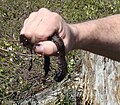
 09Knife (6517347749).jpg 4,000 × 3,000; 6.83 MB
-
 10Transfer (6517359349).jpg 4,000 × 3,000; 6.81 MB
-
 11Stability1 (6517337269).jpg 4,000 × 3,000; 6.47 MB
-
 12Stability2 (6517328625).jpg 4,000 × 3,000; 6.66 MB
-
 13StabilityEquipment (6517319775).jpg 4,000 × 3,000; 7.59 MB
-
 35-tinteniac-hede-érosion-ruissellement-21mai2007 (10).jpg 2,048 × 1,536; 1.07 MB
-
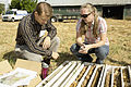
 A soil scientist examines soil health. (24816169900).jpg 4,256 × 2,832; 2.6 MB
-

-

-

-

-

-
 After Drainage Damaged Corrected (21398457034).jpg 3,648 × 5,472; 13.53 MB
-
 Amostragem-de-solo-com-estrutura-preservada.jpg 1,024 × 768; 271 KB
-
 Análise física do solo.jpg 3,328 × 1,872; 978 KB
-
 Apb thick o horizon.jpg 1,950 × 1,600; 2.22 MB
-
 Argillans.JPG 369 × 544; 47 KB
-
 B1e1fb1e76c7f8206d20bdd2a0d2f20e(1).jpg 2,496 × 1,664; 2.89 MB
-
 Badanie odczynu gleby przy użyciu kwasomierza glebowego.png 327 × 248; 148 KB
-
 BissauPolders.jpg 553 × 359; 62 KB
-
 Boden-Quartett.jpg 3,175 × 3,096; 1.81 MB
-
 Bodenerosion manaus weg.jpg 1,600 × 1,200; 370 KB
-
 Bodenkriechen.jpg 4,000 × 3,000; 4.82 MB
-
 Bodensäule vergrößert Senckenberg Museum Görlitz Mike Krüger 180930.jpg 3,648 × 5,472; 7.11 MB
-
 Box-corer disturbed hg.jpg 1,759 × 1,759; 645 KB
-
 Box-corer on-deck hg.jpg 2,695 × 1,759; 850 KB
-

-

-
 Cerosidade, película fina de argila revestindo um agregado.jpg 587 × 391; 110 KB
-
 Coleta indeformada de solo.jpg 717 × 1,274; 281 KB
-
 Core Samples (7896582158).jpg 2,400 × 1,600; 2.24 MB
-
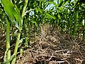 Corn in Residue with Healthy Soil (9314025147).jpg 4,608 × 3,456; 7.05 MB
-
 Cyanobacteria wrapped around sand grains (90x magnification) (8094886300).jpg 3,246 × 2,576; 2.15 MB
-
 Destroyed Part of Field - DPLA - dac0601438d504770d836ab7e8964c7a.jpg 1,678 × 1,020; 226 KB
-
 Double ring.JPG 1,280 × 960; 301 KB
-

-
 EAgronom 4okt2023 L-1117.jpg 6,426 × 4,284; 16.2 MB
-
 EAgronom 4okt2023 L-1120.jpg 4,367 × 6,550; 19.34 MB
-
 EAgronom 4okt2023 L-1128.jpg 6,720 × 4,480; 19.3 MB
-
 EAgronom 4okt2023 L-1207.jpg 6,385 × 4,257; 13.11 MB
-
 EAgronom 4okt2023 L-1215.jpg 6,720 × 4,480; 15.89 MB
-
 Equipment used for determining soil stability. (bdfac7b9-e781-44d1-a75f-6e44f84ec5be).jpg 1,200 × 1,033; 1.44 MB
-
 Erdschichtenmodell Stratorama - Grabungsschnitt (306).jpg 2,736 × 3,648; 2.24 MB
-
 FAO - 2015 anno dei suoli P1080518.jpg 3,456 × 4,608; 6.1 MB
-
 Frost heaving.jpg 4,288 × 3,216; 3.05 MB
-
 Geländegängiges Leichtfahrzeug mit elektrischem Schlaghammer.jpg 808 × 548; 401 KB
-
 Generalized Soil Profile.png 219 × 712; 42 KB
-
 Giesomat Sensor.jpg 4,608 × 3,456; 422 KB
-
 GleyClay.jpg 1,243 × 1,377; 1 MB
-
-

-

-

-
-
 Granulos.jpg 1,392 × 1,040; 93 KB
-
 Grondreiniging dwr.jpg 600 × 402; 59 KB
-
 Hellig pH-meter.jpg 1,836 × 2,639; 1.09 MB
-
 Hetény078.JPG 3,648 × 2,736; 2.62 MB
-
 Hgn-Agregat sol d'activite-LPR.jpg 1,155 × 596; 1.02 MB
-
 Hgn-bloc micromorpho.jpg 960 × 1,280; 1.11 MB
-
 Hgn-Charbon-LNA.jpg 850 × 758; 852 KB
-
 High groundwater damage on the Veszprém Plateau 01.JPG 3,120 × 2,080; 3.47 MB
-
 Humusgehalt.jpg 2,508 × 1,551; 2.47 MB
-
 Hydrosol in north Qld Ingham–Cardwell area.jpg 421 × 790; 121 KB
-
 IJzersporen in zandbodem.jpg 1,037 × 691; 171 KB
-
 IMG-20230526-WA0001.jpg 1,579 × 775; 151 KB
-
 IMG-20230526-WA0002.jpg 1,600 × 900; 262 KB
-
 IMG-20230526-WA0003.jpg 1,600 × 900; 218 KB
-
 IMG-20230526-WA0004.jpg 1,600 × 900; 261 KB
-
 Ivan Alekseev.jpg 2,560 × 1,707; 694 KB
-
 Klappersteen1.jpg 568 × 496; 24 KB
-
 Klappersteen2.jpg 715 × 418; 27 KB
-
 Kohlensaurer Kalk.jpg 2,550 × 1,881; 4.28 MB
-
 Komárom517.JPG 3,648 × 2,736; 2.62 MB
-
 Leemwoestijnoppervlak.PNG 652 × 534; 618 KB
-
 Loess (4844018184).jpg 3,055 × 2,265; 1.05 MB
-
 Loess landscape china.jpg 1,600 × 1,067; 321 KB
-
 Megyercs041.JPG 2,592 × 1,944; 1.42 MB
-
 Messung Boden-pH.jpg 938 × 580; 376 KB
-
 Miernik Testo 410.png 640 × 480; 285 KB
-
 Mollic Calcaric Fluvisol along Agula'e River.tif 3,529 × 1,688; 8.78 MB
-
 Munsell-card-4 hg.jpg 5,505 × 3,008; 1.87 MB
-
 Nc-red-clay-soil-1.jpg 2,560 × 1,920; 531 KB
-
 Nc-red-clay-soil-2.jpg 2,560 × 1,920; 562 KB
-
 NRCS pedon description soil field sheet.pdf 1,650 × 1,275, 2 pages; 78 KB
-
 NRCSAZ84003 - Arizona (499)(NRCS Photo Gallery).jpg 2,100 × 1,500; 5.69 MB
-
 NRCSAZ84003 - Arizona (499)(NRCS Photo Gallery).tif 2,100 × 1,500; 12.4 MB
-
 NRCSCA06012 - California (969)(NRCS Photo Gallery).jpg 2,100 × 1,500; 3.72 MB
-
 NRCSIA99560.png 1,498 × 2,032; 3.37 MB
-
 NRCSPA97020.png 1,500 × 2,100; 3.76 MB
-
 Nährstoffanalysen mit AAS.jpg 962 × 598; 350 KB
-
 Odkrywka1.JPG 3,264 × 2,448; 2.51 MB
-
 Oerijzer TN.JPG 600 × 486; 76 KB
-
 Olzreute-Enzisholz 2016-07-24 2.jpg 2,000 × 3,000; 7.57 MB
-
 Ondrej Kožuch 3.jpg 800 × 819; 82 KB
-
 Organossolo abaixo de horizonte mineral (Ebeling, 2010).png 614 × 938; 1.23 MB
-
 Organossolo Tiomórfico (Beutler, 2016).png 666 × 964; 1.57 MB
-
 OxyaquicEutrudept.JPG 277 × 547; 37 KB
-
 OxyaquicUstifluvent.jpg 288 × 432; 70 KB
-
 Oznaczanie barwy gleby z użyciem tablic Munsella.png 331 × 216; 88 KB
-
 Penetrômetro Digital para Solos PenetroView 01.jpg 2,154 × 1,017; 522 KB
-
 Penetrômetro Digital para Solos PenetroView.jpg 2,154 × 1,017; 435 KB
-
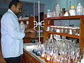
 Pesticide toxicology lab.jpg 2,560 × 1,536; 1.67 MB
-
 Petri3.jpg 637 × 599; 90 KB
-
 Plaike.jpg 2,288 × 1,712; 458 KB
-
 PlintiteKerala.JPG 321 × 500; 60 KB
-
 Podzol Guyane MASSEMIN 2011 (2).jpg 450 × 350; 269 KB
-
 Practical orcharding on rough lands (1911) (20623885580).jpg 3,544 × 2,280; 1.51 MB
-
 Probe.png 240 × 54; 21 KB
-
 Probenahme mit Leichtfahrzeug.jpg 984 × 624; 570 KB
-
 Probenzerkleinerung.jpg 938 × 586; 411 KB
-
 Producto final.JPG 5,152 × 3,864; 7.87 MB
-
 Pédologie micro cheminées de fées Guyane MASSEMIN 2011.jpg 450 × 350; 305 KB
-
 Pédologie Podzol géant tropical Guyane MASSEMIN 2011.jpg 450 × 350; 252 KB
-
 RamRayDomRepSoil.png 972 × 968; 1.88 MB
-
 Runoff of soil & fertilizer.jpg 2,100 × 1,500; 1.13 MB
-
 Sandy soil surface.jpg 800 × 460; 135 KB
-
 Scheibler apparatus.jpg 2,988 × 5,312; 3.73 MB
-
 SeawaterInlet.jpg 553 × 275; 51 KB
-
 Sheaths of cyanobacteria (950x magnification) (8094881091).jpg 3,246 × 2,186; 2.15 MB
-
 Single ring.JPG 1,280 × 960; 303 KB
-
 Soil experiment (7000920647).jpg 1,003 × 1,000; 66 KB
-
 Soil horizons.JPG 640 × 480; 94 KB
-
 Soil material containing Sand, silt, clay.jpg 3,504 × 2,336; 4.61 MB
-
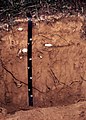
 Soil profile 0-125cm.jpg 3,024 × 4,032; 2.55 MB
-
 Soil sieve nest holder.png 432 × 394; 317 KB
-
 Soil sieve nests placed in the oven..png 391 × 391; 266 KB
-
 Soil sieve nests with aggregates.png 495 × 324; 312 KB
-
 Soil survey 1923.jpg 943 × 524; 70 KB
-
 Soil Survey09 (39041768842).jpg 2,250 × 1,500; 3.61 MB
-
 Soil-Munsell-Colour-Book.jpg 3,264 × 2,448; 3.48 MB
-
 SoilClod.jpg 3,024 × 4,032; 1.45 MB
-
 Soilcontam.JPG 1,632 × 1,224; 392 KB
-
 Soils - General - DPLA - 51c4b0e6de441b38d76b140695e1da9a.jpg 2,733 × 3,930; 852 KB
-
 Solonetz-vegetation.jpg 1,494 × 1,049; 443 KB
-
 Solontchak.jpg 2,048 × 1,536; 1.09 MB
-
 Solontchak.png 134 × 125; 31 KB
-
 Sonda ThetaProbe.png 243 × 428; 248 KB
-
 Spun-how-it-works-horizontal-stack.png 888 × 284; 285 KB
-
 Stabilized soil mixing plant.jpg 400 × 300; 32 KB
-

-

-

-
 Stream without conservation buffers.jpg 2,100 × 1,500; 1.42 MB
-
 Szafa termostatowa z reaktorami beztlenowymi.png 544 × 318; 361 KB
-
 Tanah terbiar di Bandar Baru Bangi.jpg 2,592 × 1,944; 1.54 MB
-
 Texture of some important soil formations (1896) (14594863737).jpg 2,208 × 1,672; 1.19 MB
-
 The Mastersizer 3000.jpg 5,312 × 2,988; 4.26 MB
-
 Titration for Soil.JPG 3,072 × 2,304; 3.11 MB
-
 Torv h1.JPG 1,031 × 1,672; 462 KB
-
 Torv H8.JPG 1,644 × 1,443; 702 KB
-
 TypicPaleudoll.jpg 288 × 432; 121 KB
-
 TypicUdipsamment.JPG 384 × 537; 41 KB
-
 Urban soil experiment (6931111952).jpg 1,603 × 1,603; 330 KB
-
 Urgesteinsmehl.jpg 2,886 × 1,950; 3.25 MB
-
 Vejstøv-gødning.jpg 1,360 × 908; 647 KB
-
 Vertissolo Ebânico (SIBCS, 2018).png 716 × 985; 1.95 MB
-
 Vertissolo Hidromórfico (SIBCS, 2018).png 716 × 957; 1.57 MB
-
 Vertissolo Háplico (SIBCS, 2018).png 715 × 955; 1.94 MB
-
 Wandern Schweiz auf Cassons bei Flims.jpg 3,264 × 2,448; 2.88 MB
-
 Wandern Schweiz Frostmusterboden Steinstreifen Cassons.jpg 3,264 × 2,448; 2.88 MB
-
 Water coarse beads.JPG 338 × 304; 24 KB
-
 Weilbach Kiesgruben fg01.jpg 1,200 × 798; 654 KB
-
 Wet sieving apparatus with soil sieve nest holder and nests in place.png 323 × 483; 257 KB
-
 Willow cuttings planting operation.jpg 902 × 714; 464 KB
-
 В окрестностях Фрумушики.jpg 5,472 × 3,132; 21.45 MB
-
 Підзол.jpg 1,200 × 900; 1,020 KB
-
 Создание почвенного разреза.jpg 4,000 × 3,000; 3.2 MB
-
 Խոնաւաչափ.JPG 2,848 × 2,136; 1.27 MB
-
 Ծակոտկենութեան չափում.JPG 2,848 × 2,136; 1.44 MB
-
 Հող ջրով.JPG 1,700 × 2,844; 1.15 MB
-
 Հողաթեստ 2.JPG 2,848 × 2,136; 1.3 MB
-
 Հողամաղ.JPG 2,848 × 2,136; 1.43 MB
-
 Հողանմուշի գործիք 2.JPG 2,588 × 356; 238 KB
-
 Հողանմուշի գործիք.JPG 1,224 × 2,532; 693 KB
-
 Հողաջրաչափ.JPG 484 × 2,600; 347 KB
-
 Հողի թեստ.JPG 2,136 × 2,848; 1.35 MB
-
 קרום קרקע ביולוגי.jpg 2,265 × 1,505; 1.25 MB

.jpg)
.jpg)
.jpg)
.jpg)
.jpg)
.jpg)
.jpg)
.jpg)
.jpg)
.jpg)
.jpg)
.jpg)
.jpg)


.jpg)


.jpg)
.jpg)
_(8094886300).jpg)


.jpg)
.jpg)


.jpg)


(NRCS_Photo_Gallery).jpg)
(NRCS_Photo_Gallery).jpg)


.png)
.png)


.jpg)
_(20623885580).jpg)


_(8094881091).jpg)

.jpg)


.jpg)


.jpg)
.jpg)


_(14594863737).jpg)


.jpg)


.png)
.png)
.png)


.jpg)
_(14595943777).jpg)