Category:Slipways in Cornwall
Jump to navigation
Jump to search

Subcategories
This category has only the following subcategory.
S
Media in category "Slipways in Cornwall"
The following 41 files are in this category, out of 41 total.
-
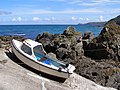 Boat on the slipway at Pendeen Cove - geograph.org.uk - 230141.jpg 640 × 480; 141 KB
-
 Boathouse and slipway by the Helford River (29334445216).jpg 3,354 × 1,796; 6.24 MB
-
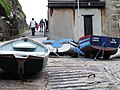 Boats on slipway, Polpeor Cove - geograph.org.uk - 548458.jpg 640 × 480; 101 KB
-
 Boats on the Slipway - geograph.org.uk - 1761230.jpg 1,024 × 682; 209 KB
-
 Boscastle Harbour - geograph.org.uk - 413608.jpg 640 × 453; 131 KB
-
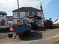
 Bringing back the catch - geograph.org.uk - 449467.jpg 640 × 426; 62 KB
-
 Coverack Slipway - geograph.org.uk - 35179.jpg 640 × 480; 64 KB
-
 Cremyll - Slipway - geograph.org.uk - 980853.jpg 640 × 480; 78 KB
-
 Cremyll - Slipway cropped.jpg 614 × 420; 62 KB
-
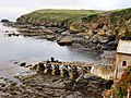 Disused lifeboat slipway, Polpeor Cove - geograph.org.uk - 1705882.jpg 1,024 × 768; 322 KB
-
 Fowey River Ferry, Cornwall (050187) (9453233319).jpg 2,914 × 2,316; 1.96 MB
-
 Fowey Rivers Ferry, Cornwall - panoramio.jpg 2,048 × 1,628; 1.06 MB
-
 Hayle Harbour slipway - geograph.org.uk - 179114.jpg 640 × 480; 92 KB
-
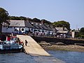
 Lanteglos, the Old Ferry Inn, Bodinnick - geograph.org.uk - 138234.jpg 640 × 427; 127 KB
-
 Mullion Cove slipway - geograph.org.uk - 179082.jpg 640 × 480; 102 KB
-
 Mullion Cove, Lizard Peninsula - geograph.org.uk - 355944.jpg 640 × 480; 93 KB
-
 New lifeboat slipway at Sennen Cove - geograph.org.uk - 1389227.jpg 640 × 480; 77 KB
-
 Newlyn Slip and the south pier - geograph.org.uk - 925727.jpg 640 × 480; 252 KB
-
 Old lifeboat house and slipway, Lizard - geograph.org.uk - 720571.jpg 640 × 517; 119 KB
-
 Padstow harbour slipway - geograph.org.uk - 484750.jpg 640 × 480; 120 KB
-
 Padstow north quay slipway - geograph.org.uk - 482285.jpg 640 × 480; 81 KB
-
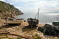 Penberth Cove - geograph.org.uk - 178014.jpg 640 × 427; 99 KB
-
 Penzance slipway - geograph.org.uk - 15718.jpg 640 × 425; 139 KB
-
 Polperro Slipway - geograph.org.uk - 1691218.jpg 999 × 669; 305 KB
-
 Port Quin and the fields beyond - geograph.org.uk - 68113.jpg 640 × 392; 79 KB
-
 Porthgwarra Slipway.jpg 1,836 × 2,453; 3.92 MB
-
 Portloe slipway - geograph.org.uk - 184208.jpg 640 × 427; 88 KB
-
 Portscatho - geograph.org.uk - 561816.jpg 640 × 480; 143 KB
-
 Saltash slipway.jpg 3,756 × 2,752; 4.98 MB
-
 Sennen Cove - geograph.org.uk - 449460.jpg 640 × 426; 88 KB
-
 Sennen Cove - geograph.org.uk - 46329.jpg 640 × 425; 112 KB
-
 Slipway at Church Cove - geograph.org.uk - 184746.jpg 640 × 427; 95 KB
-
 Slipway at Hawker's Cove - geograph.org.uk - 184676.jpg 640 × 427; 103 KB
-
 Slipway at Point Quay - geograph.org.uk - 1218241.jpg 640 × 426; 65 KB
-
 Slipway at Trevissome - geograph.org.uk - 1526239.jpg 640 × 427; 69 KB
-
 The Harbour, Portloe - geograph.org.uk - 412387.jpg 640 × 481; 116 KB
-
 The slipway at Port Quin - geograph.org.uk - 1290801.jpg 640 × 502; 131 KB
-
 The Slipway at Sennen Cove - geograph.org.uk - 912089.jpg 640 × 426; 332 KB
-
 The Slipway, Portscatho. - geograph.org.uk - 371110.jpg 640 × 480; 124 KB
-
 Bathpool, Slipway into the Lynher - geograph.org.uk - 534085.jpg 640 × 480; 201 KB
-
 The slipway, East Looe - geograph.org.uk - 293163.jpg 640 × 422; 72 KB

.jpg)


_(9453233319).jpg)


