Category:Sittingbourne
Jump to navigation
Jump to search
industrial town in Kent, England, United Kingdom  | |||||
| Upload media | |||||
| Instance of | |||||
|---|---|---|---|---|---|
| Location | Swale, Kent, South East England, England | ||||
 | |||||
English: Sittingbourne is an industrial town about eight miles (12.9 km) east of Gillingham in England, beside the Roman Watling Street off a creek in the Swale, a channel separating the Isle of Sheppey from mainland Kent. The town is growing rapidly due to a number of large residential developments, and its train line links to London Victoria, the journey taking about an hour from Sittingbourne railway station.
Français : Sittingbourne est une ville industrielle située à environ 13 kilomètres de Gillingham, dans le comté du Kent, dans le sud-est de l'Angleterre.
Nederlands: Sittingbourne is een plaats in het bestuurlijke gebied Swale, in het Engelse graafschap Kent. De plaats telt 55.000 inwoners.
Română: Sittingbourne este un oraş în comitatul Kent, regiunea South East, Anglia. Oraşul se află în districtul Swale a cărui reşedinţă este.
Subcategories
This category has the following 13 subcategories, out of 13 total.
Media in category "Sittingbourne"
The following 200 files are in this category, out of 211 total.
(previous page) (next page)-
 "The Bargee", Sittingbourne High Street - geograph.org.uk - 418984.jpg 640 × 480; 121 KB
-
 (42) Morrisons, Sittingbourne, 20 March 2014.jpg 480 × 640; 42 KB
-
 112 High St. - geograph.org.uk - 160706.jpg 640 × 480; 88 KB
-
 165 Park Rd - geograph.org.uk - 160707.jpg 640 × 480; 97 KB
-
 62 Bell Road Oast House, Sittingbourne - geograph.org.uk - 3123717.jpg 4,288 × 3,216; 3.56 MB
-

-
 A2 in Sittingbourne - geograph.org.uk - 2998244.jpg 640 × 430; 72 KB
-
 A2, Sittingbourne - geograph.org.uk - 3001180.jpg 640 × 390; 58 KB
-
 A2, Sittingbourne - geograph.org.uk - 3167037.jpg 640 × 430; 67 KB
-
 Access road to Kemsley Paper Mill - geograph.org.uk - 1713999.jpg 2,580 × 1,932; 1.1 MB
-
 Admiralty Chart No 2572 West Swale Fowley Island to Queenborough, Published 1918.jpg 11,214 × 16,292; 65.47 MB
-
 Admiralty Charts No 2571 2572 Swale, Published 1918 (composite).jpg 30,461 × 16,311; 128.19 MB
-
 Adult training gym, Sittingbourne - geograph.org.uk - 2248987.jpg 3,072 × 2,304; 1.62 MB
-
 Allotments on Riddles Road - geograph.org.uk - 364027.jpg 640 × 480; 117 KB
-
 Allotments on Riddles Road - geograph.org.uk - 4957.jpg 640 × 259; 42 KB
-
 An unidentified rebuilt Bulleid Light Pacifc 34???.jpg 556 × 363; 122 KB
-
 Avenue of Remembrance, Sittingbourne - geograph.org.uk - 2479316.jpg 3,072 × 2,304; 3.22 MB
-
 B.R.(S.R.) Class "4-CEP" 7137.jpg 619 × 415; 218 KB
-
 Barge Way - geograph.org.uk - 1714015.jpg 2,580 × 1,932; 838 KB
-
 Bayford Meadows Karting Circuit - geograph.org.uk - 1073652.jpg 640 × 481; 58 KB
-
 Beaconsfield Road, Sittingbourne - geograph.org.uk - 997112.jpg 640 × 480; 40 KB
-
 Blue Giant - geograph.org.uk - 1282009.jpg 640 × 480; 61 KB
-
 Blue Sports Pavilion, Sittingbourne - geograph.org.uk - 3123733.jpg 4,288 × 3,216; 3.74 MB
-
 BP Petrol Station - geograph.org.uk - 1639003.jpg 640 × 427; 54 KB
-
 Burnt-out van near bridleway - geograph.org.uk - 1073640.jpg 481 × 640; 64 KB
-
 Bus img 8352 (15577207274).jpg 2,256 × 1,692; 1.67 MB
-
 Bus img 8354 (16013807637).jpg 2,696 × 2,022; 2.68 MB
-
 Bus img 8355 (16199609565).jpg 3,072 × 2,304; 1.91 MB
-
 Bus img 8357 (15579797673).jpg 2,843 × 2,132; 2.7 MB
-
 Bus img 8360 (16012272020).jpg 3,072 × 2,304; 1.93 MB
-
 Bus img 8361 (16197745451).jpg 3,072 × 2,304; 2.01 MB
-
 Bus img 8364 (16012144028).jpg 3,072 × 2,304; 1.63 MB
-
 Byway to Sittingbourne - geograph.org.uk - 1221547.jpg 640 × 480; 58 KB
-
 Canterbury Archaeological Trust at work in Sittingbourne - geograph.org.uk - 2862849.jpg 4,288 × 3,216; 4.93 MB
-
 Cemetery Lodge, Sittingbourne - geograph.org.uk - 2248974.jpg 3,072 × 2,304; 1.65 MB
-
 Central Park Stadium Sittingbourne.jpg 640 × 275; 47 KB
-
 Chalkwell Road, Sittingbourne, Kent - geograph.org.uk - 927631.jpg 640 × 429; 67 KB
-
 Chapel of Rest in Sittingbourne Cemetery - geograph.org.uk - 2248964.jpg 3,072 × 2,304; 1.35 MB
-
 Computer that's had its chips - geograph.org.uk - 735712.jpg 640 × 480; 116 KB
-

-
 Construction of the Sittingbourne North Relief Road - geograph.org.uk - 1713992.jpg 2,580 × 1,932; 1.34 MB
-
 Construction Works at Sittingbourne Paper Mill (2) - geograph.org.uk - 2971945.jpg 4,288 × 3,216; 3.87 MB
-
 Construction Works at Sittingbourne Paper Mill - geograph.org.uk - 2971932.jpg 4,288 × 3,216; 6.04 MB
-
 Crown Quay Motors, Sittingbourne - geograph.org.uk - 2001762.jpg 3,072 × 2,304; 2.18 MB
-
 Custumale Roffense Fleuron T098260-22.png 2,235 × 1,019; 160 KB
-
 Dark Clouds over Swale Way Bridge - geograph.org.uk - 1715069.jpg 2,580 × 1,932; 553 KB
-
 Dolphin Yard Sailing Barge Museum - geograph.org.uk - 871444.jpg 500 × 376; 42 KB
-
 East Street in Sittingbourne - geograph.org.uk - 3180355.jpg 1,500 × 1,000; 117 KB
-
 East Street, Sittingbourne, Kent - geograph.org.uk - 928837.jpg 640 × 480; 73 KB
-
 Entrance to Church Marshes Country Park - geograph.org.uk - 1088860.jpg 640 × 481; 115 KB
-
 Entrance to Great East Hall Development - geograph.org.uk - 1671954.jpg 2,580 × 1,932; 1,018 KB
-
 Enviro400Sittingbourne.JPG 3,072 × 2,304; 4.48 MB
-
 Fancy a pizza^ - geograph.org.uk - 735801.jpg 640 × 459; 99 KB
-

-
 Gore Court Cricket Club - geograph.org.uk - 676238.jpg 640 × 480; 114 KB
-
 Gore Court Pub, Sittingbourne - geograph.org.uk - 1118121.jpg 640 × 481; 52 KB
-
 Grafton Road, Sittingbourne - geograph.org.uk - 1628268.jpg 640 × 427; 74 KB
-
 Great Easthill Way - geograph.org.uk - 1671959.jpg 2,580 × 1,932; 1.12 MB
-
 High St, Sittingbourne - geograph.org.uk - 2998253.jpg 640 × 430; 64 KB
-
 High Street, Sittingbourne - geograph.org.uk - 374698.jpg 468 × 640; 71 KB
-
 High Tide on Milton Creek - geograph.org.uk - 871435.jpg 500 × 376; 28 KB
-
 House at Sittingbourne by Walter H. Brierley 01.png 1,323 × 631; 1.17 MB
-
 House at Sittingbourne by Walter H. Brierley 02.png 1,329 × 629; 1.12 MB
-
 ISP House, Sittingbourne - geograph.org.uk - 2862810.jpg 4,288 × 3,216; 5.44 MB
-
 JCB Volkswagen, Sittingbourne - geograph.org.uk - 2001767.jpg 3,072 × 2,304; 2.46 MB
-
 Julia spicer plaque.PNG 705 × 673; 624 KB
-
 King Georges Pavilion, Sittingbourne - geograph.org.uk - 3123745.jpg 4,288 × 3,216; 3.3 MB
-
 King Georges Pavilion, Sittingbourne - geograph.org.uk - 3123751.jpg 4,288 × 3,216; 3.63 MB
-
 Kinggeorgespark sittingbourne.JPG 2,848 × 2,134; 1.06 MB
-
 Knightsfield Road, Quinton, Milton Regis - geograph.org.uk - 1727324.jpg 3,488 × 2,616; 2.18 MB
-

-

-
 Masonic Hall, Sittingbourne - geograph.org.uk - 1349827.jpg 640 × 480; 63 KB
-
 Massed crocus planting on the A2 Canterbury Road (2) - geograph.org.uk - 1760660.jpg 2,304 × 3,072; 2.83 MB
-
 Massed crocus planting on the A2 Canterbury Road - geograph.org.uk - 1760659.jpg 3,072 × 1,728; 1.95 MB
-
 McDonald's, Sittingbourne - geograph.org.uk - 2152153.jpg 640 × 400; 74 KB
-
 McDonald's, Sittingbourne - geograph.org.uk - 3125688.jpg 4,288 × 3,216; 3.54 MB
-
 Meadowfield School, Attlee Way - geograph.org.uk - 749800.jpg 640 × 480; 87 KB
-

-
 Millfield Road Recreational Ground, Sittingbourne - geograph.org.uk - 3123690.jpg 4,288 × 3,216; 3.6 MB
-
 Milton Creek - geograph.org.uk - 1091672.jpg 640 × 480; 60 KB
-
 Milton Creek - geograph.org.uk - 646673.jpg 640 × 480; 126 KB
-
 Milton Creek, Sittingbourne - geograph.org.uk - 735665.jpg 640 × 471; 60 KB
-
 Milton Pipes factory - geograph.org.uk - 735683.jpg 640 × 480; 68 KB
-
 Milton Rd, Sittingbourne - geograph.org.uk - 2149501.jpg 640 × 430; 128 KB
-
 Milton recreation ground - geograph.org.uk - 4961.jpg 640 × 480; 79 KB
-

-
 Mulberry Road, Great East Hall - geograph.org.uk - 1608961.jpg 640 × 427; 67 KB
-
 National Cyclepath Marker Route 1 - geograph.org.uk - 1088905.jpg 481 × 640; 80 KB
-

-

-
 New bridge and steps - geograph.org.uk - 711060.jpg 640 × 480; 102 KB
-
 New housing at Kemsley - geograph.org.uk - 710888.jpg 640 × 480; 102 KB
-
 New Morrisons under construction, Sittingbourne (2) - geograph.org.uk - 3125682.jpg 4,288 × 3,216; 3.66 MB
-
 New Morrisons under construction, Sittingbourne - geograph.org.uk - 3125677.jpg 4,288 × 3,216; 3.58 MB
-

-
 Newly planted woodland, Sittingbourne - geograph.org.uk - 733160.jpg 640 × 480; 93 KB
-
 Oast House at 62, Bell Road, Sittingbourne, Kent - geograph.org.uk - 1849439.jpg 1,024 × 683; 150 KB
-

-
 Old Town Hall clock, Sittingbourne - geograph.org.uk - 3362.jpg 640 × 480; 53 KB
-
 Paper Mill north of Sittingbourne - geograph.org.uk - 2155703.jpg 640 × 430; 103 KB
-

-
 Path towards Avenue of Remembrance, Sittingbourne - geograph.org.uk - 3123728.jpg 4,288 × 3,216; 3.69 MB
-
 Pepper Pig, The Forum, Sittingbourne - geograph.org.uk - 3239791.jpg 4,288 × 3,216; 4.41 MB
-
 Period factory frontage - geograph.org.uk - 732512.jpg 640 × 472; 116 KB
-
 Phoenix House, Sittingbourne - geograph.org.uk - 2479329.jpg 3,072 × 2,304; 1.51 MB
-
 Pizza Gogo, Chalkwell Road Sittingbourne - geograph.org.uk - 2363634.jpg 4,000 × 3,000; 4.08 MB
-
 Pizza Hut Mill Way Sittingbourne - geograph.org.uk - 1285141.jpg 640 × 480; 71 KB
-
 Pond in Little Murston Nature Reserve - geograph.org.uk - 1073636.jpg 640 × 481; 103 KB
-
 Poppies in field (Unsplash).jpg 4,608 × 3,072; 6.59 MB
-
 Powakaddy Warehouse - geograph.org.uk - 1671943.jpg 2,580 × 1,932; 845 KB
-
 Pudsey in Sittingbourne - geograph.org.uk - 2171705.jpg 3,072 × 2,304; 1.91 MB
-
 Quinton Farm House - geograph.org.uk - 742782.jpg 640 × 478; 121 KB
-
 Quinton Road railway bridge - geograph.org.uk - 742744.jpg 480 × 640; 59 KB
-
 Quinton Roadbridge over Railway - geograph.org.uk - 1073716.jpg 640 × 481; 73 KB
-
 Railway bridge over Chalkwell Road - geograph.org.uk - 1035553.jpg 640 × 481; 70 KB
-
 Railway Bridge over Chalkwell Road, Sittingbourne - geograph.org.uk - 2363626.jpg 4,000 × 3,000; 2.93 MB
-
 Railway to Sheerness - geograph.org.uk - 1715087.jpg 2,580 × 1,932; 1.97 MB
-
 Railway to Sittingbourne - geograph.org.uk - 1715078.jpg 2,580 × 1,932; 1.93 MB
-
 Railway towards the A249 Sheppey Bridge - geograph.org.uk - 1715095.jpg 2,536 × 1,878; 592 KB
-
 Rec Way over Marsh Stream - geograph.org.uk - 1088869.jpg 640 × 481; 94 KB
-
 Red sky over Milton Creek - geograph.org.uk - 1062673.jpg 400 × 320; 62 KB
-
 Ridham Avenue - geograph.org.uk - 1713983.jpg 2,376 × 1,932; 1.12 MB
-

-
 Roundabout on Castle Road - geograph.org.uk - 1671924.jpg 2,580 × 1,932; 832 KB
-
 Roundabout on Swale Way - geograph.org.uk - 1671949.jpg 2,580 × 1,932; 789 KB
-
 Roundabout on Swale Way - geograph.org.uk - 1713977.jpg 2,580 × 1,932; 732 KB
-
 Roundabout on Swale Way from Barge Way - geograph.org.uk - 1714007.jpg 2,580 × 1,932; 1.04 MB
-

-
 Sitingbourne paper mill, office block - geograph.org.uk - 735764.jpg 640 × 471; 90 KB
-
 Sittingbourne - 2015 - geograph.org.uk - 4635662.jpg 3,648 × 2,736; 4.29 MB
-
 Sittingbourne - 2015 - geograph.org.uk - 4636334.jpg 3,648 × 2,736; 1.93 MB
-
 Sittingbourne - 2015 - geograph.org.uk - 4636337.jpg 3,648 × 2,736; 3.52 MB
-
 Sittingbourne - 2015 - geograph.org.uk - 4636347.jpg 3,648 × 2,736; 1.61 MB
-
 Sittingbourne - 2015 - geograph.org.uk - 4636353.jpg 3,648 × 2,736; 2.57 MB
-
 Sittingbourne - 2015 - geograph.org.uk - 4636358.jpg 3,648 × 2,736; 1.16 MB
-
 Sittingbourne - 2015 - geograph.org.uk - 4636360.jpg 3,648 × 2,736; 2.18 MB
-

-
 Sittingbourne and Milton Sign - geograph.org.uk - 1049679.jpg 640 × 481; 147 KB
-
 Sittingbourne banner Massed crocus planting on the A2 Canterbury Road.jpg 2,100 × 300; 304 KB
-
 Sittingbourne Cinema Kent.jpg 5,184 × 3,888; 4.12 MB
-
 Sittingbourne Community College - geograph.org.uk - 10795.jpg 640 × 480; 53 KB
-
 Sittingbourne fire station - geograph.org.uk - 1284386.jpg 640 × 426; 161 KB
-
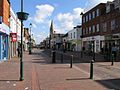
 Sittingbourne High Street - geograph.org.uk - 2932087.jpg 640 × 480; 95 KB
-
 Sittingbourne in 2007.jpg 640 × 479; 99 KB
-
 Sittingbourne Mill - geograph.org.uk - 2149532.jpg 640 × 430; 109 KB
-
 Sittingbourne Mill Water Tower (2) - geograph.org.uk - 2862885.jpg 4,288 × 3,216; 5.53 MB
-
 Sittingbourne Mill Water Tower (3) - geograph.org.uk - 2862889.jpg 4,288 × 3,216; 4.74 MB
-
 Sittingbourne Mill Water Tower - geograph.org.uk - 2862879.jpg 4,288 × 3,216; 5.2 MB
-
 Sittingbourne paper mill - geograph.org.uk - 735736.jpg 640 × 468; 65 KB
-
 Sittingbourne paper mill - geograph.org.uk - 735792.jpg 640 × 461; 59 KB
-
 Sittingbourne, Swale Estuary & The Isle of Sheppey seen from the North Downs, June 2011.jpg 3,888 × 2,592; 5.61 MB
-
 SMC Ford, Sittingbourne - geograph.org.uk - 2001887.jpg 3,072 × 2,304; 2.18 MB
-
 SMC Mitsubishi, Sittingbourne - geograph.org.uk - 2001775.jpg 3,072 × 2,304; 2.49 MB
-
 Snipeshill Cross roads - geograph.org.uk - 1565333.jpg 640 × 427; 63 KB
-
 South side of Sittingbourne High Street - geograph.org.uk - 2932146.jpg 480 × 640; 122 KB
-
 St Michael's Road, Sittingbourne - geograph.org.uk - 2001770.jpg 3,072 × 2,304; 2.56 MB
-
 St. Mary's Church, Sittingbourne (2) - geograph.org.uk - 2248995.jpg 3,072 × 2,304; 1.53 MB
-
 St. Marys Church, Sittingbourne - geograph.org.uk - 2248992.jpg 3,072 × 2,304; 1.03 MB
-
 Staplehurst Lodge Industrial Centre - geograph.org.uk - 733137.jpg 640 × 465; 64 KB
-
 Subway under Staplehurst Road - geograph.org.uk - 733149.jpg 640 × 467; 93 KB
-

-
 Tent caterpillar web - geograph.org.uk - 178948.jpg 640 × 480; 103 KB
-
 Tesco in The Forum, Sittingbourne - geograph.org.uk - 2308284.jpg 3,072 × 2,304; 1.88 MB
-
 Tesco, Sittingbourne - geograph.org.uk - 2998230.jpg 640 × 430; 50 KB
-
 The Avenue Theatre, Sittingbourne - geograph.org.uk - 2479325.jpg 3,072 × 2,304; 1.9 MB
-
 The Barge Pub, Sittingbourne - geograph.org.uk - 1073655.jpg 640 × 481; 61 KB
-
 The Clock Tower Hall, Adisham Green - geograph.org.uk - 749784.jpg 640 × 480; 58 KB
-
 The Forum, Sittingbourne (geograph 5232418).jpg 496 × 640; 112 KB
-
 The High Street in Sittingbourne - geograph.org.uk - 3180348.jpg 1,500 × 1,000; 264 KB
-
 The High Street in Sittingbourne - geograph.org.uk - 3180350.jpg 1,500 × 1,000; 141 KB
-
 The lines meet... - geograph.org.uk - 732486.jpg 640 × 471; 120 KB
-
 The Parade Co-Operative Store, Sittingbourne - geograph.org.uk - 3123722.jpg 4,288 × 3,216; 3.67 MB
-

-

-
 Track to Sittingbourne and Kemsley Light Railway - geograph.org.uk - 2867262.jpg 4,288 × 3,216; 6.66 MB
-
 Tunstall Court, Sittingbourne - geograph.org.uk - 3123759.jpg 4,288 × 3,216; 3.64 MB
-
 Tunstall Court, Sittingbourne - geograph.org.uk - 3123767.jpg 4,288 × 3,216; 3.85 MB
-
 UK Paper Sports Ground - geograph.org.uk - 9372.jpg 640 × 480; 68 KB
-
 United Reformed Church, Sittingbourne - geograph.org.uk - 2444093.jpg 2,304 × 3,072; 1.91 MB
-
 Water at Sittingbourne being polluted by eff Wellcome V0020275.jpg 648 × 486; 96 KB
-
 Watermill Mews, Sittingbourne - geograph.org.uk - 2972040.jpg 4,288 × 3,216; 6.69 MB
-
 Westfield, Sittingbourne - geograph.org.uk - 2972049.jpg 4,288 × 3,216; 6.37 MB
-
 Wilkinson's, Sittingbourne - geograph.org.uk - 2149472.jpg 640 × 430; 112 KB
-
 Wilkinson, Sittingbourne - geograph.org.uk - 2998218.jpg 640 × 430; 64 KB
-
 Woodberry Drive, Sittingbourne - geograph.org.uk - 991435.jpg 640 × 480; 58 KB
-
 Woodberry Drive, Sittingbourne - geograph.org.uk - 991948.jpg 640 × 480; 69 KB
-
 YD63VBN Go well, go CHALKWELL.jpg 4,043 × 2,695; 6.84 MB
-
 Yellow Poles on Gas Road - geograph.org.uk - 1016659.jpg 640 × 480; 83 KB
-
 Bags of WEEE - geograph.org.uk - 735722.jpg 480 × 640; 87 KB
-
 Cavell Way - Children at Play - geograph.org.uk - 732496.jpg 480 × 640; 70 KB
-
 Charlotte Street, Sittingbourne - geograph.org.uk - 735900.jpg 640 × 472; 72 KB
-
 Charlotte Street, Sittingbourne - geograph.org.uk - 735914.jpg 640 × 480; 83 KB
-
 Coniston Hotel - geograph.org.uk - 10791.jpg 640 × 480; 45 KB
-
 Demolition in Crown Quay Lane - geograph.org.uk - 735825.jpg 640 × 480; 114 KB
-
 East Street looking West - geograph.org.uk - 9381.jpg 640 × 480; 84 KB
-
 Eastern Approach to Sittingbourne - geograph.org.uk - 10797.jpg 640 × 480; 86 KB
-
 Footbridge over railway - geograph.org.uk - 735933.jpg 640 × 480; 71 KB
-
 Footpath towards Bobbing from Grove Park - geograph.org.uk - 676226.jpg 480 × 640; 146 KB
-
 French Market, Sittingbourne - geograph.org.uk - 67005.jpg 640 × 480; 112 KB

_Morrisons,_Sittingbourne,_20_March_2014.jpg)


.jpg)


_Class_%224-CEP%22_7137.jpg)


.jpg)
.jpg)
.jpg)
.jpg)
.jpg)
.jpg)
.jpg)


_-_geograph.org.uk_-_2971945.jpg)


_-_geograph.org.uk_-_1760660.jpg)


_-_geograph.org.uk_-_3125682.jpg)


.jpg)


_-_geograph.org.uk_-_2862885.jpg)
_-_geograph.org.uk_-_2862889.jpg)


_-_geograph.org.uk_-_2248995.jpg)


.jpg)


