Category:Sithney
Jump to navigation
Jump to search
village and civil parish in Cornwall, England, United Kingdom  Eglwys Sant Sithney, Sithney | |||||
| Upload media | |||||
| Instance of | |||||
|---|---|---|---|---|---|
| Location | Cornwall, South West England, England | ||||
 | |||||
English: Sithney is a village and civil parish in Cornwall, England, United Kingdom. It is named for Saint Sithney, the patron saint of the parish church.
Subcategories
This category has the following 7 subcategories, out of 7 total.
Media in category "Sithney"
The following 101 files are in this category, out of 101 total.
-
 A394 junction with B3302 - geograph.org.uk - 3188857.jpg 3,648 × 2,048; 1.09 MB
-

-
 Approaching Men-Amber - geograph.org.uk - 2128577.jpg 640 × 427; 91 KB
-
 B3302 junction with B3303 - geograph.org.uk - 3188903.jpg 2,917 × 1,988; 754 KB
-
 B3302 junction with road to Carleen - geograph.org.uk - 3188889.jpg 2,702 × 2,048; 692 KB
-
 B3302 northwest of Pednavounder Farm - geograph.org.uk - 3188874.jpg 2,701 × 2,048; 833 KB
-
 B3302 towards Helston - geograph.org.uk - 5466521.jpg 640 × 480; 44 KB
-
 B3302 towards Helston - geograph.org.uk - 5466533.jpg 640 × 480; 56 KB
-
 B3302, Sithney - geograph.org.uk - 5466531.jpg 640 × 480; 92 KB
-
 Churchyard of Sithney church - geograph.org.uk - 6140286.jpg 1,024 × 680; 295 KB
-

-
 Cornwall , Helston Scenery - geograph.org.uk - 4608242.jpg 4,288 × 2,848; 5.34 MB
-
 Cornwall , The A394 - geograph.org.uk - 4608233.jpg 4,288 × 2,848; 5.39 MB
-
 Cornwall , The A394 - geograph.org.uk - 4608234.jpg 4,288 × 2,848; 4.48 MB
-
 Cornwall , The A394 - geograph.org.uk - 4608238.jpg 4,288 × 2,848; 4.59 MB
-
 Cornwall , The A394 - geograph.org.uk - 4608241.jpg 4,288 × 2,848; 4.72 MB
-
 Cottage on the bend at Mellangoose - geograph.org.uk - 2396285.jpg 640 × 427; 98 KB
-
 Crop field, Higher Poldown - geograph.org.uk - 5466517.jpg 640 × 480; 57 KB
-
 Daffodils and view to Wendron - geograph.org.uk - 2349989.jpg 640 × 427; 98 KB
-
 Daffodils at Higher Boscadjack - geograph.org.uk - 2349980.jpg 640 × 427; 107 KB
-
 Derelict barn at Marsinney Farm - geograph.org.uk - 2396412.jpg 640 × 427; 68 KB
-
 Entrance to Longstone Farm - geograph.org.uk - 2349963.jpg 640 × 427; 119 KB
-
 Field in Sithney - geograph.org.uk - 6140291.jpg 1,024 × 680; 212 KB
-
 Finger post near Mellangoose House - geograph.org.uk - 2396301.jpg 640 × 427; 115 KB
-

-
 Former Methodist chapel at Lowertown - geograph.org.uk - 4240621.jpg 3,872 × 2,592; 5.65 MB
-
 Former post office, Nancegollan - geograph.org.uk - 3377155.jpg 3,012 × 1,893; 1,003 KB
-

-
 George V postbox, Sithney Common - geograph.org.uk - 5484505.jpg 967 × 1,911; 338 KB
-

-
 Grazing, Sithney - geograph.org.uk - 5466532.jpg 640 × 480; 46 KB
-
 Helston - John Rogers and Mary Rogers (née Oldham) memorial.jpg 2,137 × 2,710; 1.93 MB
-
 Helston Railway - geograph.org.uk - 3131139.jpg 640 × 424; 91 KB
-
 Helston Railway - geograph.org.uk - 3131150.jpg 640 × 424; 80 KB
-
 Helston Railway - geograph.org.uk - 3131151.jpg 640 × 424; 82 KB
-
 Helston Railway - geograph.org.uk - 3131157.jpg 640 × 424; 80 KB
-
 Helston Railway - geograph.org.uk - 3131161.jpg 640 × 424; 74 KB
-
 Helston Railway - geograph.org.uk - 3131169.jpg 640 × 424; 81 KB
-
 Helston Railway - geograph.org.uk - 3131174.jpg 640 × 424; 83 KB
-
 Helston Railway - geograph.org.uk - 3131180.jpg 640 × 424; 91 KB
-
 Helston Railway - Prospidnick Halt - geograph.org.uk - 5414649.jpg 640 × 427; 155 KB
-
 Helston Railway - Prospidnick Halt - geograph.org.uk - 5416373.jpg 640 × 427; 126 KB
-
 Helston Railway - Pump House Crossing - geograph.org.uk - 5416012.jpg 640 × 427; 147 KB
-
-
 Helston Railway - Trevarno Station - geograph.org.uk - 5416001.jpg 640 × 427; 142 KB
-
 Helston Railway - Truthall Halt - geograph.org.uk - 5416009.jpg 640 × 427; 106 KB
-

-
 Helston Railway Company, line near Truthall - geograph.org.uk - 5125316.jpg 1,600 × 1,200; 686 KB
-
 Higher Boscadjack - geograph.org.uk - 2349971.jpg 640 × 427; 88 KB
-
 House on the B3302, Sithney - geograph.org.uk - 5466528.jpg 640 × 480; 58 KB
-
 House, Sithney Common - geograph.org.uk - 5484506.jpg 2,002 × 1,366; 536 KB
-
 Junction at Sithney Common - geograph.org.uk - 4041579.jpg 640 × 390; 38 KB
-
 Little Bosoha - geograph.org.uk - 2349968.jpg 640 × 427; 76 KB
-
 Looking south east on the B3302 - geograph.org.uk - 5466523.jpg 640 × 480; 44 KB
-
 Marsinney Farmhouse - geograph.org.uk - 2396407.jpg 640 × 481; 98 KB
-
 Men-Amber Farm - geograph.org.uk - 2128590.jpg 640 × 427; 82 KB
-
 Mill Farm - geograph.org.uk - 2360413.jpg 640 × 427; 96 KB
-
 Minor crossroads at Sithney Green - geograph.org.uk - 2396323.jpg 640 × 427; 72 KB
-
 Minor road towards Sithney Green - geograph.org.uk - 5466525.jpg 640 × 480; 130 KB
-
 Muddy lane - geograph.org.uk - 2636883.jpg 640 × 427; 128 KB
-

-

-

-

-

-
 Old doorway, Truthall - geograph.org.uk - 3379801.jpg 2,000 × 1,500; 1.12 MB
-

-
 Pasture, Sithney - geograph.org.uk - 6144433.jpg 1,024 × 768; 236 KB
-
 Penrose - Cows - panoramio.jpg 1,408 × 940; 344 KB
-
 Penrose - panoramio.jpg 1,944 × 1,296; 338 KB
-
 Public footpath at Mellangoose - geograph.org.uk - 2396293.jpg 640 × 427; 142 KB
-
 Railway bridge at Lower Prospidnick - geograph.org.uk - 5601921.jpg 480 × 640; 111 KB
-
 Road junction near Truthall - geograph.org.uk - 1958104.jpg 640 × 426; 97 KB
-
 Roadside stile at Nancegollan - geograph.org.uk - 2396435.jpg 427 × 640; 94 KB
-
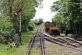
 Rolling stock in the siding at Trevarno - geograph.org.uk - 5416395.jpg 640 × 411; 129 KB
-
 Shaft at Wheal Metal - geograph.org.uk - 217834.jpg 524 × 480; 100 KB
-
 Sheep grazing near Sithney - geograph.org.uk - 5466522.jpg 640 × 480; 56 KB
-
 Silage bales on Longstone Farm - geograph.org.uk - 5601913.jpg 640 × 480; 75 KB
-
 Sithney - geograph.org.uk - 6140289.jpg 1,024 × 680; 243 KB
-
 Sithney church - geograph.org.uk - 6140282.jpg 680 × 1,024; 218 KB
-
 Sithney Green - geograph.org.uk - 124148.jpg 640 × 427; 97 KB
-
 Sithney Post Box.jpg 2,315 × 2,699; 2.26 MB
-
 Stream at Sithney Green - geograph.org.uk - 2396314.jpg 640 × 427; 102 KB
-

-
 The new graveyard - geograph.org.uk - 54728.jpg 640 × 427; 115 KB
-

-
 Track to Higher Poldown - geograph.org.uk - 5466519.jpg 640 × 480; 65 KB
-
 Tregoose - geograph.org.uk - 2360391.jpg 640 × 427; 109 KB
-
 Trevarno Gardens - geograph.org.uk - 2126638.jpg 600 × 900; 623 KB
-
 Trevarno Gardens and Lake - geograph.org.uk - 2126646.jpg 900 × 600; 707 KB
-
 Trevarno Lake - geograph.org.uk - 2126658.jpg 900 × 600; 498 KB
-
 Trevarno Lake, The Cascade - geograph.org.uk - 2126653.jpg 900 × 600; 626 KB
-
 Trevarno Lake, Victorian Boathouse - geograph.org.uk - 2126666.jpg 900 × 600; 555 KB
-
 Trevarno Platform railway station (site), Cornwall - geograph.org.uk - 5125313.jpg 1,600 × 1,200; 565 KB
-
 Truthall Geograph-3379799-by-Humphrey-Bolton.jpg 2,000 × 1,485; 933 KB
-
 Truthall House - geograph.org.uk - 3379753.jpg 2,000 × 1,500; 805 KB
-
 Truthall old hall - geograph.org.uk - 3379796.jpg 2,000 × 1,500; 795 KB
-
 Wheal Christopher - geograph.org.uk - 2128550.jpg 640 × 427; 96 KB
-
 Wheal Mount Farm on Trannack Downs - geograph.org.uk - 5601899.jpg 640 × 452; 59 KB
-

-
 Sithney General Stores - geograph.org.uk - 175496.jpg 640 × 480; 113 KB


_by_car_park_for_Helston_Railway_-_geograph.org.uk_-_5414616.jpg)


_memorial.jpg)


,_Cornwall_-_geograph.org.uk_-_5125313.jpg)


