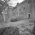
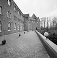
Category:Sint Paulusabdij, Oosterhout
Jump to navigation
Jump to search
| Object location | | View all coordinates using: OpenStreetMap |
|---|
abbey in Oosterhout, Netherlands | |||||
| Upload media | |||||
| Instance of | |||||
|---|---|---|---|---|---|
| Location |
| ||||
| Architect | |||||
| Headquarters location | |||||
| Inception |
| ||||
| Dissolved, abolished or demolished date |
| ||||
| Religion or worldview | |||||
| official website | |||||
 | |||||
|
This is a category about rijksmonumentcomplex number 520005
|
Klooster:
|
This is a category about rijksmonument number 520006
|
Werkplaats:
|
This is a category about rijksmonument number 520007
|
Garage:
|
This is a category about rijksmonument number 520008
|
Loods:
|
This is a category about rijksmonument number 525658
|
Pompstation:
|
This is a category about rijksmonument number 525661
|
Tuin:
|
This is a category about rijksmonument number 525662
|
Schuur:
|
This is a category about a municipal monument in Oosterhout with number 2002-08 |
| Address |
|
Subcategories
This category has the following 2 subcategories, out of 2 total.
L
- Hendrik Coenraad Louwerse (14 F)
Media in category "Sint Paulusabdij, Oosterhout"
The following 80 files are in this category, out of 80 total.
-
Abbaye St Paul d'Oosterhout.jpg 3,000 × 2,000; 1.59 MB
-
Abdijkerk Paulusabdij Oosterhout 2.jpg 6,283 × 4,974; 20.09 MB
-
Bouw St. Paulus abdij Hoogstraat 80 Oosterhout, Glasplaatnegatieven van rond 1905-1910.jpg 5,370 × 3,932; 7.01 MB
-
De kloosterkerk van de Paulusabdij te Oosterhout7.jpg 3,732 × 5,596; 17.02 MB
-
De kloosterkerk van de Paulusabdij te Oosterhout8.jpg 4,748 × 5,954; 17.23 MB
-
Ingangspoort, vanaf het voorplein - Oosterhout - 20342178 - RCE.jpg 1,179 × 1,200; 438 KB
-
Overzicht - Oosterhout - 20342180 - RCE.jpg 1,186 × 1,200; 355 KB
-
Overzicht - Oosterhout - 20342189 - RCE.jpg 1,173 × 1,200; 465 KB
-
Overzicht - Oosterhout - 20342190 - RCE.jpg 1,183 × 1,200; 519 KB
-
Overzicht - Oosterhout - 20342191 - RCE.jpg 1,186 × 1,200; 491 KB
-
Overzicht begraafplaats - Oosterhout - 20342236 - RCE.jpg 1,189 × 1,200; 373 KB
-
Overzicht begraafplaats - Oosterhout - 20342237 - RCE.jpg 1,189 × 1,200; 517 KB
-
Overzicht boerderij met schuren - Oosterhout - 20342203 - RCE.jpg 1,176 × 1,200; 426 KB
-
Overzicht dienstgebouw - Oosterhout - 20342200 - RCE.jpg 1,185 × 1,200; 533 KB
-
Overzicht dienstgebouw - Oosterhout - 20342201 - RCE.jpg 1,183 × 1,200; 460 KB
-
Overzicht dienstgebouw - Oosterhout - 20342202 - RCE.jpg 1,181 × 1,200; 548 KB
-
Overzicht grote schuur - Oosterhout - 20342206 - RCE.jpg 1,185 × 1,200; 369 KB
-
Overzicht grote schuur vanaf de Hoogstraat - Oosterhout - 20342207 - RCE.jpg 1,190 × 1,200; 309 KB
-
Overzicht hof tussen kerk en klooster - Oosterhout - 20342198 - RCE.jpg 1,186 × 1,200; 447 KB
-
Overzicht ingangspoort vanaf de Hoogstraat - Oosterhout - 20342177 - RCE.jpg 1,174 × 1,200; 450 KB
-
Overzicht kerk en boerderij - Oosterhout - 20342195 - RCE.jpg 1,186 × 1,200; 344 KB
-
Overzicht kerk met muur, richting klooster - Oosterhout - 20342187 - RCE.jpg 1,183 × 1,200; 458 KB
-
Overzicht kerk, noordzijde - Oosterhout - 20342196 - RCE.jpg 1,185 × 1,200; 315 KB
-
Overzicht kerk, noordzijde - Oosterhout - 20342197 - RCE.jpg 1,181 × 1,200; 324 KB
-
Overzicht kerk, zuidzijde - Oosterhout - 20342194 - RCE.jpg 1,181 × 1,200; 390 KB
-
Overzicht met nieuw terras en poortgebouw - Oosterhout - 20342192 - RCE.jpg 1,183 × 1,200; 334 KB
-
Overzicht met v.l.n.r.- klooster, kerk en boerderij - Oosterhout - 20342181 - RCE.jpg 1,186 × 1,200; 348 KB
-
Overzicht noordwest zijde - Oosterhout - 20342182 - RCE.jpg 1,179 × 1,200; 395 KB
-
Overzicht noordwest zijde en tuin met begraafplaats - Oosterhout - 20342183 - RCE.jpg 1,186 × 1,200; 313 KB
-
Overzicht over het nieuwe terras - Oosterhout - 20342193 - RCE.jpg 1,188 × 1,200; 384 KB
-
Overzicht pandhof - Oosterhout - 20342210 - RCE.jpg 1,187 × 1,200; 435 KB
-
Overzicht pandhof - Oosterhout - 20342211 - RCE.jpg 1,182 × 1,200; 415 KB
-
Overzicht poortgebouw - Oosterhout - 20342186 - RCE.jpg 1,187 × 1,200; 394 KB
-
Overzicht poortgebouw - Oosterhout - 20342188 - RCE.jpg 1,174 × 1,200; 429 KB
-
Overzicht richting begraafplaats - Oosterhout - 20342235 - RCE.jpg 1,187 × 1,200; 386 KB
-
Overzicht trafohuisje - Oosterhout - 20342205 - RCE.jpg 1,181 × 1,200; 433 KB
-
Overzicht tuinmuur, westelijk parkgedeelte - Oosterhout - 20342208 - RCE.jpg 1,181 × 1,200; 478 KB
-
Overzicht van de achtergevel van het klooster - Oosterhout - 20419774 - RCE.jpg 958 × 1,200; 334 KB
-
Overzicht van de achtergevel van het klooster - Oosterhout - 20419775 - RCE.jpg 951 × 1,200; 355 KB
-
Overzicht westzijde - Oosterhout - 20342185 - RCE.jpg 1,183 × 1,200; 493 KB
-
Overzicht zuidwest zijde - Oosterhout - 20342184 - RCE.jpg 1,181 × 1,200; 386 KB
-
Overzicht, tuin richting begraafplaats en bosschage - Oosterhout - 20342234 - RCE.jpg 1,186 × 1,200; 272 KB
-
Overzicht. Links- klooster, Rechts- kerk - Oosterhout - 20342179 - RCE.jpg 1,188 × 1,200; 472 KB
-
Sint-Paulusabdij P1050105.JPG 3,264 × 2,448; 3.79 MB
-
Sint-Paulusabdij P1050106.JPG 2,448 × 3,264; 3.7 MB
-
WLM - M.arjon - Oosterhout Sint Paulus Abdij Begraafplaats.jpg 2,241 × 1,493; 1.66 MB
-
WLM - M.arjon - Oosterhout Sint Paulus Abdij Binnenhof.jpg 1,536 × 2,246; 1,006 KB
-
WLM - M.arjon - Oosterhout Sint Paulus Abdij kloosterkerk.jpg 2,304 × 1,536; 774 KB
-
WLM - M.arjon - Oosterhout Sint Paulus Abdij Kloosterlaan.jpg 2,304 × 1,536; 1.81 MB
-
WLM - M.arjon - Oosterhout Sint Paulus Abdij Oostzijde.jpg 2,304 × 1,536; 1,003 KB
-
WLM - M.arjon - Oosterhout Sint Paulus Abdij Schuur.jpg 2,304 × 1,536; 1.3 MB
-
WLM - M.arjon - Oosterhout Sint Paulus Abdij Westzijde.jpg 1,126 × 718; 394 KB
-
WLM - M.arjon - Oosterhout Sint Paulus Abdij Zuidzijde.jpg 1,536 × 2,304; 1.61 MB
-
WLM - M.arjon - Oosterhout Sint Paulus Abdij, Hoofdingang.jpg 3,094 × 2,318; 6.78 MB
-
Zicht op de achtergevel en rechter zijgevel - Oosterhout - 20419792 - RCE.jpg 1,200 × 800; 281 KB
-
Zicht op de achtergevel van het klooster - Oosterhout - 20419770 - RCE.jpg 1,200 × 800; 263 KB


