Category:Sint Martinuskerk, Beek (Montferland)
Jump to navigation
Jump to search
| Object location | | View all coordinates using: OpenStreetMap |
|---|
_3.JPG) | |||||
| Upload media | |||||
| Instance of | |||||
|---|---|---|---|---|---|
| Part of | |||||
| Location | Beek, Montferland, Montferland, Gelderland, Netherlands | ||||
| Street address |
| ||||
| Located on street |
| ||||
| Architect | |||||
| Heritage designation |
| ||||
 | |||||
Nederlands: Martinus, Beek (Montferland) - Anno 1864
|
This is a category about rijksmonument number 514893
|
| Address |
|
Subcategories
This category has only the following subcategory.
Media in category "Sint Martinuskerk, Beek (Montferland)"
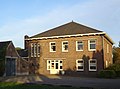
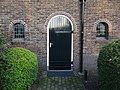
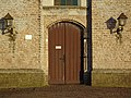
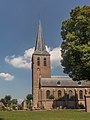
The following 49 files are in this category, out of 49 total.
-
 Beek (Montferland), Sint-Martinuskerk (01).jpg 2,756 × 2,187; 1.19 MB
-
 Beek (Montferland), Sint-Martinuskerk (02).jpg 2,095 × 2,623; 1.26 MB
-
 Beek (Montferland), Sint-Martinuskerk (03).jpg 3,930 × 2,263; 1.79 MB
-
 Beek (Montferland), Sint-Martinuskerk (04).jpg 3,387 × 3,055; 2.25 MB
-
 Beek (Montferland), Sint-Martinuskerk (05).jpg 4,612 × 2,987; 4.62 MB
-
 Beek (Montferland), Sint-Martinuskerk (06).jpg 4,588 × 2,756; 3.71 MB
-
 Beek (Montferland), Sint-Martinuskerk (07).jpg 4,565 × 2,365; 2.45 MB
-
 Beek (Montferland), Sint-Martinuskerk (08).jpg 994 × 1,627; 382 KB
-
 Beek (Montferland), Sint-Martinuskerk (47).jpg 3,036 × 2,039; 1.64 MB
-
 Beek (Montferland), Sint-Martinuskerk (48).jpg 2,562 × 3,418; 1.36 MB
-
 Beek (Montferland), Sint-Martinuskerk (49).jpg 3,374 × 2,814; 2.3 MB
-
 Beek (Montferland), Sint-Martinuskerk (50).jpg 3,400 × 3,259; 2.16 MB
-
 Beek (Montferland), Sint-Martinuskerk (51).jpg 2,980 × 3,955; 2.31 MB
-
 Beek (Montferland), Sint-Martinuskerk (52).jpg 3,073 × 4,391; 1.59 MB
-
 Beek (Montferland), Sint-Martinuskerk (53).jpg 1,717 × 2,507; 654 KB
-
 Beek 104026.jpg 3,120 × 4,160; 4.17 MB
-
 Beek 104209.jpg 3,120 × 4,160; 3.6 MB
-
 Beek Montferland Sint Jansgildestraat PM19-02.jpg 4,896 × 3,672; 8.45 MB
-
 Beek Montferland St. Martinus PM19-01.jpg 3,982 × 3,387; 4.8 MB
-
 Beek Montferland St. Martinus PM19-02.jpg 3,630 × 2,706; 2.57 MB
-
 Beek Montferland St. Martinus PM19-03.jpg 4,896 × 3,672; 6.32 MB
-
 Beek Montferland St. Martinus PM19-04.jpg 4,461 × 3,360; 4.64 MB
-
 Beek Montferland St. Martinus PM19-05.jpg 4,752 × 3,603; 4.31 MB
-
 Beek Montferland St. Martinus PM19-06.jpg 4,896 × 3,672; 8.13 MB
-
 Beek Montferland St. Martinus PM19-07.jpg 4,896 × 3,672; 7.1 MB
-
 Beek Montferland St. Martinus PM19-08.jpg 3,464 × 4,656; 5.77 MB
-
 Beek Montferland St. Martinus PM19-09.jpg 3,672 × 4,896; 7.14 MB
-
 Beek Montferland St. Martinus PM19-10.jpg 4,896 × 3,672; 7.02 MB
-
 Beek Montferland St. Martinus PM19-11.jpg 3,672 × 4,896; 5.75 MB
-
 Beek Montferland St. Martinus PM19-12.jpg 3,672 × 4,896; 4.18 MB
-
 Beek Montferland St. Martinus PM19-13.jpg 3,672 × 4,896; 6.26 MB
-
 Beek, de Sint Martinuskerk RM514893 foto4 2015-08-20 13.20.jpg 3,179 × 4,238; 3.5 MB
-
 Beek, kerk foto4 2010-04-12 12.28.JPG 3,456 × 2,592; 6.9 MB
-
 Kop- en zijgevel PBK Fa. G.J. Timmerman, Arnhem - Beek - 20507138 - RCE.jpg 1,200 × 900; 199 KB
-
 Noordgevel - Beek (Bergh) - 20028852 - RCE.jpg 1,200 × 950; 272 KB
-
 Oostgevel (koor) - Beek (Bergh) - 20028853 - RCE.jpg 1,200 × 957; 386 KB
-
 Overzicht - Beek (Bergh) - 20028849 - RCE.jpg 949 × 1,200; 188 KB
-
 St. Martinus Beek (Montferland) 1.JPG 3,072 × 2,304; 2.54 MB
-
 St. Martinus Beek (Montferland) 2.JPG 3,072 × 2,304; 2.48 MB
-
 St. Martinus Beek (Montferland) 3.JPG 2,304 × 3,072; 2.49 MB
-
 St. Martinus Beek (Montferland) 5.JPG 2,304 × 3,072; 2.26 MB
-
 St. Martinus Beek (Montferland) 6.JPG 2,304 × 3,072; 2.49 MB
-
 Toren - Beek (Bergh) - 20028850 - RCE.jpg 953 × 1,200; 234 KB
-
 Toren - Beek - 20028836 - RCE.jpg 958 × 1,200; 191 KB
-
 Toren - Beek - 20028840 - RCE.jpg 951 × 1,200; 216 KB
-
 Toren - Beek - 20028841 - RCE.jpg 942 × 1,200; 175 KB
-
 Toren en noordgevel - Beek (Bergh) - 20028851 - RCE.jpg 953 × 1,200; 203 KB
-
 Zuidgevel - Beek (Bergh) - 20028854 - RCE.jpg 954 × 1,200; 243 KB
-
 Zuidgevel - Beek (Bergh) - 20028855 - RCE.jpg 1,200 × 953; 291 KB
,_Sint-Martinuskerk_(01).jpg)
,_Sint-Martinuskerk_(02).jpg)
,_Sint-Martinuskerk_(03).jpg)
,_Sint-Martinuskerk_(04).jpg)
,_Sint-Martinuskerk_(05).jpg)
,_Sint-Martinuskerk_(06).jpg)
,_Sint-Martinuskerk_(07).jpg)
,_Sint-Martinuskerk_(08).jpg)
,_Sint-Martinuskerk_(47).jpg)
,_Sint-Martinuskerk_(48).jpg)
,_Sint-Martinuskerk_(49).jpg)
,_Sint-Martinuskerk_(50).jpg)
,_Sint-Martinuskerk_(51).jpg)
,_Sint-Martinuskerk_(52).jpg)
,_Sint-Martinuskerk_(53).jpg)


_-_20028852_-_RCE.jpg)
_-_Beek_(Bergh)_-_20028853_-_RCE.jpg)
_-_20028849_-_RCE.jpg)
_1.JPG)
_2.JPG)
_5.JPG)
_6.JPG)
_-_20028850_-_RCE.jpg)


_-_20028851_-_RCE.jpg)
_-_20028854_-_RCE.jpg)
_-_20028855_-_RCE.jpg)