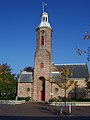
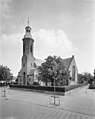
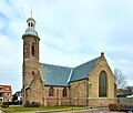
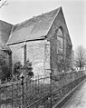
Category:Sint Martinus ('s-Gravenpolder)
Jump to navigation
Jump to search
| Object location | | View all coordinates using: OpenStreetMap |
|---|
church in 's-Gravenpolder, Netherlands  | |||||
| Upload media | |||||
| Instance of | |||||
|---|---|---|---|---|---|
| Named after | |||||
| Dedicated to | |||||
| Location | 's-Gravenpolder, Borsele, Zeeland, Netherlands | ||||
| Street address |
| ||||
| Located on street |
| ||||
| Heritage designation |
| ||||
| Inception |
| ||||
| Significant event |
| ||||
 | |||||
Nederlands: Sint Martinuskerk, 's-Gravenpolder - anno 14e eeuw
Kerk
|
This is a category about rijksmonument number 9968
|
Toren
|
This is a category about rijksmonument number 9969
|
| Address |
|
]]
Media in category "Sint Martinus ('s-Gravenpolder)"
The following 32 files are in this category, out of 32 total.
-
 Doopvont - 's-Gravenpolder - 20091644 - RCE.jpg 956 × 1,200; 229 KB
-
 Exterieur achter - 's-Gravenpolder - 20091648 - RCE.jpg 942 × 1,200; 245 KB
-
 Exterieur naar het noord-oosten - 's-Gravenpolder - 20091641 - RCE.jpg 1,003 × 1,200; 264 KB
-
 Exterieur naar het zuid-oosten - 's-Gravenpolder - 20091637 - RCE.jpg 1,200 × 956; 386 KB
-

-
 Interieur met kansel - 's-Gravenpolder - 20091646 - RCE.jpg 998 × 1,200; 180 KB
-
 Interieur overzicht - 's-Gravenpolder - 20091647 - RCE.jpg 940 × 1,200; 173 KB
-

-
 Kansel - 's-Gravenpolder - 20091645 - RCE.jpg 952 × 1,200; 175 KB
-
 KerksGravenpolder.jpg 1,920 × 2,560; 1,018 KB
-
 Orgel - 's-Gravenpolder - 20091636 - RCE.jpg 963 × 1,200; 256 KB
-
 Orgel - 's-Gravenpolder - 20091643 - RCE.jpg 945 × 1,200; 180 KB
-

-
 Overzicht zuidwestgevel met kerktoren - 's-Gravenpolder - 20352765 - RCE.jpg 956 × 1,200; 203 KB
-
 Sint Martinus ('s-Gravenpolder) (1).JPG 1,634 × 1,395; 1.55 MB
-
 Sint Martinus ('s-Gravenpolder) (2).JPG 1,680 × 1,488; 488 KB
-
 Sint Martinus ('s-Gravenpolder) (3).JPG 1,536 × 2,048; 624 KB
-
 Sint Martinus ('s-Gravenpolder) (4).JPG 2,048 × 1,536; 745 KB
-
 Sint Martinus ('s-Gravenpolder) (5).JPG 1,746 × 1,362; 903 KB
-
 Sint Martinus ('s-Gravenpolder) (6).JPG 1,870 × 1,444; 1.14 MB
-
 Sint Martinus ('s-Gravenpolder) (7).JPG 1,705 × 1,310; 986 KB
-
 Sint Martinus ('s-Gravenpolder) (8).JPG 2,048 × 1,536; 849 KB
-
 Sint Martinus ('s-Gravenpolder) (9).JPG 1,747 × 1,460; 602 KB
-
 Sint Martinuskerk ('s-Gravenpolder) (1).jpg 2,045 × 1,880; 853 KB
-
 Sint Martinuskerk ('s-Gravenpolder) (2).jpg 1,989 × 1,884; 969 KB
-
 Sint Martinuskerk ('s-Gravenpolder) (3).jpg 3,284 × 2,876; 1.48 MB
-
 Sint Martinuskerk ('s-Gravenpolder) (4).jpg 1,270 × 2,246; 700 KB
-
 Sint Martinuskerk ('s-Gravenpolder) (5).jpg 3,352 × 2,744; 2.17 MB
-
 Sint Martinuskerk ('s-Gravenpolder) (6).jpg 3,344 × 2,964; 2.34 MB
-
 Vooraanzicht - 's-Gravenpolder - 20091650 - RCE.jpg 954 × 1,200; 235 KB
-
 Zijaanzicht - 's-Gravenpolder - 20091649 - RCE.jpg 963 × 1,200; 232 KB
-
 Zuid transept naar het oosten - 's-Gravenpolder - 20091640 - RCE.jpg 956 × 1,200; 362 KB


_(1).JPG)
_(2).JPG)
_(3).JPG)
_(4).JPG)
_(5).JPG)
_(6).JPG)
_(7).JPG)
_(8).JPG)
_(9).JPG)
_(1).jpg)
_(2).jpg)
_(3).jpg)
_(4).jpg)
_(5).jpg)
_(6).jpg)

