Category:Sint Elisabethskerk, Grave
Jump to navigation
Jump to search
| Object location | | View all coordinates using: OpenStreetMap |
|---|
church building in Grave, Netherlands  | |||||
| Upload media | |||||
| Instance of | |||||
|---|---|---|---|---|---|
| Location | Grave, Land van Cuijk, North Brabant, Netherlands | ||||
| Street address |
| ||||
| Located on street |
| ||||
| Heritage designation |
| ||||
| Significant event |
| ||||
| Religion or worldview | |||||
 | |||||
|
This is a category about rijksmonument number 17255
|
| Address |
|
Media in category "Sint Elisabethskerk, Grave"
The following 200 files are in this category, out of 457 total.
(previous page) (next page)-
 01 Sint Elisabethskerk, Grave.jpg 1,589 × 1,235; 677 KB
-
 02 Sint Elisabethskerk, Grave.jpg 1,705 × 1,528; 905 KB
-
 03 Sint Elisabethskerk, Grave.jpg 2,048 × 1,536; 788 KB
-
 04 Sint Elisabethskerk, Grave.jpg 1,444 × 1,359; 577 KB
-
 05 Sint Elisabethskerk, Grave.jpg 2,048 × 1,536; 1.23 MB
-
 06 Sint Elisabethskerk, Grave.jpg 1,536 × 2,048; 1.34 MB
-
 07 Sint Elisabethskerk, Grave.jpg 2,048 × 1,536; 1.63 MB
-
 08 Sint Elisabethskerk, Grave.jpg 2,048 × 1,536; 1.68 MB
-
 17255 Sint-Elisabethkerk 2.jpg 3,000 × 2,433; 5.03 MB
-
 17255 Sint-Elisabethkerk.jpg 5,029 × 5,165; 17.21 MB
-
 20170102 grave skyline normandie.jpg 4,288 × 3,216; 9.81 MB
-
 5361 Grave, Netherlands - panoramio (15).jpg 1,148 × 2,048; 537 KB
-
 5361 Grave, Netherlands - panoramio (34).jpg 2,048 × 1,155; 569 KB
-
 Aanzicht oostzijde noord-transept bij de viering - Grave - 20083769 - RCE.jpg 1,197 × 1,200; 366 KB
-
 Anna te Drieën na behandeling - Grave - 20083840 - RCE.jpg 775 × 1,200; 203 KB
-
 Beeld - Grave - 20083732 - RCE.jpg 1,011 × 1,200; 182 KB
-
 Beeld - Grave - 20083739 - RCE.jpg 970 × 1,200; 236 KB
-
 Beeld - Grave - 20083908 - RCE.jpg 1,197 × 1,200; 229 KB
-
 Beeld - Grave - 20083909 - RCE.jpg 1,197 × 1,200; 224 KB
-
 Beeld - Grave - 20083914 - RCE.jpg 788 × 1,200; 153 KB
-
 Beeld - Grave - 20083915 - RCE.jpg 783 × 1,200; 171 KB
-
 Beeld - Grave - 20083916 - RCE.jpg 788 × 1,200; 199 KB
-
 Beeld en detail van beeld - Grave - 20083910 - RCE.jpg 1,190 × 1,200; 252 KB
-
 Beeld en detail van beeld - Grave - 20083911 - RCE.jpg 1,192 × 1,200; 221 KB
-
 Beeld van het altaar - Grave - 20083893 - RCE.jpg 788 × 1,200; 209 KB
-
 Beeld van het altaar - Grave - 20083894 - RCE.jpg 780 × 1,200; 220 KB
-
 Beeld van het altaar - Grave - 20083895 - RCE.jpg 788 × 1,200; 227 KB
-
 Beeld van het altaar - Grave - 20083896 - RCE.jpg 796 × 1,200; 212 KB
-
 Beeld van St. Barbara - Grave - 20083917 - RCE.jpg 788 × 1,200; 261 KB
-
 Beeld van St. Barbara tussentijdse opname van Polychromie - Grave - 20083905 - RCE.jpg 1,195 × 1,200; 250 KB
-
 Beelden met opschrift Ad maiorem dei gloriam - Grave - 20083918 - RCE.jpg 788 × 1,200; 243 KB
-
-
 Beelden van het altaar - Grave - 20083891 - RCE.jpg 797 × 1,200; 220 KB
-
 Beelden van het altaar - Grave - 20083892 - RCE.jpg 805 × 1,200; 222 KB
-
 Cenotaaf voor Anoud van Gelre in de Sint-Elisabethkerk te Grave.jpg 467 × 650; 871 KB
-
 Crucifix na restauratie - Grave - 20083984 - RCE.jpg 1,197 × 1,200; 181 KB
-
 Crucifix na restauratie - Grave - 20083985 - RCE.jpg 1,200 × 1,190; 175 KB
-
 Crucifix na restauratie - Grave - 20083986 - RCE.jpg 1,188 × 1,200; 207 KB
-
 Crucifix na restauratie - Grave - 20083987 - RCE.jpg 1,195 × 1,200; 217 KB
-
 Crusifix voor restauratie - Grave - 20083826 - RCE.jpg 788 × 1,200; 174 KB
-
 Dagkant noordzijde van opening noorderzijkoor - Grave - 20083767 - RCE.jpg 1,200 × 1,200; 354 KB
-
 Dak - panoramio.jpg 3,648 × 2,736; 2.5 MB
-
 De kerk uit het zuid-westen - Grave - 20083931 - RCE.jpg 788 × 1,200; 213 KB
-
 Detail beeld van St. Barbara - Grave - 20083906 - RCE.jpg 1,190 × 1,200; 217 KB
-
 Detail beeld van St. Barbara - Grave - 20083907 - RCE.jpg 1,192 × 1,200; 266 KB
-
 Detail Crusifix, na restauratie - Grave - 20083952 - RCE.jpg 3,042 × 3,048; 2.76 MB
-

-

-
 Detail gewelf tijdens restauratie - Grave - 20083789 - RCE.jpg 788 × 1,200; 105 KB
-
 Detail gewelf tijdens restauratie - Grave - 20083790 - RCE.jpg 789 × 1,200; 194 KB
-
 Detail hoofdaltaar, thans als los stuk aanwezig - Grave - 20083814 - RCE.jpg 797 × 1,200; 283 KB
-
 Detail muur - Grave - 20083782 - RCE.jpg 1,195 × 1,200; 415 KB
-

-

-

-

-

-

-

-

-

-
 Detail preekstoel - Grave - 20083803 - RCE.jpg 1,200 × 788; 250 KB
-
 Detail preekstoel - Grave - 20083804 - RCE.jpg 788 × 1,200; 230 KB
-
 Detail preekstoel - Grave - 20083805 - RCE.jpg 788 × 1,200; 228 KB
-
 Detail preekstoel - Grave - 20083806 - RCE.jpg 788 × 1,200; 234 KB
-
 Detail preekstoel - Grave - 20083808 - RCE.jpg 788 × 1,200; 236 KB
-
 Detail preekstoel - Grave - 20083809 - RCE.jpg 788 × 1,200; 240 KB
-
 Detail preekstoel - Grave - 20083810 - RCE.jpg 1,200 × 792; 230 KB
-
 Detail preekstoel - Grave - 20083811 - RCE.jpg 1,200 × 788; 222 KB
-
 Detail preekstoel - Grave - 20083812 - RCE.jpg 1,200 × 788; 219 KB
-
 Detail preekstoel - Grave - 20083813 - RCE.jpg 1,200 × 788; 219 KB
-
 Detail van Beeld - Grave - 20083912 - RCE.jpg 1,183 × 1,200; 257 KB
-
 Detail van zuid-transept en schip - Grave - 20083708 - RCE.jpg 879 × 1,200; 246 KB
-
 Detail westmuur noorderdwarsschip - Grave - 20083926 - RCE.jpg 788 × 1,200; 245 KB
-
 Detail zuid transeptgevel - Grave - 20083793 - RCE.jpg 1,200 × 788; 293 KB
-
 Detail zuid-west steunbeer dwarsschip - Grave - 20083924 - RCE.jpg 1,200 × 788; 254 KB
-
 Detail zuid-west steunbeer dwarsschip - Grave - 20083925 - RCE.jpg 784 × 1,200; 288 KB
-
 Detail zuider transept gevel - Grave - 20083794 - RCE.jpg 788 × 1,200; 284 KB
-
 Detail zuider transept gevel - Grave - 20083795 - RCE.jpg 788 × 1,200; 288 KB
-
 Detail zuider transept gevel - Grave - 20083796 - RCE.jpg 788 × 1,200; 294 KB
-
 Detail zuider transept gevel - Grave - 20083797 - RCE.jpg 1,200 × 788; 301 KB
-
 Detail zuider transept gevel - Grave - 20083798 - RCE.jpg 788 × 1,200; 289 KB
-
 Detail zuider transept gevel - Grave - 20083799 - RCE.jpg 1,200 × 788; 293 KB
-
 Detail zuider transept gevel - Grave - 20083800 - RCE.jpg 1,200 × 788; 288 KB
-
 Detail zuider transept gevel - Grave - 20083801 - RCE.jpg 1,200 × 788; 316 KB
-
 Detail zuider transept gevel - Grave - 20083802 - RCE.jpg 788 × 1,200; 298 KB
-

-
 Detail zuidgevel dwarsschip - Grave - 20083919 - RCE.jpg 783 × 1,200; 242 KB
-
 Detail zuidgevel dwarsschip - Grave - 20083920 - RCE.jpg 783 × 1,200; 277 KB
-
 Detail zuidgevel dwarsschip - Grave - 20083921 - RCE.jpg 782 × 1,200; 279 KB
-
 Detail zuidgevel dwarsschip - Grave - 20083922 - RCE.jpg 1,200 × 780; 244 KB
-

-
 Elisabeth anna heilige.jpg 1,712 × 2,288; 797 KB
-
 Elisabeth baptista.jpg 1,712 × 2,288; 836 KB
-
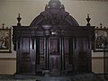 Elisabeth biechtstoel.jpg 2,288 × 1,712; 837 KB
-
 Elisabeth buiten markt.jpg 2,288 × 1,712; 790 KB
-
 Elisabeth buiten toren01.jpg 1,712 × 2,288; 794 KB
-
 Elisabeth buiten toren02.jpg 1,712 × 2,288; 772 KB
-
 Elisabeth buiten01.jpg 1,712 × 2,288; 835 KB
-
 Elisabeth buiten02.jpg 2,288 × 1,712; 834 KB
-
 Elisabeth doopvont.jpg 1,712 × 2,288; 841 KB
-
 Elisabeth elisabeth01.jpg 1,712 × 2,288; 807 KB
-
 Elisabeth elisabeth02.jpg 1,712 × 2,288; 830 KB
-
 Elisabeth elisabeth03.jpg 1,712 × 2,288; 836 KB
-
 Elisabeth elisabeth04.jpg 1,712 × 2,288; 860 KB
-
 Elisabeth elisabeth05.jpg 1,712 × 2,288; 837 KB
-
 Elisabeth gewelven hoofdaltaar boven.jpg 2,288 × 1,712; 845 KB
-
 Elisabeth gewelven klokmechanisme.jpg 1,712 × 2,288; 827 KB
-
 Elisabeth gewelven plafond01.jpg 2,288 × 1,712; 840 KB
-
 Elisabeth gewelven plafond02.jpg 2,288 × 1,712; 821 KB
-
 Elisabeth gewelven plafond03.jpg 2,288 × 1,712; 854 KB
-
 Elisabeth gewelven toren ladder.jpg 2,288 × 1,712; 834 KB
-
 Elisabeth gewelven01.jpg 1,712 × 2,288; 815 KB
-
 Elisabeth gewelven02.jpg 1,712 × 2,288; 828 KB
-
 Elisabeth gewelven03.jpg 1,712 × 2,288; 804 KB
-
 Elisabeth gewelven04.jpg 2,288 × 1,712; 816 KB
-
 Elisabeth gewelven05.jpg 1,712 × 2,288; 798 KB
-
 Elisabeth klok.jpg 1,712 × 2,288; 723 KB
-
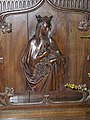
 Elisabeth maria01.jpg 2,288 × 1,712; 829 KB
-
 Elisabeth maria02.jpg 1,712 × 2,288; 815 KB
-
 Elisabeth orgel.jpg 1,622 × 2,220; 594 KB
-
 Elisabeth preekstoel.jpg 1,712 × 2,288; 823 KB
-
 Elisabeth priesterkoor01.jpg 1,712 × 2,288; 834 KB
-
 Elisabeth priesterkoor02.jpg 1,712 × 2,288; 834 KB
-
 Elisabeth ragaij.jpg 2,288 × 1,712; 830 KB
-
 Elisabeth theresia.jpg 1,712 × 2,288; 818 KB
-
 Elisabeth wapen.jpg 2,288 × 1,712; 860 KB
-
 Elisabeth02.jpg 1,712 × 2,288; 772 KB
-
 Elisabeth03.jpg 1,712 × 2,288; 807 KB
-
 Engel - Grave - 20083820 - RCE.jpg 784 × 1,200; 155 KB
-
 Engel - Grave - 20083821 - RCE.jpg 795 × 1,200; 161 KB
-
 Expositietroon hoofdaltaar - Grave - 20083815 - RCE.jpg 788 × 1,200; 253 KB
-
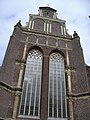
 Exterieur naar het noorden - Grave - 20083696 - RCE.jpg 958 × 1,200; 243 KB
-
 Exterieur naar het zuiden - Grave - 20083697 - RCE.jpg 962 × 1,200; 249 KB
-
 Exterieur noord-west zijde - Grave - 20083688 - RCE.jpg 956 × 1,200; 254 KB
-
 Exterieur zuid-oost zijde - Grave - 20083743 - RCE.jpg 1,200 × 941; 335 KB
-
 Exterieur zuid-oost zijde - Grave - 20083744 - RCE.jpg 1,200 × 957; 369 KB
-
 Exterieur zuid-oost zijde - Grave - 20083745 - RCE.jpg 1,200 × 957; 351 KB
-
 Exterieur zuid-west zijde - Grave - 20083690 - RCE.jpg 952 × 1,200; 264 KB
-

-

-

-
-

-

-

-

-

-

-
 Fundering gothische toren, naar het noord-oosten - Grave - 20083992 - RCE.jpg 1,195 × 1,200; 454 KB
-

-

-

-

-

-

-

-

-

-

-
 Gedeelte hoofdaltaar voor restauratie - Grave - 20083817 - RCE.jpg 1,200 × 788; 193 KB
-
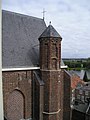
 Geveltop noord-transept - Grave - 20083695 - RCE.jpg 941 × 1,200; 325 KB
-
 Gevonden bouwfragmenten - Grave - 20083869 - RCE.jpg 1,195 × 1,200; 292 KB
-
 Gevonden bouwfragmenten - Grave - 20083870 - RCE.jpg 1,195 × 1,200; 320 KB
-
 Gewelf aanzet in noordzijde koor - Grave - 20083750 - RCE.jpg 1,192 × 1,200; 390 KB
-
 Gewelfaanzetten in het koor - Grave - 20083749 - RCE.jpg 1,200 × 1,197; 365 KB
-
 Gewelven in het koor in afwerkstadium - Grave - 20083791 - RCE.jpg 1,200 × 788; 279 KB
-
 Gewelven in het koor in afwerkstadium - Grave - 20083792 - RCE.jpg 788 × 1,200; 278 KB
-
 Gewelven in koor tijdens restauratie - Grave - 20083788 - RCE.jpg 1,200 × 788; 230 KB
-
 Gewelven tijdens restauratie - Grave - 20083787 - RCE.jpg 1,200 × 788; 212 KB
-

-

-

-
 Grave - Arsenaalplein.jpg 2,592 × 1,944; 1.54 MB
-
 Grave - Hoofdwagt 1 (vvv).jpg 1,944 × 2,592; 1.51 MB
-
 Grave - Hoofdwagt 1.jpg 2,592 × 1,944; 1.13 MB
-
 Grave kerk.JPG 2,100 × 1,400; 401 KB
-
 Grave skyline maaskade.jpg 1,760 × 900; 462 KB
-
 H. Barbara tijdens onderzoek - Grave - 20083829 - RCE.jpg 788 × 1,200; 167 KB
-
 H. Catharina tijdens onderzoek van polychromie - Grave - 20083830 - RCE.jpg 788 × 1,200; 169 KB
-
 H. Cecillia voor restauratie - Grave - 20083827 - RCE.jpg 791 × 1,200; 179 KB
-
 H. Elisabeth - Grave - 20356922 - RCE.jpg 784 × 1,200; 150 KB
-
 H. Elisabeth tijdens onderzoek van Polychromie - Grave - 20083831 - RCE.jpg 788 × 1,200; 187 KB
-
 H. Franciscus? - Grave - 20083823 - RCE.jpg 791 × 1,200; 149 KB
-
 H. Maria met Kind - Grave - 20356923 - RCE.jpg 783 × 1,200; 161 KB
-
 H. Theresia - Grave - 20083822 - RCE.jpg 793 × 1,200; 156 KB
-
 Heilig Hart beeld - Grave - 20356927 - RCE.jpg 784 × 1,200; 166 KB
-

-
 Hoofdaltaar en preekstoel, reproductie van foto - Grave - 20083741 - RCE.jpg 845 × 1,200; 239 KB
-
 Hoofdaltaar voor restauratie - Grave - 20083816 - RCE.jpg 1,200 × 789; 208 KB
-
 Ingestort west gedeelte - Grave - 20083710 - RCE.jpg 1,200 × 886; 233 KB
-
 Interieur - Grave - 20083735 - RCE.jpg 1,200 × 958; 207 KB
-
 Interieur - Grave - 20083736 - RCE.jpg 960 × 1,200; 258 KB
-
 Interieur - Grave - 20083737 - RCE.jpg 958 × 1,200; 260 KB
-
 Interieur - Grave - 20083738 - RCE.jpg 958 × 1,200; 265 KB
-
 Interieur beeld - Grave - 20083717 - RCE.jpg 966 × 1,200; 201 KB
-
 Interieur beelden - Grave - 20083716 - RCE.jpg 1,200 × 963; 194 KB
-
 Interieur beelden - Grave - 20083718 - RCE.jpg 967 × 1,200; 144 KB
-
 Interieur beelden - Grave - 20083719 - RCE.jpg 953 × 1,200; 249 KB
-
 Interieur beelden - Grave - 20083720 - RCE.jpg 958 × 1,200; 204 KB


.jpg)
.jpg)


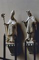
_en_St._Johannes_Nepomuk(r),_na_restauratie_-_Grave_-_20363562_-_RCE.jpg)


_-_Grave_-_20083941_-_RCE.jpg)


_-_Grave_-_20083923_-_RCE.jpg)


.jpg)


