Category:Sint Agathakerk (Harreveld)
Jump to navigation
Jump to search
| Object location | | View all coordinates using: OpenStreetMap |
|---|
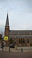
church building in Oost Gelre, Netherlands  | |||||
| Upload media | |||||
| Instance of | |||||
|---|---|---|---|---|---|
| Location | Harreveld, Oost Gelre, Gelderland, Netherlands | ||||
| Street address |
| ||||
| Located on street |
| ||||
| Architect | |||||
| Heritage designation |
| ||||
| Inception |
| ||||
| Religion or worldview | |||||
 | |||||
|
This is a category about rijksmonument number 516287
|
| Address |
|
Media in category "Sint Agathakerk (Harreveld)"
The following 3 files are in this category, out of 3 total.
-
 Harreveld kerk.JPG 1,080 × 1,920; 586 KB
-
 Harreveld, de Sint Agathakerk RM516287 foto5 2015-08-21 16.57.jpg 3,235 × 4,313; 10.73 MB
-
 Harreveld, kerk 2009-07-26 12.03.JPG 1,944 × 2,592; 3.22 MB

