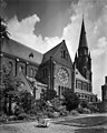
Category:Sint-Werenfriduskerk (Wervershoof)
Jump to navigation
Jump to search
| Object location | | View all coordinates using: OpenStreetMap |
|---|
 | |||||
| Upload media | |||||
| Instance of | |||||
|---|---|---|---|---|---|
| Location | Wervershoof, North Holland, Netherlands | ||||
| Has part(s) | |||||
| Heritage designation |
| ||||
 | |||||
Kerk:
|
This is a category about rijksmonument number 38671
|
Pastorie:
|
This is a category about rijksmonument number 501527
|
| Address |
|
Media in category "Sint-Werenfriduskerk (Wervershoof)"
The following 18 files are in this category, out of 18 total.
-
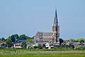
 20180712 Zicht op Wervershoof met Sint-Werenfriduskerk1.jpg 5,033 × 3,354; 3.28 MB
-
 20180712 Zicht op Wervershoof met Sint-Werenfriduskerk3.jpg 5,081 × 3,386; 3.22 MB
-
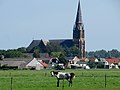
 3620180712 Zicht op Wervershoof met Sint-Werenfriduskerk2.jpg 4,941 × 3,295; 1.6 MB
-
 Apsis van de St. Werenfridus, Wervershoof.JPG 2,592 × 3,888; 3.25 MB
-
 Exterieur - Wervershoof - 20253583 - RCE.jpg 960 × 1,200; 245 KB
-
 Exterieur - Wervershoof - 20253584 - RCE.jpg 952 × 1,200; 158 KB
-
 Exterieur - Wervershoof - 20253585 - RCE.jpg 948 × 1,200; 167 KB
-
 Exterieur - Wervershoof - 20253586 - RCE.jpg 1,200 × 943; 325 KB
-
 Interieur naar 't orgel - Wervershoof - 20253582 - RCE.jpg 954 × 1,200; 182 KB
-
 Interieur naar het koor - Wervershoof - 20253587 - RCE.jpg 957 × 1,200; 186 KB
-
 Interieur, aanzicht orgel, orgelnummer 1635 - Wervershoof - 20370310 - RCE.jpg 962 × 1,200; 173 KB
-
 Koperen kandelaars - Wervershoof - 20253581 - RCE.jpg 937 × 1,200; 175 KB
-
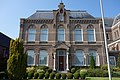 Pastorie van de St. Werenfridus, Wervershoof.JPG 3,888 × 2,592; 5.31 MB
-
 Portaal St. Werenfridus, Wervershoof.JPG 2,592 × 3,888; 4.32 MB
-
 Sint-Werenfriduskerk (Wervershoof).JPG 2,592 × 3,888; 4.05 MB
-
 St. Werenfriduskerk Wervershoof.jpg 4,000 × 3,000; 1.26 MB
-

-
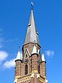 Torenspits Sint Werenfriduskerk Wervershoof.jpg 3,672 × 4,896; 1.24 MB


.JPG)

