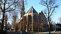
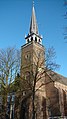
Category:Sint-Nicolaaskerk, Broek in Waterland
Jump to navigation
Jump to search
| Object location | | View all coordinates using: OpenStreetMap |
|---|
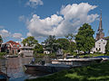
church in Broek in Waterland, Netherlands  | |||||
| Upload media | |||||
| Instance of | |||||
|---|---|---|---|---|---|
| Named after | |||||
| Dedicated to | |||||
| Location | Broek in Waterland, Broek in Waterland | ||||
| Street address |
| ||||
| Located on street |
| ||||
| Heritage designation |
| ||||
 | |||||
Nederlands: Nicolaaskerk - anno 1639
|
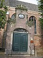
This is a category about rijksmonument number 11042
|
| Address |
|
Subcategories
This category has only the following subcategory.
I
Media in category "Sint-Nicolaaskerk, Broek in Waterland"
The following 54 files are in this category, out of 54 total.
-
 1151 Broek in Waterland, Netherlands - panoramio (11).jpg 2,048 × 1,155; 738 KB
-
 1151 Broek in Waterland, Netherlands - panoramio (38).jpg 2,048 × 1,155; 545 KB
-

-
 Broek in waterland 027.JPG 2,448 × 3,264; 1.89 MB
-
 Broek in waterland kerk.jpg 500 × 281; 170 KB
-
 Broek in Waterland, de Sint Nicolaaskerk in straatzicht RM114402 foto2 2014-05-25 10.20.jpg 4,416 × 3,312; 8.57 MB
-
 Broek in Waterland, view to the Sint-Nicolaaskerk.jpg 2,497 × 1,631; 993 KB
-
 Brook in woaterland.jpg 281 × 500; 135 KB
-
 Detail goot - Broek in Waterland - 20043671 - RCE.jpg 1,200 × 1,195; 424 KB
-
 Detail Kerkplein 13.JPG 1,944 × 2,592; 919 KB
-
 Detail zuidgevel - Broek in Waterland - 20043666 - RCE.jpg 1,200 × 1,200; 424 KB
-
 Entreeportaal kerk, Broek in Waterland 02.JPG 2,592 × 3,888; 4.31 MB
-
 Entreeportaal kerk, Broek in Waterland.JPG 2,592 × 3,888; 4.17 MB
-
 Exterieur Kerk - Broek in Waterland - 20043646 - RCE.jpg 860 × 1,200; 349 KB
-
 Exterieur Kerk - Broek in Waterland - 20043647 - RCE.jpg 859 × 1,200; 241 KB
-
 Exterieur naar het noord-westen - Broek in Waterland - 20043654 - RCE.jpg 1,200 × 880; 338 KB
-
 Exterieur naar het noorden - Broek in Waterland - 20043648 - RCE.jpg 886 × 1,200; 248 KB
-
 Exterieur naar het westen - Broek in Waterland - 20043649 - RCE.jpg 1,200 × 883; 232 KB
-
 Exterieur naar het westen - Broek in Waterland - 20043650 - RCE.jpg 1,200 × 879; 289 KB
-
 Exterieur naar het westen - Broek in Waterland - 20043651 - RCE.jpg 880 × 1,200; 319 KB
-
 Exterieur naar het zuid-westen - Broek in Waterland - 20043652 - RCE.jpg 1,200 × 892; 273 KB
-
 Exterieur naar het zuid-westen - Broek in Waterland - 20043653 - RCE.jpg 878 × 1,200; 223 KB
-
 Exterieur NOORDGEVEL - Broek in Waterland - 20282865 - RCE.jpg 1,200 × 953; 384 KB
-
 Exterieur OOSTGEVEL - Broek in Waterland - 20282866 - RCE.jpg 953 × 1,200; 348 KB
-
 Exterieur OVERZICHT - Broek in Waterland - 20311515 - RCE.jpg 1,191 × 1,200; 375 KB
-
 Exterieur OVERZICHT - Broek in Waterland - 20311516 - RCE.jpg 1,186 × 1,200; 343 KB
-
 Exterieur OVERZICHT TOREN - Broek in Waterland - 20282863 - RCE.jpg 958 × 1,200; 222 KB
-
-
 Exterieur OVERZICHT, PASTORIE - Broek in Waterland - 20282862 - RCE.jpg 960 × 1,200; 311 KB
-
 Exterieur ZUIDGEVEL - Broek in Waterland - 20282867 - RCE.jpg 1,200 × 953; 425 KB
-
 Gezicht op het dorp - Broek in Waterland - 20373520 - RCE.jpg 1,200 × 1,193; 218 KB
-
 Hervormde Sint Nicolaaskerk.JPG 1,944 × 2,592; 607 KB
-
 Ingang noordgevel - Broek in Waterland - 20043670 - RCE.jpg 1,197 × 1,200; 431 KB
-
 Ingang zuidgevel - Broek in Waterland - 20043665 - RCE.jpg 1,200 × 1,200; 439 KB
-
 Kerkplein 13.JPG 1,944 × 2,592; 800 KB
-
 N.H. kerk Broek in Waterland (2).JPG 2,244 × 2,968; 2.07 MB
-
 N.H. kerk Broek in Waterland.JPG 3,024 × 2,268; 2.29 MB
-
 N.H. kerk Ingang.JPG 2,304 × 3,072; 1.71 MB
-
 Noordgevel - Broek in Waterland - 20043669 - RCE.jpg 1,200 × 953; 327 KB
-

-
 Oostgevel - Broek in Waterland - 20043667 - RCE.jpg 953 × 1,200; 318 KB
-
 Oostgevel - Broek in Waterland - 20043668 - RCE.jpg 950 × 1,200; 264 KB
-
 Overstroming, watersnood, SFA022813642.jpg 4,196 × 2,360; 1.45 MB
-
 Overzicht, reproductie van oude foto - Broek in Waterland - 20043642 - RCE.jpg 1,200 × 809; 172 KB
-
 Overzicht, woonhuizen aan de Dorpsstraat - Broek in Waterland - 20372770 - RCE.jpg 1,200 × 1,200; 302 KB
-
 Toren - Broek in Waterland - 20043643 - RCE.jpg 784 × 1,200; 183 KB
-
 Toren - Broek in Waterland - 20043644 - RCE.jpg 782 × 1,200; 221 KB
-
 Toren - Broek in Waterland - 20043645 - RCE.jpg 788 × 1,200; 184 KB
-
 Zicht vanuit het westen - Broek in Waterland - 20323312 - RCE.jpg 819 × 1,200; 175 KB
-
 Zuid-west zijde toren - Broek in Waterland - 20043660 - RCE.jpg 1,197 × 1,200; 363 KB
-
 Zuid-westgevel - Broek in Waterland - 20043662 - RCE.jpg 954 × 1,200; 312 KB
-
 Zuidgevel - Broek in Waterland - 20043661 - RCE.jpg 965 × 1,200; 376 KB
-
 Zuidgevel - Broek in Waterland - 20043663 - RCE.jpg 951 × 1,200; 283 KB
-
 Zuidgevel - Broek in Waterland - 20043664 - RCE.jpg 1,200 × 950; 342 KB
.jpg)
.jpg)


.JPG)


