Category:Sint-Georgiuskerk, Bredevoort
Jump to navigation
Jump to search
| Object location | | View all coordinates using: OpenStreetMap |
|---|
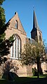
church building in Aalten, Netherlands  | |||||
| Upload media | |||||
| Instance of | |||||
|---|---|---|---|---|---|
| Location | Bredevoort, Aalten, Gelderland, Netherlands | ||||
| Street address |
| ||||
| Architectural style | |||||
| Architect | |||||
| Heritage designation | |||||
| Inception |
| ||||
| Significant event |
| ||||
| Religion or worldview | |||||
 | |||||
|
This is a category about a municipal monument in Aalten with number wiki7126AM14 |
Nederlands: Bredevoort, Kerkstraat 16 - Heilig Hart van Jezuskerk - anno 1876
Media in category "Sint-Georgiuskerk, Bredevoort"
The following 20 files are in this category, out of 20 total.
-
 7126 Bredevoort, Netherlands - panoramio (21).jpg 4,896 × 3,264; 5.67 MB
-
 Bredevoort (NL), Sint-Georgius-Kerk -- 2018 -- 1792.jpg 3,501 × 6,149; 10.82 MB
-
 Bredevoort (NL), Sint-Georgius-Kerk -- 2018 -- 1808.jpg 6,720 × 3,780; 15.88 MB
-
 Bredevoort 004.jpg 870 × 1,248; 189 KB
-
 Bredevoort gregrorius kerk.jpg 281 × 500; 113 KB
-
 Bredevoort Gregrorius kerk.jpg 3,205 × 2,377; 1.48 MB
-
 Bredevoort gregroriuskerk interieur.jpg 400 × 300; 96 KB
-
 Bredevoort, de Sint Georgiuskerk GM0197wiki7126AM14 foto5 2015-05-14 09.39.jpg 3,104 × 4,085; 6.19 MB
-
 Bredevoort, Georgiustsjerke.jpg 6,000 × 4,000; 13.62 MB
-
 Bredevoort9.JPG 2,112 × 2,816; 2.06 MB
-
 Catholic church of Bredevoort near Aalten - panoramio.jpg 3,264 × 4,928; 2.81 MB
-
 Exterieur - Bredevoort - 20041785 - RCE.jpg 965 × 1,200; 207 KB
-
 Exterieur - Bredevoort - 20041786 - RCE.jpg 957 × 1,200; 262 KB
-
 Exterieur - Bredevoort - 20041787 - RCE.jpg 941 × 1,200; 150 KB
-
 Gregroriuskerk bredevoort.jpg 1,080 × 1,920; 625 KB
-
 Interieur - Bredevoort - 20041789 - RCE.jpg 972 × 1,200; 154 KB
-
 Interieur naar 't koor - Bredevoort - 20041788 - RCE.jpg 965 × 1,200; 160 KB
-
 Reliëf St.Joris - Bredevoort - 20041784 - RCE.jpg 950 × 1,200; 211 KB
-
 RKkerk-bredevoort 032.jpg 640 × 480; 273 KB
-
 St Gregroriuskerk - panoramio.jpg 360 × 640; 181 KB
.jpg)
,_Sint-Georgius-Kerk_--_2018_--_1792.jpg)
,_Sint-Georgius-Kerk_--_2018_--_1808.jpg)


