Category:Sint-Andrieskerk (Amerongen)
Jump to navigation
Jump to search
| Object location | | View all coordinates using: OpenStreetMap |
|---|
church building in Utrechtse Heuvelrug, Netherlands   | |||||
| Upload media | |||||
| Instance of | |||||
|---|---|---|---|---|---|
| Location | Amerongen, Utrecht, Netherlands | ||||
| Street address |
| ||||
| Located on street |
| ||||
| Heritage designation |
| ||||
| Inception |
| ||||
| Significant event |
| ||||
| official website | |||||
 | |||||
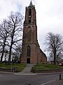
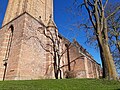
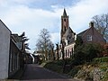
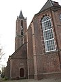
Nederlands: De Andrieskerk is een kerk uit de 12e eeuw in de Nederlandse plaats Amerongen. Sinds de reformatie zit hier de Hervormde Gemeente.
Kerk:
|
This is a category about rijksmonument number 7755
|
Toren:
|
This is a category about rijksmonument number 7756
|
| Address |
|
Subcategories
This category has the following 3 subcategories, out of 3 total.
I
T
- Tower of Andrieskerk, Amerongen (27 F)
Media in category "Sint-Andrieskerk (Amerongen)"
The following 43 files are in this category, out of 43 total.
-
 2006-04-25 10.41 Amerongen, kerk.JPG 1,704 × 2,272; 1.35 MB
-
 20170731 19 Amerongen (36318097575).jpg 5,184 × 3,456; 2.67 MB
-
 3958 Amerongen, Netherlands - panoramio (145).jpg 2,048 × 1,155; 801 KB
-
 3958 Amerongen, Netherlands - panoramio (148).jpg 2,048 × 1,155; 603 KB
-
 3958 Amerongen, Netherlands - panoramio (156).jpg 2,048 × 1,155; 654 KB
-
 3958 Amerongen, Netherlands - panoramio (45).jpg 2,048 × 1,375; 530 KB
-
 3958 Amerongen, Netherlands - panoramio (93).jpg 2,048 × 1,148; 668 KB
-
 Amerongen - Andrieskerk 1.jpg 3,264 × 2,448; 1.98 MB
-
 Amerongen - Andrieskerk 2.jpg 3,264 × 2,448; 1.87 MB
-
 Amerongen - Andrieskerk 3.jpg 3,264 × 2,448; 1.89 MB
-
 Amerongen - Andrieskerk 4.jpg 3,264 × 2,448; 2.19 MB
-
 Amerongen - Andrieskerk 5.jpg 3,264 × 2,448; 2.31 MB
-
 Amerongen - Andrieskerk RM7755.JPG 2,580 × 3,295; 1.37 MB
-
 Amerongen - Andrieskerk RM7756.JPG 3,456 × 4,608; 2.42 MB
-
 AMERONGEN ANDRIESKERK 2.jpg 4,608 × 3,456; 5.17 MB
-
 AMERONGEN ANDRIESKERK 3.jpg 4,608 × 3,456; 5.59 MB
-
 Amerongen Andrieskerk RM7756.JPG 3,456 × 4,608; 9.22 MB
-
 Amerongen Andrieskerk RM7756.png 3,456 × 4,608; 19.29 MB
-
 AMERONGEN ANDRIESKERK.jpg 4,608 × 3,456; 5.39 MB
-
 Amerongen kerk.jpg 400 × 300; 98 KB
-
 Amerongen november 2010 (39).jpg 3,264 × 2,448; 2.7 MB
-
 Amerongen november 2010 (86).jpg 2,448 × 3,264; 2.26 MB
-
 Amerongen november 2010 (87).jpg 2,448 × 3,264; 2.3 MB
-
 Amerongen november 2010 (96).jpg 3,264 × 2,448; 1.88 MB
-
 Amerongen, de Andrieskerk RM7755 IMG 6547 2020-07-12 15.52.jpg 2,777 × 4,309; 8.37 MB
-
 Andrieskerk Amerongen.jpg 6,016 × 4,016; 17.27 MB
-
 Exterieur naar het noord-westen - Amerongen - 20008414 - RCE.jpg 959 × 1,200; 352 KB
-
 Exterieur OVERZICHT MET ARMENHUISJES - Amerongen - 20313947 - RCE.jpg 1,200 × 1,146; 290 KB
-
 Exterieur zuid-oost zijde - Amerongen - 20008421 - RCE.jpg 957 × 1,200; 413 KB
-
 Exterieur zuid-oost zijde - Amerongen - 20008422 - RCE.jpg 953 × 1,200; 397 KB
-

-
 Gezicht op het dorp vanuit het zuiden - Amerongen - 20008401 - RCE.jpg 1,200 × 961; 293 KB
-
 Gezicht vanuit het Westen, vanaf de Dijk - Arnhem - 20008402 - RCE.jpg 1,200 × 1,018; 235 KB
-
 Kasteel Amerongen - onderdeel 50.jpg 2,448 × 3,264; 2.26 MB
-
 Kerk en toren vanuit het oosten - Amerongen - 20008409 - RCE.jpg 886 × 1,200; 275 KB
-
 Kerk exterieur naar het noord-westen - Amerongen - 20008413 - RCE.jpg 1,200 × 956; 351 KB
-
 Noordgevel - Amerongen - 20001544 - RCE.jpg 947 × 1,200; 370 KB
-
 OVERZICHT - Amerongen - 20266351 - RCE.jpg 961 × 1,200; 359 KB
-
 Overzicht noordgevel - Amerongen - 20001543 - RCE.jpg 1,200 × 950; 331 KB
-
 Overzicht, noordwest zijde - Amerongen - 20370463 - RCE.jpg 1,200 × 1,200; 347 KB
-
 Voorgevels - Amerongen - 20008811 - RCE.jpg 1,200 × 963; 323 KB
-
 Zicht op de Nederstraat met de Hervormde kerk - Amerongen - 20313940 - RCE.jpg 1,192 × 1,200; 328 KB
-
 Zicht op de Nederstraat met de Hervormde kerk - Amerongen - 20396554 - RCE.jpg 1,200 × 1,200; 236 KB
.jpg)
.jpg)
.jpg)
.jpg)
.jpg)
.jpg)


.jpg)
.jpg)
.jpg)
.jpg)


