Category:Singel 500, Amsterdam
Jump to navigation
Jump to search
| Object location | | View all coordinates using: OpenStreetMap |
|---|
 | |||||
| Upload media | |||||
| Instance of |
| ||||
|---|---|---|---|---|---|
| Location | Amsterdam, North Holland, Netherlands | ||||
| Street address |
| ||||
| Located on street | |||||
| Heritage designation |
| ||||
 | |||||
|
This is a category about rijksmonument number 5414
|
| Address |
|
Media in category "Singel 500, Amsterdam"
The following 4 files are in this category, out of 4 total.
-
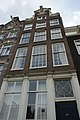 Amsterdam - Singel 500.JPG 3,056 × 4,592; 3.71 MB
-
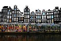 Bloemenmarkt 2008 (3).jpg 1,024 × 681; 657 KB
-
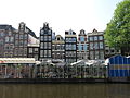 Houses in Amsterdam (15654622583).jpg 4,000 × 3,000; 3.04 MB
-
 The Flower Market.jpg 3,072 × 2,304; 1.29 MB
.jpg)
.jpg)
