Category:Simplified Chinese maps of South Korea
Jump to navigation
Jump to search
Media in category "Simplified Chinese maps of South Korea"
The following 16 files are in this category, out of 16 total.
-
 2016 20대 총선 지역구 zh-hans.svg 1,477 × 1,443; 583 KB
-
 Battle of Kyongju (zh-hans).jpg 1,020 × 916; 299 KB
-
 Battle of Osan Map (zh-hans).jpg 503 × 769; 112 KB
-
 Inchon landing map (zh-hans).svg 702 × 462; 126 KB
-
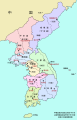 Korea-8provinces (zh-hans).svg 800 × 1,245; 274 KB
-
 Korea-8provinces.jpg 800 × 1,245; 333 KB
-
 KTX linemap zh-hans.svg 1,324 × 1,591; 563 KB
-
 Naktong Defense (zh-hans).jpg 587 × 945; 281 KB
-
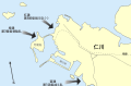
 P'ohang-dong Map 1 (zh-hans).jpg 600 × 772; 148 KB
-
 Pusan Perimeter (zh-hans).jpg 350 × 572; 72 KB
-

-

-

-

-
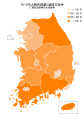 South Korea Nationwide Local Elections 2010 HMCP rate (Zh-hans).svg 1,233 × 1,750; 277 KB
-
 South Korea Nationwide Local Elections 2010 HMCP(Zh-hans).svg 1,233 × 1,750; 223 KB

.jpg)
.jpg)
.svg)
.svg)


.jpg)
.jpg)
.jpg)
_zh-hans.png)
_zh-hans.png)
_zh-hans.png)
_zh-hans.png)
.svg)
.svg)