Category:Signs in Worcester County, Massachusetts
Jump to navigation
Jump to search
Subcategories
This category has the following 2 subcategories, out of 2 total.
M
Media in category "Signs in Worcester County, Massachusetts"
The following 22 files are in this category, out of 22 total.
-
 Boston Post Road Milestone 65, Brookfield MA.jpg 2,272 × 1,704; 2.1 MB
-
 Boston Post Road, 66 Miles - Brookfield, MA - DSC04746.JPG 3,240 × 4,320; 4.89 MB
-
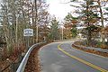 Entering Groton eastbound on MA Route 225, MA.jpg 2,572 × 1,716; 1.18 MB
-
 Fisherville sign with Main Street home in the background.jpg 2,708 × 3,238; 4.08 MB
-
 Historic Marker, Rivulet Mill Complex, North Uxbridge, MA.jpg 3,264 × 2,448; 3.39 MB
-
 Historic sign, North Lancaster MA.jpg 4,032 × 3,024; 4.84 MB
-
 Ironstone, MA 037.jpg 3,648 × 2,736; 2.19 MB
-
 MA Route 101 southbound entering Gardner MA.jpg 2,592 × 1,728; 725 KB
-
 MA Route 122 southbound entering Oakham MA.jpg 3,264 × 2,448; 2.19 MB
-
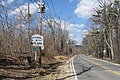 MA Route 56 northbound entering Rutland MA.jpg 2,592 × 1,728; 1.23 MB
-
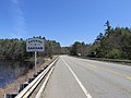
 MA Route 67 northbound entering New Braintree MA.jpg 2,046 × 1,365; 651 KB
-
 MA Route 98 entering Uxbridge MA.jpg 5,472 × 3,648; 6.49 MB
-
 Milford Upper Charles Trail beginning, Milford MA.jpg 4,032 × 3,024; 8.03 MB
-
 Milford Upper Charles Trail rest area sign, Milford MA.jpg 4,032 × 3,024; 7.02 MB
-
 Sign, Ashburnham Rail Trail, Ashburnham MA.jpg 4,032 × 3,024; 6.99 MB
-
 Sign, MCRT Sterling Section, Sterling MA.jpg 4,032 × 3,024; 7.18 MB
-
 Sign, Quinebaug River Rail Trail, Dudley MA.jpg 4,032 × 3,024; 5.42 MB
-
 Sign, Southern New England Trunkline Trail, East Douglas MA.jpg 4,032 × 3,024; 7.29 MB
-
 Town Pound, Charlton MA.jpg 1,730 × 2,590; 1.29 MB
-
 US Route 20 westbound entering Sturbridge MA.jpg 2,592 × 1,728; 1.04 MB
-
 Whitinsville Historic District Massachusetts.jpg 3,000 × 1,949; 2.79 MB
-
 Willard House and Clock Museum plaque - North Grafton, MA - DSC04498.JPG 4,320 × 3,240; 5.57 MB


