Category:Signs in Aberdeenshire
Jump to navigation
Jump to search
Subcategories
This category has the following 3 subcategories, out of 3 total.
Media in category "Signs in Aberdeenshire"
The following 200 files are in this category, out of 206 total.
(previous page) (next page)-
 "Rabbit control in progress" - geograph.org.uk - 835740.jpg 640 × 431; 115 KB
-
 'Fire Danger' notice - geograph.org.uk - 1209416.jpg 640 × 480; 96 KB
-
 'Gordon Way' signpost - geograph.org.uk - 1232889.jpg 640 × 471; 103 KB
-
 'The Three Straths' - geograph.org.uk - 883934.jpg 640 × 480; 98 KB
-
 A sign of the times - geograph.org.uk - 725842.jpg 640 × 480; 466 KB
-
 A very apt sign at Andet Farm^^ - geograph.org.uk - 308839.jpg 640 × 426; 94 KB
-
 Access to Birselasie - geograph.org.uk - 258499.jpg 640 × 480; 88 KB
-
 Access to Moss-side of Esslie - geograph.org.uk - 1615227.jpg 640 × 459; 59 KB
-
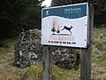
 Advice to hill walkers - geograph.org.uk - 249779.jpg 480 × 640; 76 KB
-
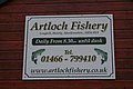 Artloch Fishings. - geograph.org.uk - 266845.jpg 640 × 426; 81 KB
-
 Auchintoul road - geograph.org.uk - 386740.jpg 640 × 480; 65 KB
-
 Bedstead sign for Tillyfar Farm - geograph.org.uk - 688859.jpg 640 × 426; 137 KB
-
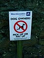 Better You Pick Up - panoramio.jpg 3,240 × 4,320; 4.37 MB
-
-
 Bogjurgan farm - geograph.org.uk - 644244.jpg 640 × 480; 28 KB
-
 Broadbog Farm - geograph.org.uk - 455805.jpg 640 × 480; 82 KB
-
 Cairngorms National Park - geograph.org.uk - 377217.jpg 640 × 480; 129 KB
-
 Caveat^ - geograph.org.uk - 792277.jpg 640 × 480; 113 KB
-
 Cliffs at Cowie - geograph.org.uk - 106228.jpg 640 × 480; 79 KB
-
 Crathes School sign - geograph.org.uk - 299672.jpg 640 × 408; 56 KB
-
 Donald Trump Golf links, entrance sign.JPG 3,072 × 2,304; 3.01 MB
-
 Douglashead Farm Sign - geograph.org.uk - 1103468.jpg 640 × 480; 50 KB
-
 Duncanstone Sign - geograph.org.uk - 422048.jpg 640 × 480; 94 KB
-
 Ellismoss Farm sign - geograph.org.uk - 509286.jpg 640 × 415; 64 KB
-
 Get off - geograph.org.uk - 364482.jpg 480 × 640; 79 KB
-
 Harbour notice, Stonehaven - geograph.org.uk - 1371992.jpg 640 × 480; 120 KB
-
 Invercauld Estate notice - geograph.org.uk - 1562587.jpg 480 × 640; 76 KB
-
 Killyquharn Farm sign - geograph.org.uk - 317596.jpg 640 × 426; 88 KB
-
 Lane to Townhead and Altons Farms. - geograph.org.uk - 309411.jpg 640 × 426; 119 KB
-
 Laneside sign for Hilton of Culsh - geograph.org.uk - 684850.jpg 640 × 426; 97 KB
-
 Moorland Track, Ballochan - geograph.org.uk - 741789.jpg 640 × 480; 91 KB
-
 Moray-Aberdeenshire border - geograph.org.uk - 381476.jpg 640 × 480; 90 KB
-

-
 Newton Skene - geograph.org.uk - 514468.jpg 526 × 384; 53 KB
-
 Only one mile to Sillyearn^ - geograph.org.uk - 256114.jpg 640 × 426; 94 KB
-
 Pathmarker in Loanhead Plantation - geograph.org.uk - 885255.jpg 640 × 480; 150 KB
-
 Public Footpath sign - geograph.org.uk - 55778.jpg 640 × 427; 46 KB
-
 Really ^ A licence ^ - geograph.org.uk - 447060.jpg 480 × 640; 112 KB
-
 Rights of way sign, Glen Tanar - geograph.org.uk - 717442.jpg 640 × 480; 185 KB
-
 Road to Kildrummy Hotel - geograph.org.uk - 1326480.jpg 640 × 480; 152 KB
-
 Roadside sign for Headroom Farm. - geograph.org.uk - 318011.jpg 640 × 426; 49 KB
-
 Roadside signs - geograph.org.uk - 178373.jpg 640 × 480; 85 KB
-

-
 Sign announcing access to Uppermuir - geograph.org.uk - 584786.jpg 640 × 480; 75 KB
-
 Sign at Farewell - Fairwell - geograph.org.uk - 470263.jpg 640 × 480; 134 KB
-
 Sign for Beechcroft Farm - geograph.org.uk - 1215670.jpg 640 × 480; 59 KB
-
 Sign for Hillocks Farm - geograph.org.uk - 887527.jpg 640 × 480; 59 KB
-
 Sign for Maryfield Farm - geograph.org.uk - 801290.jpg 480 × 640; 120 KB
-
 Sign for Pittenkerrie Farm - geograph.org.uk - 1065613.jpg 640 × 480; 63 KB
-
 Sign for Robins Cottage, South Redbriggs - geograph.org.uk - 688231.jpg 640 × 426; 185 KB
-
 Sign for Wark Farm - geograph.org.uk - 885090.jpg 640 × 510; 73 KB
-
 Sign on the "Mount Keen road" - geograph.org.uk - 548713.jpg 640 × 480; 85 KB
-
 Sign, Glen Tanar - geograph.org.uk - 988526.jpg 640 × 480; 183 KB
-

-
 Sleepytown Farm Sign - geograph.org.uk - 1271198.jpg 640 × 384; 218 KB
-
 Stone Sign for Meikle Bogs Farm - geograph.org.uk - 1136862.jpg 640 × 480; 156 KB
-
 The border of Aberdeenshire - geograph.org.uk - 945633.jpg 640 × 480; 157 KB
-
 The Old Station - geograph.org.uk - 517389.jpg 640 × 480; 114 KB
-
 Towmill Car Park Sign - geograph.org.uk - 491760.jpg 640 × 480; 74 KB
-
 Tullich kirkyard 07.jpg 2,112 × 2,816; 1.47 MB
-
 Was he lost^ - geograph.org.uk - 413819.jpg 480 × 640; 163 KB
-
 Waymark - geograph.org.uk - 6137120.jpg 640 × 427; 341 KB
-
 We Know What It Means - geograph.org.uk - 1275884.jpg 640 × 427; 240 KB
-
 Welcome to Banchory - geograph.org.uk - 107527.jpg 640 × 427; 126 KB
-
 West and East Redhill farm entrance - geograph.org.uk - 666124.jpg 640 × 426; 86 KB
-
 Who is watching^ - geograph.org.uk - 421715.jpg 480 × 640; 113 KB
-
 A Good Winter At Last - geograph.org.uk - 1419116.jpg 640 × 429; 68 KB
-
 Access to 'The Den' - geograph.org.uk - 468975.jpg 640 × 480; 113 KB
-
 Access to Auchnavenie - geograph.org.uk - 469005.jpg 640 × 463; 102 KB
-
 Access to Clashnettie - geograph.org.uk - 447011.jpg 640 × 480; 65 KB
-
 Access to Firmounth path - geograph.org.uk - 632461.jpg 640 × 480; 109 KB
-
 Access to Hilton by Lumphanan - geograph.org.uk - 298645.jpg 640 × 480; 80 KB
-
 Access to Meadowbrae - geograph.org.uk - 454990.jpg 640 × 480; 96 KB
-
 Access to the Burnside farms - geograph.org.uk - 436092.jpg 640 × 480; 147 KB
-
 An Intriguing Sign - geograph.org.uk - 766700.jpg 640 × 427; 237 KB
-

-
 Approach to Heughhead from Semeil - geograph.org.uk - 465552.jpg 640 × 480; 84 KB
-
 Auchenhove - geograph.org.uk - 353844.jpg 640 × 480; 100 KB
-
 Awaiting collection - geograph.org.uk - 509302.jpg 640 × 426; 130 KB
-
 Ballogie School 11kv Transformer Pole - geograph.org.uk - 99463.jpg 640 × 427; 56 KB
-
 Be aware, deer cull in progress - geograph.org.uk - 576749.jpg 640 × 480; 101 KB
-
 Beware lead poisoning^ - geograph.org.uk - 377830.jpg 640 × 480; 107 KB
-

-
 Cairn O'Mount - geograph.org.uk - 258353.jpg 640 × 480; 109 KB
-
 Cairnhill on a frosty morning. - geograph.org.uk - 296725.jpg 640 × 400; 70 KB
-
 Cammiewood Sand and Gravel - geograph.org.uk - 445056.jpg 480 × 640; 166 KB
-
 Cave Juggernautes - geograph.org.uk - 443450.jpg 640 × 468; 106 KB
-
 Caveat - geograph.org.uk - 420504.jpg 640 × 480; 139 KB
-
 Cave^ - geograph.org.uk - 368697.jpg 480 × 640; 128 KB
-
 Cluny signpost east of Ordhead - geograph.org.uk - 436979.jpg 640 × 472; 55 KB
-
 Coire View Cottage - geograph.org.uk - 489883.jpg 640 × 480; 119 KB
-
 Corrennie Forest - geograph.org.uk - 266035.jpg 640 × 480; 128 KB
-
 Corsedardar - geograph.org.uk - 254627.jpg 640 × 406; 57 KB
-
 Coull of Newe sign - geograph.org.uk - 446850.jpg 640 × 480; 132 KB
-
 Craiglea. - geograph.org.uk - 265554.jpg 640 × 401; 37 KB
-
 Crathienaird - geograph.org.uk - 443291.jpg 640 × 525; 77 KB
-
 Cul de Sac - geograph.org.uk - 437072.jpg 640 × 480; 142 KB
-
 Cults farm - geograph.org.uk - 256636.jpg 640 × 480; 70 KB
-
 Direction signs - geograph.org.uk - 437092.jpg 640 × 480; 134 KB
-
 Diving in the Moray Firth. - geograph.org.uk - 317976.jpg 640 × 426; 128 KB
-
 Durno House - geograph.org.uk - 405929.jpg 640 × 427; 102 KB
-
 Early warning^ - geograph.org.uk - 420569.jpg 640 × 480; 153 KB
-

-
 Entry to Drumshallock - geograph.org.uk - 305308.jpg 640 × 480; 125 KB
-
 Entry to Dubston - geograph.org.uk - 256585.jpg 640 × 480; 137 KB
-
 Farm Sign - geograph.org.uk - 462591.jpg 640 × 480; 129 KB
-
 Farquharson Park, Finzean - geograph.org.uk - 256559.jpg 480 × 640; 131 KB
-
 Fedderate - geograph.org.uk - 434148.jpg 640 × 480; 66 KB
-
 Fishery Board notice at Potarch - geograph.org.uk - 604668.jpg 480 × 640; 93 KB
-
 Foggieley tannery sign - geograph.org.uk - 373966.jpg 640 × 480; 72 KB
-
 Forestry Commission sign - geograph.org.uk - 377777.jpg 640 × 480; 123 KB
-
 Gardener's Cottage - geograph.org.uk - 257294.jpg 640 × 480; 113 KB
-
 Greenburn Farm sign - geograph.org.uk - 440152.jpg 438 × 640; 61 KB
-
 Guessing game - geograph.org.uk - 287794.jpg 640 × 480; 94 KB
-
 Home Farm, Auchenhove - geograph.org.uk - 353834.jpg 640 × 409; 50 KB
-
 House at Hillhead. - geograph.org.uk - 312098.jpg 640 × 426; 83 KB
-
 House signs on track to Corrennie Moor. - geograph.org.uk - 266040.jpg 640 × 480; 124 KB
-
 Information about Birse War Memorial - geograph.org.uk - 603479.jpg 480 × 640; 60 KB
-
 Insch sign - geograph.org.uk - 451427.jpg 480 × 640; 136 KB
-
 Invitation to Investigate - geograph.org.uk - 507656.jpg 640 × 480; 99 KB
-
 Junction for Glenkindie - geograph.org.uk - 468209.jpg 640 × 480; 78 KB
-
 Kilduthie sign - geograph.org.uk - 366598.jpg 640 × 480; 105 KB
-
 Kirkyard of Braemar - geograph.org.uk - 478505.jpg 640 × 421; 66 KB
-
 Knowhead sign - geograph.org.uk - 468089.jpg 640 × 480; 61 KB
-
 Lebhall Steading - geograph.org.uk - 378043.jpg 640 × 480; 164 KB
-
 Lyne of Skene historic monument^ - geograph.org.uk - 514356.jpg 640 × 480; 100 KB
-
 Mains of Congraig - geograph.org.uk - 259658.jpg 640 × 480; 122 KB
-
 Mains of Glencarvie - geograph.org.uk - 465982.jpg 640 × 480; 107 KB
-
 Midmar Public Hall. - geograph.org.uk - 265560.jpg 640 × 500; 59 KB
-
 Millstone sign for Commonty Farm - geograph.org.uk - 684820.jpg 640 × 426; 127 KB
-
 MONTGATEHEAD sign - geograph.org.uk - 365466.jpg 640 × 480; 59 KB
-
 Morven View sign - geograph.org.uk - 298671.jpg 640 × 480; 111 KB
-
 Muir of Dinnet NNR - geograph.org.uk - 588382.jpg 480 × 640; 98 KB
-
 Nether Bankhead Cottage. - geograph.org.uk - 266002.jpg 640 × 396; 90 KB
-
 Nether Shiels. - geograph.org.uk - 265991.jpg 640 × 480; 139 KB
-
-
 North Redbriggs Farm sign. - geograph.org.uk - 307159.jpg 640 × 426; 121 KB
-
 Novel advert - geograph.org.uk - 354566.jpg 640 × 455; 121 KB
-
 Old Lethenty Croft - geograph.org.uk - 455897.jpg 640 × 480; 85 KB
-
 Old-style signpost at Potarch - geograph.org.uk - 353357.jpg 556 × 640; 93 KB
-
 Open House - geograph.org.uk - 489033.jpg 480 × 640; 111 KB
-
 Parish of Upper Donside notice board - geograph.org.uk - 468248.jpg 480 × 640; 82 KB
-
 Penalty clause - geograph.org.uk - 364403.jpg 480 × 640; 148 KB
-
 Pet Hotel sign, Clockhill - geograph.org.uk - 459845.jpg 640 × 480; 103 KB
-
 Peterhead Fishermen's Mission Sign - geograph.org.uk - 468569.jpg 640 × 480; 86 KB
-
 Pointing the way - geograph.org.uk - 442916.jpg 640 × 427; 142 KB
-
 Road end signage at Arthrath - geograph.org.uk - 501499.jpg 640 × 480; 113 KB
-
 Road junction at Finzean - geograph.org.uk - 420575.jpg 480 × 640; 147 KB
-
 Road Junction signpost - geograph.org.uk - 437384.jpg 640 × 480; 78 KB
-
 Road sign - geograph.org.uk - 509395.jpg 640 × 425; 66 KB
-
 Roadside reminder^ - geograph.org.uk - 587322.jpg 640 × 480; 96 KB
-
 Rumbling Pots Farm Road-end signpost - geograph.org.uk - 260344.jpg 640 × 480; 39 KB
-
 Rustic signpost^ - geograph.org.uk - 366463.jpg 640 × 640; 34 KB
-
 Salmon Lodge and an old mill wheel. - geograph.org.uk - 309332.jpg 640 × 426; 131 KB
-
 Sawmill acoutrements of yesteryear. - geograph.org.uk - 266900.jpg 640 × 426; 123 KB
-
 Scottish ROW Society sign - geograph.org.uk - 443170.jpg 640 × 480; 68 KB
-
 Shooting Greens - geograph.org.uk - 359093.jpg 640 × 480; 124 KB
-
 Sign at access for Banks of Finnercy - geograph.org.uk - 387914.jpg 640 × 480; 116 KB
-
 Sign at entrance to Knockburn Loch - geograph.org.uk - 563795.jpg 640 × 480; 93 KB
-
 Sign at Little Blackpots - geograph.org.uk - 470227.jpg 640 × 480; 116 KB
-
 Sign at north entrance to Skene House - geograph.org.uk - 584123.jpg 640 × 384; 85 KB
-

-
 Sign at West Drymuir - geograph.org.uk - 459779.jpg 640 × 480; 65 KB
-
 Sign for access to Southbank farm - geograph.org.uk - 584271.jpg 640 × 480; 81 KB
-
 Sign for Corfeidly cattery - geograph.org.uk - 423201.jpg 640 × 480; 61 KB
-
 Sign for Kildrummy Castle Hotel - geograph.org.uk - 468978.jpg 640 × 480; 40 KB
-
 Sign for Knockburn Loch - geograph.org.uk - 595416.jpg 640 × 480; 104 KB
-
 Sign for Meikle Ley - geograph.org.uk - 387557.jpg 640 × 480; 135 KB
-
 Sign for Newbigging - geograph.org.uk - 426799.jpg 640 × 480; 145 KB
-
 Sign for North Gellan - geograph.org.uk - 472313.jpg 640 × 464; 115 KB
-
 Sign for right of way to Glenbervie - geograph.org.uk - 595428.jpg 640 × 480; 102 KB
-
 Sign for Shevado Sheep Cheese dairy - geograph.org.uk - 443141.jpg 589 × 442; 67 KB
-
 Sign for Whitehill - geograph.org.uk - 474008.jpg 640 × 631; 128 KB
-

-
 Signpost - geograph.org.uk - 313685.jpg 512 × 640; 296 KB
-
 Signpost - geograph.org.uk - 509338.jpg 640 × 426; 74 KB
-
 Signpost a West Crichie - geograph.org.uk - 470223.jpg 640 × 480; 141 KB
-
 Signpost at junction of the track to Kerloch - geograph.org.uk - 597046.jpg 1,704 × 2,272; 5.32 MB
-
 Signpost by road junction at Blairdaff - geograph.org.uk - 503845.jpg 535 × 640; 127 KB
-
 Signpost for Tillenteach - geograph.org.uk - 353319.jpg 640 × 480; 102 KB
-
 Signpost near Broomfield - geograph.org.uk - 366370.jpg 640 × 480; 49 KB
-
 Signpost to Comers - geograph.org.uk - 436966.jpg 640 × 431; 57 KB
-
 Signpost to Mill House - geograph.org.uk - 303954.jpg 640 × 480; 141 KB
-
 Signpost to Nowhere - geograph.org.uk - 313737.jpg 640 × 427; 217 KB
-
 Signpost to Somewhere - geograph.org.uk - 313741.jpg 640 × 478; 277 KB
-
-
 Signs at access point for two farms - geograph.org.uk - 412292.jpg 640 × 480; 135 KB
-
 Signs on the edge of Rhindbuckie Wood - geograph.org.uk - 439261.jpg 640 × 480; 124 KB
-
 South Deeside road - geograph.org.uk - 356859.jpg 640 × 480; 58 KB
-
 St Palladius' Church - geograph.org.uk - 257910.jpg 640 × 480; 92 KB
-
 Stoneyhill Farm Shop Sign - geograph.org.uk - 706587.jpg 640 × 427; 256 KB
-
 Street Sign in the Countryside ^ - geograph.org.uk - 463870.jpg 480 × 640; 106 KB
-
 Suie Hill viewpoint - geograph.org.uk - 258614.jpg 640 × 480; 89 KB
-

-
 This way to Rowanbush - geograph.org.uk - 437368.jpg 640 × 480; 139 KB
-
 Tillenturk Farm - geograph.org.uk - 258497.jpg 640 × 480; 58 KB
-
 Tillyfruskie, Finzean Estate - geograph.org.uk - 604570.jpg 480 × 640; 114 KB
-
 Torphins Golf Club - geograph.org.uk - 257694.jpg 480 × 640; 103 KB
-
 Truthful signpost - geograph.org.uk - 470257.jpg 640 × 480; 66 KB
-
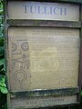
 Tullich Kirkyard notice - geograph.org.uk - 254462.jpg 640 × 439; 79 KB


