Category:Shouldham
Jump to navigation
Jump to search
village and civil parish in Norfolk, United Kingdom  | |||||
| Upload media | |||||
| Instance of | |||||
|---|---|---|---|---|---|
| Location | King's Lynn and West Norfolk, Norfolk, East of England, England | ||||
| Area |
| ||||
 | |||||
Subcategories
This category has only the following subcategory.
A
Media in category "Shouldham"
The following 161 files are in this category, out of 161 total.
-
 A field full of pigs near Shouldham Warren - geograph.org.uk - 3965300.jpg 4,320 × 3,240; 5.65 MB
-
 A hollow tree trunk - geograph.org.uk - 1739230.jpg 640 × 480; 175 KB
-
 A strip of young conifers - geograph.org.uk - 1739225.jpg 640 × 480; 165 KB
-

-
 A touch of frost is in the air - geograph.org.uk - 2163750.jpg 640 × 579; 179 KB
-
 A walk in Shouldham Warren - geograph.org.uk - 1739333.jpg 640 × 480; 171 KB
-
 Abbey Farm, Shouldham - geograph.org.uk - 2163608.jpg 640 × 509; 93 KB
-
 All Saints church, Shouldham - benchmark - geograph.org.uk - 1844303.jpg 640 × 551; 237 KB
-
 All Saints, Shouldham - Chancel - geograph.org.uk - 4442588.jpg 900 × 600; 542 KB
-
 All Saints, Shouldham - East end - geograph.org.uk - 4442587.jpg 900 × 600; 539 KB
-
 All Saints, Shouldham - geograph.org.uk - 4442607.jpg 900 × 625; 681 KB
-
 All Saints, Shouldham - geograph.org.uk - 4442608.jpg 900 × 592; 621 KB
-
 All Saints, Shouldham - Memorial stone - geograph.org.uk - 4442609.jpg 900 × 639; 799 KB
-
 All Saints, Shouldham - Monument - geograph.org.uk - 4442597.jpg 552 × 900; 371 KB
-
 All Saints, Shouldham - Piscina - geograph.org.uk - 4442600.jpg 585 × 900; 388 KB
-
 All Saints, Shouldham - Pulpit - geograph.org.uk - 4442589.jpg 900 × 615; 534 KB
-
 All Saints, Shouldham - Reredos - geograph.org.uk - 4442602.jpg 900 × 617; 642 KB
-
 All Saints, Shouldham - Roof - geograph.org.uk - 4442595.jpg 900 × 600; 558 KB
-
 All Saints, Shouldham - Roof - geograph.org.uk - 4442605.jpg 900 × 600; 430 KB
-

-

-

-

-
 An ancient site - geograph.org.uk - 1738431.jpg 640 × 480; 139 KB
-
 And here they are - geograph.org.uk - 4131674.jpg 639 × 700; 110 KB
-

-
 Autumn colours in the hedgerow - geograph.org.uk - 2162209.jpg 640 × 480; 204 KB
-
 Autumn hedgerow - geograph.org.uk - 2162112.jpg 640 × 480; 128 KB
-

-
 Avenue of trees from Mill Farm, Fincham - geograph.org.uk - 2162203.jpg 640 × 480; 182 KB
-
 Busy day at RAF Marham - geograph.org.uk - 4131643.jpg 640 × 480; 173 KB
-
 Chapel Hill, Marham - geograph.org.uk - 2163409.jpg 640 × 480; 90 KB
-
 Circular walk in Shouldham Warren - geograph.org.uk - 1739348.jpg 640 × 480; 111 KB
-
 Clearfell in Shouldham Warren - geograph.org.uk - 1739245.jpg 640 × 480; 141 KB
-
 Clearfell in Shouldham Warren - geograph.org.uk - 1739258.jpg 640 × 480; 145 KB
-
 Clearfell in Shouldham Warren - geograph.org.uk - 1739344.jpg 640 × 480; 142 KB
-
 Colts Hall - geograph.org.uk - 1738648.jpg 640 × 465; 167 KB
-
 Cottages along Lynn Road - geograph.org.uk - 1738615.jpg 640 × 480; 99 KB
-
 Cottages by the village green - geograph.org.uk - 1738622.jpg 640 × 480; 101 KB
-

-
 Cottages in Lynn Road - geograph.org.uk - 1738614.jpg 640 × 480; 107 KB
-
 Cottages in Shouldham - geograph.org.uk - 1738619.jpg 640 × 480; 122 KB
-
 Crop breaking through before the winter - geograph.org.uk - 4402335.jpg 640 × 480; 118 KB
-
 Cross roads at Shouldham warren - geograph.org.uk - 2074923.jpg 640 × 481; 87 KB
-
 Crowds gathering at RAF Marham - geograph.org.uk - 4131649.jpg 640 × 394; 101 KB
-
-

-
 Deep ditch in Shouldham Warren - geograph.org.uk - 1739206.jpg 640 × 480; 126 KB
-
 Ditch in Shouldham Warren - geograph.org.uk - 1739175.jpg 640 × 473; 124 KB
-
 Drainage ditch - geograph.org.uk - 823144.jpg 480 × 640; 81 KB
-
 Drainage ditch - geograph.org.uk - 823148.jpg 480 × 640; 144 KB
-
 Earthworks in field east of Shouldham - geograph.org.uk - 1738424.jpg 640 × 480; 133 KB
-
 Earthworks in field east of Shouldham - geograph.org.uk - 1738428.jpg 640 × 480; 134 KB
-
 Earthworks in field east of Shouldham - geograph.org.uk - 1738607.jpg 640 × 480; 111 KB
-
 Entering Shouldham from the west - geograph.org.uk - 4402325.jpg 640 × 480; 61 KB
-
 Entrance to Shouldham Hall Care Home - geograph.org.uk - 1738654.jpg 640 × 480; 156 KB
-
 Farm building being converted to housing - geograph.org.uk - 5109861.jpg 4,093 × 3,071; 4.29 MB
-
 Farm track off Spring Lane, Shouldham - geograph.org.uk - 3963696.jpg 4,320 × 3,240; 5.64 MB
-
 Farmland north of Gallow Lane - geograph.org.uk - 5110002.jpg 4,057 × 3,043; 3.64 MB
-
 Field barns beside Marham Road - geograph.org.uk - 2163445.jpg 640 × 480; 110 KB
-
 Footpath over farmland - geograph.org.uk - 5109919.jpg 4,320 × 3,240; 4.13 MB
-

-
 Forbidden path^ - geograph.org.uk - 2162220.jpg 640 × 480; 197 KB
-
 Forest clearing - geograph.org.uk - 823135.jpg 640 × 480; 101 KB
-
 Forest walk - geograph.org.uk - 823118.jpg 480 × 640; 131 KB
-
 Forest Walk at Shouldham warren - geograph.org.uk - 2074917.jpg 640 × 481; 124 KB
-
 Forest walk at Shouldham Warren - geograph.org.uk - 2075672.jpg 640 × 481; 95 KB
-
 Gnarled tree stump - geograph.org.uk - 1856367.jpg 640 × 480; 102 KB
-
 Golden oaks in a country lane - geograph.org.uk - 2162151.jpg 640 × 480; 123 KB
-
 Heading home - geograph.org.uk - 2163701.jpg 640 × 626; 185 KB
-
 Hill Plantation near Shouldham - geograph.org.uk - 5109242.jpg 4,285 × 3,213; 4.06 MB
-
 Inquisitive pigs near Shouldham Warren - geograph.org.uk - 3965206.jpg 4,320 × 3,240; 5.42 MB
-

-
 Large field at Button Fen, Marham - geograph.org.uk - 2163738.jpg 640 × 480; 110 KB
-
 Last remnants of the sun - geograph.org.uk - 2162175.jpg 640 × 480; 100 KB
-
 Late afternoon sun burning like a fire - geograph.org.uk - 2162163.jpg 640 × 480; 193 KB
-
 London House - geograph.org.uk - 1738623.jpg 640 × 480; 103 KB
-
 Lynn Road meets Eastgate Street - geograph.org.uk - 1738651.jpg 640 × 480; 118 KB
-
 Marham Road joins Norwich Road - geograph.org.uk - 5109825.jpg 4,241 × 3,181; 2.49 MB
-
 Marham Road meets Norwich Road - geograph.org.uk - 5109844.jpg 4,320 × 3,240; 4.08 MB
-
 Marham village sign - geograph.org.uk - 4402319.jpg 582 × 776; 211 KB
-
 Mill Drove near Shouldham - geograph.org.uk - 5109262.jpg 4,169 × 3,127; 4.18 MB
-
 Muddy track near Shouldham Thorpe - geograph.org.uk - 2162126.jpg 640 × 480; 152 KB
-
 Multi coloured farm machinery in Norfolk - geograph.org.uk - 5109228.jpg 4,185 × 3,139; 3.56 MB
-
 Nar valley way - geograph.org.uk - 823333.jpg 640 × 480; 109 KB
-
 On Mill Drove near Shouldham, Norfolk - geograph.org.uk - 5109268.jpg 4,320 × 3,240; 4.73 MB
-

-
 Path in Shouldham Warren - geograph.org.uk - 1739190.jpg 640 × 468; 136 KB
-

-

-
 Path through a clearing - geograph.org.uk - 1739236.jpg 640 × 480; 134 KB
-
 Path traversing clearfell - geograph.org.uk - 1739263.jpg 640 × 480; 123 KB
-
 Picnic area in Shouldham Warren - geograph.org.uk - 1739200.jpg 640 × 480; 170 KB
-
 Pig farming at Shouldham Warren, Norfolk - geograph.org.uk - 3963707.jpg 4,320 × 3,240; 5.22 MB
-
 Pig farming near Shouldham Warren - geograph.org.uk - 3963704.jpg 4,320 × 3,240; 5.75 MB
-
 Pigs expecting to be fed - geograph.org.uk - 3965307.jpg 4,320 × 3,240; 5.41 MB
-
 Pigs in space - geograph.org.uk - 3965182.jpg 4,320 × 3,240; 5.9 MB
-

-

-
 Public footpath to Marham - geograph.org.uk - 1738420.jpg 640 × 480; 158 KB
-
 Public footpath to Marham - geograph.org.uk - 1738599.jpg 640 × 480; 119 KB
-
 Red and yellow path marker - geograph.org.uk - 1739212.jpg 640 × 480; 148 KB
-
 Runner beans in an allotment - geograph.org.uk - 529643.jpg 3,008 × 2,000; 3.38 MB
-

-
 Sheep in stubble field, Shouldham - geograph.org.uk - 2163461.jpg 640 × 580; 178 KB
-
 Shouldham All Saints church - geograph.org.uk - 4345840.jpg 640 × 480; 62 KB
-
 Shouldham village sign - geograph.org.uk - 529611.jpg 2,000 × 3,008; 3.47 MB
-
 Shouldham village sign - geograph.org.uk - 823356.jpg 640 × 480; 100 KB
-
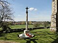 Shouldham War Memorial - geograph.org.uk - 4891464.jpg 3,456 × 2,592; 3.81 MB
-
 Shouldham warren - geograph.org.uk - 823110.jpg 640 × 480; 101 KB
-
 Skirting the edge of a clearing - geograph.org.uk - 1739340.jpg 640 × 480; 130 KB
-
 Spring Lane past Redmere Plantation - geograph.org.uk - 2163636.jpg 640 × 480; 159 KB
-
 Spring Lane, Shouldham - geograph.org.uk - 4402309.jpg 1,024 × 768; 180 KB
-
 Spring Lane, Shouldham - geograph.org.uk - 4402329.jpg 640 × 480; 72 KB
-
 Stubble field by Abbey Farm, Shouldham - geograph.org.uk - 2163660.jpg 640 × 480; 115 KB
-
 Stubble field in winter sunshine - geograph.org.uk - 2163431.jpg 640 × 480; 135 KB
-
 Stubble field near Shouldham, Norfolk - geograph.org.uk - 5109275.jpg 4,073 × 3,055; 3.26 MB
-

-

-
 Sunset at Asholt Plantation, Marham - geograph.org.uk - 2163733.jpg 640 × 598; 120 KB
-
 Sunset in Spring Lane, Shouldham - geograph.org.uk - 2163640.jpg 640 × 480; 156 KB
-
 Sunset in Spring Lane, Shouldham - geograph.org.uk - 2163683.jpg 640 × 541; 136 KB
-
 Sunset over Button Fen - geograph.org.uk - 2163724.jpg 640 × 480; 140 KB
-
 Sunset over fields in Button Fen, Marham - geograph.org.uk - 2163742.jpg 640 × 480; 141 KB
-

-
 Tank and silo at Cunnington's Barn near Shouldham, Norfolk - geograph.org.uk - 5109770.jpg 4,049 × 3,037; 2.69 MB
-
 The green in Shouldham - geograph.org.uk - 1738593.jpg 640 × 480; 107 KB
-
 The King's Arms, Shouldham - geograph.org.uk - 529607.jpg 3,008 × 2,000; 2.4 MB
-
 The last rays of a winter sun - geograph.org.uk - 2163667.jpg 526 × 640; 150 KB
-
 The last rays of a winter sun - geograph.org.uk - 2163688.jpg 640 × 531; 115 KB
-
 The old school in Shouldham (detail) - geograph.org.uk - 1738676.jpg 640 × 522; 128 KB
-
 The old school in Shouldham (detail) - geograph.org.uk - 1738681.jpg 405 × 640; 128 KB
-
 The old school in Shouldham - geograph.org.uk - 1738672.jpg 640 × 516; 110 KB
-
 The private track to Button Fen, Marham - geograph.org.uk - 2163709.jpg 640 × 480; 120 KB
-
 To Button Fen - geograph.org.uk - 821795.jpg 480 × 640; 80 KB
-
 To Shouldham Thorpe on Gallow Lane - geograph.org.uk - 2163480.jpg 640 × 480; 145 KB
-
 Track and dike on Button Fen, Shouldham - geograph.org.uk - 3963700.jpg 4,320 × 3,240; 5.74 MB
-
 Track to Black Drain - geograph.org.uk - 1739329.jpg 480 × 640; 188 KB
-
 Track to farmland next to Shouldham Warren - geograph.org.uk - 3963682.jpg 4,320 × 3,240; 5.74 MB
-
 Track to Limekiln Plantation, Marham - geograph.org.uk - 4402318.jpg 800 × 600; 206 KB
-
 Track to the car park - geograph.org.uk - 1739350.jpg 640 × 480; 153 KB
-
 Tractor at work near Abbey Farm, Shouldham Warren - geograph.org.uk - 3963687.jpg 4,320 × 3,240; 5.39 MB
-
 Transformer beside footpath - geograph.org.uk - 1738416.jpg 480 × 640; 128 KB
-
 Transformer beside footpath - geograph.org.uk - 1738587.jpg 480 × 640; 97 KB
-

-
 Two Avro Lancasters and a Vulcan - geograph.org.uk - 4131678.jpg 700 × 364; 75 KB
-
 Unmarked path in Shouldham Warren - geograph.org.uk - 1739215.jpg 640 × 480; 172 KB
-
 Unmarked path in Shouldham Warren - geograph.org.uk - 1739338.jpg 480 × 640; 203 KB
-

-

-
 View east along Gallow Lane - geograph.org.uk - 2163476.jpg 640 × 444; 119 KB
-
 View west along Eastgate Street - geograph.org.uk - 1738659.jpg 640 × 480; 133 KB
-
 Village Green, Shouldham - geograph.org.uk - 1195555.jpg 640 × 480; 59 KB
-

-
 Well-nourished sheep in stubble field - geograph.org.uk - 2163465.jpg 479 × 640; 173 KB
-
 White Lane - geograph.org.uk - 809118.jpg 640 × 480; 59 KB
-
 Young trees growing on clearfell - geograph.org.uk - 1739252.jpg 640 × 480; 138 KB
-
 Country Road east of Shouldham Thorpe - geograph.org.uk - 576916.jpg 640 × 426; 61 KB
-
 Edge of felled area, Shouldham Warren - geograph.org.uk - 549871.jpg 3,008 × 2,000; 2.56 MB
-
 Forest track, Shouldham Warren - geograph.org.uk - 549876.jpg 2,000 × 3,008; 2.55 MB
-
 Shouldham Warren car park - geograph.org.uk - 529602.jpg 3,008 × 2,000; 3.17 MB


_-_geograph.org.uk_-_1738676.jpg)
_-_geograph.org.uk_-_1738681.jpg)


