Category:Shire of Upper Gascoyne
Jump to navigation
Jump to search
local government area in Western Australia  | |||||
| Upload media | |||||
| Instance of | |||||
|---|---|---|---|---|---|
| Location | Western Australia, AUS | ||||
| Population |
| ||||
| Elevation above sea level |
| ||||
| official website | |||||
 | |||||
Subcategories
This category has the following 11 subcategories, out of 11 total.
B
- Burringurrah Community (6 F)
E
- Emu Hill Lookout (3 F)
G
K
L
- Landor River (7 F)
- Landor-Mount Augustus Road (6 F)
M
- Mount Augustus Tourist Park (4 F)
O
Media in category "Shire of Upper Gascoyne"
The following 15 files are in this category, out of 15 total.
-
 Gascoyne Region and Shire of Upper Gascoyne boundary sign, July 2020.jpg 3,456 × 4,608; 3.76 MB
-
 Gascoyne River Crossing - panoramio.jpg 2,304 × 1,728; 816 KB
-
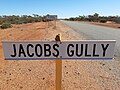 Jacobs Gully crossing on the Carnarvon-Mullewa Road, July 2020.jpg 4,608 × 3,456; 7.35 MB
-
 Mookaite4.jpg 4,608 × 3,456; 3.7 MB
-
 Mount Sandiman, Upper Gascoyne, Western Australia, July 2020.jpg 4,608 × 3,456; 5.46 MB
-
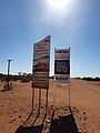
 Remote area warning sign, Shire of Upper Gascoyne, July 2020.jpg 4,608 × 3,456; 3.99 MB
-
 Shire of Upper Gascoyne boundary sign, July 2020 01.jpg 3,456 × 4,608; 6.74 MB
-
 Shire of Upper Gascoyne boundary sign, July 2020 02.jpg 4,608 × 3,456; 6.47 MB
-
 Shire of Upper Gascoyne boundary sign, July 2020 03.jpg 3,456 × 4,608; 5.74 MB
-
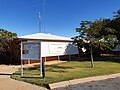 Shire of Upper Gascoyne office, July 2020.jpg 4,608 × 3,456; 5.04 MB
-
 Upper Gascoyne landscape, July 2020 01.jpg 4,608 × 3,456; 5.46 MB
-
 Upper Gascoyne landscape, July 2020 02.jpg 4,608 × 3,456; 5.25 MB
-
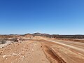
 Upper Gascoyne landscape, July 2020 03.jpg 4,608 × 2,592; 3.75 MB
-
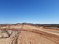
 Upper Gascoyne landscape, July 2020 04.jpg 4,608 × 2,592; 4.19 MB
-
 Windmill - panoramio - Rob McGregor.jpg 2,304 × 3,072; 1.43 MB


