Category:Shipbourne
Jump to navigation
Jump to search
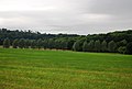
English: Shipbourne (pronounced 'Shibbun') lies in the English county of Kent, in an undulating landscape traversed by the small streams of the River Bourne, set in a clay vale at the foot of the wooded Sevenoaks Greensand Ridge.
Português: Shipbourne (pronuncia-se Shibbun) é uma aldeia situada no condado de Kent, Inglaterra, num vale aos pés do Sevenoaks Greensand Ridge, entrecortado pelos afluentes do rio Bourne.
village in United Kingdom .jpg) | |||||
| Upload media | |||||
| Instance of | |||||
|---|---|---|---|---|---|
| Location | Tonbridge and Malling, Kent, South East England, England | ||||
 | |||||
Subcategories
This category has the following 9 subcategories, out of 9 total.
A
- Avenue Cottage (Shipbourne) (5 F)
C
G
- St Giles Church, Shipbourne (23 F)
H
- Hildenborough Road, Shipbourne (12 F)
O
- Oasts in Shipbourne (18 F)
S
- Shipbourne War Memorial (1 F)
T
- The Chaser Inn, Shipbourne (3 F)
- Tinley Lodge, Shipbourne (7 F)
W
- West Green Farm, Shipbourne (10 F)
Media in category "Shipbourne"
The following 200 files are in this category, out of 546 total.
(previous page) (next page)-
 A broken bridge abutment - geograph.org.uk - 4007200.jpg 4,000 × 3,000; 4.33 MB
-
 A field of Legumes, Ightham Mote Estate - geograph.org.uk - 1362564.jpg 640 × 430; 149 KB
-
 A field of wheat - geograph.org.uk - 1969302.jpg 640 × 430; 147 KB
-
 A field of wheat near Budd's Green - geograph.org.uk - 1969327.jpg 640 × 430; 130 KB
-
 A field of young linseed - geograph.org.uk - 1349687.jpg 640 × 409; 71 KB
-
 A field off Mote Rd near Budds Green - geograph.org.uk - 1362561.jpg 640 × 430; 135 KB
-
 A line of 6 trees - geograph.org.uk - 3511557.jpg 640 × 430; 69 KB
-
 A line of trees west of Shipbourne - geograph.org.uk - 1362505.jpg 640 × 430; 77 KB
-
 A ploughed field near Shipbourne - geograph.org.uk - 1574954.jpg 640 × 430; 133 KB
-
 A rapeseed crop - geograph.org.uk - 1969290.jpg 640 × 430; 140 KB
-
 A sea of wheat - geograph.org.uk - 1969341.jpg 640 × 430; 147 KB
-

-

-
 A tree in a sea of wheat - geograph.org.uk - 1969335.jpg 640 × 430; 138 KB
-

-
 A227 - entering Shipbourne - geograph.org.uk - 2753213.jpg 640 × 428; 120 KB
-
 A227, Shipbourne - geograph.org.uk - 3511505.jpg 640 × 430; 62 KB
-
 Alder Shaw - geograph.org.uk - 2043052.jpg 640 × 430; 137 KB
-
 Alder Shaw - geograph.org.uk - 2043068.jpg 640 × 430; 120 KB
-
 Animal pens, Fairlawne Park - geograph.org.uk - 3501614.jpg 640 × 430; 60 KB
-
 Approach to St Giles Church at Shipbourne - geograph.org.uk - 5372875.jpg 4,000 × 3,000; 5.07 MB
-
 Approach to St Giles Church at Shipbourne - geograph.org.uk - 5372878.jpg 4,000 × 3,000; 4.47 MB
-
 Approaching the Greensand Ridge - geograph.org.uk - 284638.jpg 640 × 419; 94 KB
-
 Autumn, Hoad Wood - geograph.org.uk - 1575128.jpg 640 × 430; 210 KB
-
 Autumnal Colours - geograph.org.uk - 1575120.jpg 640 × 430; 210 KB
-
 Avenue Cottage - geograph.org.uk - 4326428.jpg 640 × 480; 60 KB
-
 Back Lane, Shipbourne - geograph.org.uk - 1763116.jpg 3,072 × 2,304; 2.44 MB
-
 Back Lane, Shipbourne - geograph.org.uk - 1763119.jpg 3,072 × 2,304; 2.39 MB
-
 Back Lane, Shipbourne - geograph.org.uk - 5069498.jpg 3,264 × 2,448; 1.76 MB
-
 Back Lane, Shipbourne - geograph.org.uk - 5069505.jpg 3,264 × 2,448; 2.37 MB
-
 Back Lane, Shipbourne - geograph.org.uk - 5069509.jpg 3,264 × 2,448; 1.67 MB
-
 Barn, Great Budds - geograph.org.uk - 3722958.jpg 2,048 × 1,536; 767 KB
-
 Blossom on Shipbourne Common - geograph.org.uk - 3505253.jpg 4,000 × 3,000; 4 MB
-
 Blossom on Shipbourne Common - geograph.org.uk - 3505258.jpg 4,000 × 3,000; 4.29 MB
-

-

-

-
 Bluebells south of Ightham Mote - geograph.org.uk - 2388526.jpg 1,024 × 681; 351 KB
-
 Boundary Wall, St Giles Church - geograph.org.uk - 3511523.jpg 640 × 430; 74 KB
-
 Bourne Valley - geograph.org.uk - 3511430.jpg 640 × 430; 73 KB
-
 Bridge on Hildenborough Road - geograph.org.uk - 4007209.jpg 4,000 × 3,000; 4.33 MB
-

-
 Bridleway entering Coach Road Woods - geograph.org.uk - 1350313.jpg 640 × 430; 112 KB
-
 Bridleway in Dene Park - geograph.org.uk - 1399469.jpg 640 × 480; 127 KB
-
 Bridleway in Hoad Wood - geograph.org.uk - 1350363.jpg 640 × 430; 127 KB
-
 Bridleway Junction in Dene Park - geograph.org.uk - 1399477.jpg 640 × 480; 120 KB
-
 Bridleway through Tinley Lodge Toll - geograph.org.uk - 1575142.jpg 640 × 430; 199 KB
-
 Bridleway through Tinley Lodge Toll - geograph.org.uk - 1576070.jpg 640 × 430; 195 KB
-
 Bridleway through Tinley Lodge Toll - geograph.org.uk - 1576077.jpg 640 × 430; 200 KB
-
 Bridleway waymarked off Ightham Rd - geograph.org.uk - 1350398.jpg 640 × 430; 106 KB
-
 Bridleway, Coach Road Woods - geograph.org.uk - 1350320.jpg 640 × 430; 134 KB
-
 Bridleway, Dene Park (2) - geograph.org.uk - 1350409.jpg 640 × 430; 139 KB
-
 Bridleway, Dene Park (3) - geograph.org.uk - 1350425.jpg 640 × 430; 126 KB
-
 Bridleway, Dene Park (4) - geograph.org.uk - 1350441.jpg 640 × 430; 129 KB
-
 Bridleway, Dene Park (5) - geograph.org.uk - 1350455.jpg 640 × 430; 106 KB
-
 Bridleway, Dene Park (6) - geograph.org.uk - 1350464.jpg 640 × 430; 131 KB
-
 Bridleway, Dene Park (7) - geograph.org.uk - 1350470.jpg 640 × 430; 132 KB
-
 Bridleway, Dene Park - geograph.org.uk - 1350404.jpg 640 × 430; 130 KB
-
 Bridleway, Hoad Wood - geograph.org.uk - 1350371.jpg 640 × 430; 92 KB
-
 Bridleway, Tinley Lodge Toll - geograph.org.uk - 1576110.jpg 640 × 430; 195 KB
-
 Bridleway, Tinley Lodge Toll - geograph.org.uk - 1576114.jpg 640 × 430; 189 KB
-
 Bridleway, Tinley Lodge Toll - geograph.org.uk - 3518979.jpg 640 × 430; 100 KB
-
 Bridleway, Tinley Lodge Toll - geograph.org.uk - 3518993.jpg 640 × 430; 118 KB
-
 Budd's Green - geograph.org.uk - 4184795.jpg 4,000 × 3,000; 4.25 MB
-
 Budd's Green - geograph.org.uk - 4186018.jpg 4,000 × 3,000; 4.28 MB
-
 Budd's Toll - geograph.org.uk - 3722917.jpg 2,048 × 1,536; 752 KB
-

-
 Bus stop, Shipbourne Common - geograph.org.uk - 1349648.jpg 640 × 430; 75 KB
-
 Bus stop, Shipbourne Common - geograph.org.uk - 1574908.jpg 640 × 399; 64 KB
-
 Buttercup field seen from the Greensand Way - geograph.org.uk - 3505297.jpg 4,000 × 3,000; 4.06 MB
-

-
 Byway off Claygate Lane (2) - geograph.org.uk - 1349514.jpg 640 × 430; 144 KB
-
 Byway off Claygate Lane - geograph.org.uk - 1349512.jpg 640 × 430; 139 KB
-
 Byway off Reeds Lane - geograph.org.uk - 1349518.jpg 640 × 430; 125 KB
-
 Byway waymarked off Claygate Lane - geograph.org.uk - 1349510.jpg 640 × 430; 105 KB
-
 Byway waymarked off Reeds Lane - geograph.org.uk - 1349520.jpg 640 × 430; 98 KB
-
 Callis Wood across a field - geograph.org.uk - 1349720.jpg 640 × 430; 75 KB
-
 Callis Wood from the NW - geograph.org.uk - 1349728.jpg 640 × 430; 86 KB
-
 Calvary scene at St Giles Church at Shipbourne - geograph.org.uk - 5372884.jpg 4,000 × 3,000; 4.67 MB
-

-
 Church Gate Cottages (geograph 6722520).jpg 1,024 × 685; 259 KB
-
 Church Gate Cottages - geograph.org.uk - 3723207.jpg 2,009 × 1,351; 558 KB
-
 Church of St Giles - geograph.org.uk - 3511514.jpg 640 × 430; 113 KB
-
 Church of St Giles - geograph.org.uk - 3511527.jpg 640 × 430; 90 KB
-
 Church of St Giles - geograph.org.uk - 3511550.jpg 640 × 430; 60 KB
-
 Churchyard of St Giles, Shipbourne - geograph.org.uk - 2043366.jpg 640 × 430; 159 KB
-
 Claygate Lane, near Shipbourne - geograph.org.uk - 5069525.jpg 3,264 × 2,448; 1.87 MB
-
 Claygate Lane, Shipbourne - geograph.org.uk - 5069435.jpg 3,264 × 2,448; 1.67 MB
-
 Claygate wood, Dene Park - geograph.org.uk - 1349448.jpg 640 × 430; 142 KB
-
 Climbing up Wilmot Hill - geograph.org.uk - 1969350.jpg 640 × 430; 129 KB
-
 Clump of trees, Shipbourne Common - geograph.org.uk - 1349587.jpg 640 × 430; 79 KB
-
 Cold Blows Wood - geograph.org.uk - 1362481.jpg 640 × 430; 185 KB
-

-
 Collens Cottage (geograph 6736726).jpg 1,024 × 684; 240 KB
-
 Converted barn, Great Budd's - geograph.org.uk - 1969297.jpg 640 × 430; 189 KB
-
 Coppiced trees, Dene Park - geograph.org.uk - 1350460.jpg 640 × 430; 145 KB
-
 Coppiced trees, Hollanden Wood - geograph.org.uk - 1350034.jpg 640 × 430; 136 KB
-
 Coppiced trees, Twelve Acre Plantation - geograph.org.uk - 1350185.jpg 640 × 430; 142 KB
-
 Coppiced trees, Twelve Acre Plantation - geograph.org.uk - 1350196.jpg 640 × 430; 149 KB
-
 Cottage in School Lane - geograph.org.uk - 3506935.jpg 4,000 × 3,000; 4.09 MB
-
 Cottage on Ightham Rd, Shipbourne - geograph.org.uk - 2043484.jpg 640 × 430; 140 KB
-
 Cottage on Mote Lane - geograph.org.uk - 1240430.jpg 640 × 480; 87 KB
-
 Cottage, Reeds Lane - geograph.org.uk - 1349523.jpg 640 × 430; 96 KB
-
 Cottages , The Common, Shipbourne - geograph.org.uk - 1364085.jpg 640 × 430; 151 KB
-
 Cottages Ightham Mote - geograph.org.uk - 412223.jpg 640 × 480; 167 KB
-
 Countryside west of Shipbourne - geograph.org.uk - 3511539.jpg 640 × 430; 72 KB
-
 Cowl of the oast house, Shipbourne - geograph.org.uk - 2043286.jpg 640 × 430; 146 KB
-
 Crabtree Wood - geograph.org.uk - 1349722.jpg 640 × 430; 88 KB
-
 Daffodils in Shipbourne - geograph.org.uk - 6099482.jpg 4,000 × 3,000; 4.97 MB
-
 Deer Fence, Hoad Wood - geograph.org.uk - 3518884.jpg 430 × 640; 110 KB
-
 Dene Park - geograph.org.uk - 3518865.jpg 640 × 430; 58 KB
-
 Dene Park - geograph.org.uk - 3518974.jpg 640 × 430; 58 KB
-
 Dene Park - geograph.org.uk - 3518996.jpg 640 × 430; 93 KB
-
 Dene Park woods - geograph.org.uk - 2977650.jpg 640 × 480; 97 KB
-
 Do not deviate from the path^ - geograph.org.uk - 1349757.jpg 640 × 415; 84 KB
-
 Drive Slowly Children^ - geograph.org.uk - 1242811.jpg 640 × 480; 125 KB
-
 Dunk's Green - geograph.org.uk - 2793043.jpg 640 × 425; 70 KB
-
 Dunk's Green Road, Shipbourne - geograph.org.uk - 5069418.jpg 3,264 × 2,448; 2.01 MB
-
 Edge of Long Slope Wood - geograph.org.uk - 3511595.jpg 640 × 430; 118 KB
-
 Edge of Long Slope Wood - geograph.org.uk - 3511608.jpg 640 × 430; 100 KB
-
En-Shipbourne.ogg 0.7 s; 15 KB
-
 Enclosed trees, Fairlawne Park - geograph.org.uk - 3501596.jpg 640 × 430; 74 KB
-
 Entering Ightham Mote Estate - geograph.org.uk - 1969478.jpg 640 × 430; 195 KB
-
 Entering the Fairlawne Estate - geograph.org.uk - 2041419.jpg 640 × 430; 177 KB
-
 Entrance to Dene Park - geograph.org.uk - 331404.jpg 640 × 428; 96 KB
-
 Entrance to Fairhill - geograph.org.uk - 6095309.jpg 4,000 × 3,000; 4.8 MB
-
 Estate building, Fairlawne Park - geograph.org.uk - 3501604.jpg 640 × 430; 125 KB
-
 Estate building, Fairlawne Park - geograph.org.uk - 3501609.jpg 640 × 430; 114 KB
-
 Estate buildings, Fairlawne Park - geograph.org.uk - 2042424.jpg 640 × 430; 145 KB
-
 Evening sunlight on Shipbourne Common - geograph.org.uk - 5787897.jpg 4,000 × 3,000; 4.82 MB
-
 Exiting Tinley Lodge Toll - geograph.org.uk - 3519001.jpg 640 × 430; 129 KB
-
 Extensive areas of wheat - geograph.org.uk - 1969344.jpg 640 × 430; 129 KB
-
 Fairhill seen from Riding Lane - geograph.org.uk - 1350055.jpg 640 × 430; 89 KB
-
 Fairlawne from a footpath on the estate - geograph.org.uk - 5596740.jpg 4,000 × 3,000; 4.9 MB
-
 Fairlawne House - geograph.org.uk - 2042418.jpg 640 × 430; 128 KB
-
 Fairlawne House - geograph.org.uk - 2042421.jpg 640 × 430; 123 KB
-
 Fairlawne House - geograph.org.uk - 3501559.jpg 640 × 430; 75 KB
-
 Fairlawne House - geograph.org.uk - 3501569.jpg 640 × 430; 70 KB
-
 Fairlawne House - geograph.org.uk - 3501580.jpg 640 × 430; 71 KB
-
 Fairlawne House - geograph.org.uk - 3501598.jpg 640 × 430; 76 KB
-
 Fairlawne Park - geograph.org.uk - 2042404.jpg 640 × 430; 173 KB
-
 Fairlawne Park - geograph.org.uk - 2042414.jpg 640 × 430; 144 KB
-
 Fairlawne Park - geograph.org.uk - 3501588.jpg 640 × 430; 125 KB
-
 Fairlawne Park, July evening light - geograph.org.uk - 5038528.jpg 1,600 × 1,064; 474 KB
-
 Fallow field - geograph.org.uk - 3511590.jpg 640 × 430; 69 KB
-
 Fallow field - geograph.org.uk - 3511606.jpg 640 × 430; 78 KB
-
 Farm building, Hookwood Farm - geograph.org.uk - 1349460.jpg 640 × 430; 63 KB
-
 Farmland near Shipbourne - geograph.org.uk - 3511437.jpg 640 × 430; 77 KB
-
 Farmland, Dene Park - geograph.org.uk - 3518977.jpg 640 × 430; 63 KB
-
 Farmyard, Fairlawne Home Farm - geograph.org.uk - 1364018.jpg 640 × 430; 80 KB
-
 Felled woodland - geograph.org.uk - 3518995.jpg 640 × 430; 91 KB
-
 Fenced off tree, Fairlawne Park - geograph.org.uk - 2042407.jpg 640 × 430; 128 KB
-
 Fenced off trees by the Greensand Way - geograph.org.uk - 2043343.jpg 640 × 430; 138 KB
-
 Fenced off trees near Shipbourne - geograph.org.uk - 2043325.jpg 640 × 430; 171 KB
-
 Field by Hamptons Road - geograph.org.uk - 3723276.jpg 2,048 × 1,536; 676 KB
-
 Field by Hildenborough Road - geograph.org.uk - 3722969.jpg 2,048 × 1,536; 704 KB
-
 Field near Shipbourne - geograph.org.uk - 3511427.jpg 640 × 430; 77 KB
-
 Field next to the Greensand Way near Ightham Mote - geograph.org.uk - 3505692.jpg 4,000 × 3,000; 4.27 MB
-
 Fields west of Shipbourne - geograph.org.uk - 1362502.jpg 640 × 430; 127 KB
-

-
 Footbridge - geograph.org.uk - 3501628.jpg 640 × 430; 126 KB
-

-

-
 Footpath across a field - geograph.org.uk - 3511543.jpg 640 × 430; 70 KB
-
 Footpath at Shipbourne - geograph.org.uk - 4184860.jpg 4,000 × 3,000; 4.2 MB
-
 Footpath at West Green Farm - geograph.org.uk - 3518838.jpg 640 × 430; 73 KB
-
 Footpath between Budd's Green and Underriver - geograph.org.uk - 3483541.jpg 4,320 × 3,240; 3.42 MB
-
 Footpath between Ightham Mote and Shipbourne (1) - geograph.org.uk - 3482671.jpg 4,320 × 3,240; 3.18 MB
-
 Footpath between Ightham Mote and Shipbourne (2) - geograph.org.uk - 3482691.jpg 4,320 × 3,240; 3.88 MB
-

-
 Footpath from Shipbourne - geograph.org.uk - 3511536.jpg 640 × 430; 113 KB
-
 Footpath gate out of the churchyard, Shipbourne - geograph.org.uk - 4666035.jpg 2,048 × 1,536; 736 KB
-
 Footpath heading East towards Shipbourne - geograph.org.uk - 3482706.jpg 4,320 × 3,240; 3.02 MB
-
 Footpath heading south - geograph.org.uk - 3518862.jpg 640 × 430; 65 KB
-
 Footpath heading west from Shipbourne - geograph.org.uk - 1362482.jpg 640 × 430; 137 KB
-
 Footpath heading West towards Cold Blows Wood - geograph.org.uk - 3482717.jpg 4,320 × 3,240; 2.75 MB
-
 Footpath heads towards Shipbourne - geograph.org.uk - 1574866.jpg 640 × 430; 142 KB
-
 Footpath in Cold Blows Wood - geograph.org.uk - 3483518.jpg 4,320 × 3,240; 5.81 MB
-

-
 Footpath MR392 - geograph.org.uk - 2753237.jpg 640 × 480; 186 KB
-
 Footpath near Shipbourne - geograph.org.uk - 173532.jpg 640 × 480; 128 KB
-
 Footpath on Fairlawne Estate - geograph.org.uk - 5596738.jpg 4,000 × 3,000; 4.58 MB
-
 Footpath signed leaving Shipbourne - geograph.org.uk - 1574886.jpg 640 × 430; 126 KB
-
 Footpath signpost, Budd's Green - geograph.org.uk - 1969299.jpg 640 × 430; 161 KB
-
 Footpath SW from Shipbourne Church - geograph.org.uk - 1574939.jpg 640 × 430; 124 KB
-
 Footpath SW from Shipbourne Church - geograph.org.uk - 1574948.jpg 640 × 430; 120 KB
-
 Footpath through rapeseed - geograph.org.uk - 1969291.jpg 640 × 430; 149 KB
-
 Footpath through the rapeseed - geograph.org.uk - 1969284.jpg 640 × 430; 171 KB
-
 Footpath through the wheat to Shipbourne - geograph.org.uk - 2041365.jpg 640 × 430; 133 KB
-
 Footpath to Budd's Green - geograph.org.uk - 4186032.jpg 4,000 × 3,000; 4.29 MB
-
 Footpath to Dunk's Green - geograph.org.uk - 2793025.jpg 640 × 425; 60 KB
-
 Footpath to Shipbourne - geograph.org.uk - 2041407.jpg 640 × 430; 183 KB
-
 Footpath to Shipbourne - geograph.org.uk - 3511434.jpg 640 × 430; 73 KB
-
 Footpath to Shipbourne Church - geograph.org.uk - 6254720.jpg 4,000 × 3,000; 4.9 MB
-
 Footpath to Shipbourne Common - geograph.org.uk - 1399490.jpg 640 × 480; 119 KB
-
 Footpath to St Giles Church at Shipbourne - geograph.org.uk - 5372881.jpg 4,000 × 3,000; 4.67 MB
-

-
 Footpath up Wilmot Hill - geograph.org.uk - 1969347.jpg 640 × 430; 183 KB
-
 Footpath up Wilmot Hill - geograph.org.uk - 1969353.jpg 640 × 430; 176 KB
-
 Footpath west of Shipbourne - geograph.org.uk - 284631.jpg 640 × 417; 99 KB


_-_geograph.org.uk_-_1350409.jpg)
_-_geograph.org.uk_-_1350425.jpg)
_-_geograph.org.uk_-_1350441.jpg)
_-_geograph.org.uk_-_1350455.jpg)
_-_geograph.org.uk_-_1350464.jpg)
_-_geograph.org.uk_-_1350470.jpg)


_-_geograph.org.uk_-_1349514.jpg)


.jpg)


.jpg)


_-_geograph.org.uk_-_3482671.jpg)
_-_geograph.org.uk_-_3482691.jpg)


