Category:Shawbury
Jump to navigation
Jump to search
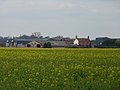
English: Shawbury is a village and civil parish in the English county of Shropshire, England. The village is 8.4 miles north east of the town of Shrewsbury, 11.5 miles north west of Telford and 163 miles north west of London. The village straddles the A53 between Shrewsbury and Market Drayton. The nearest railway station is at Yorton on the Welsh Marches Line for Shrewsbury/Crewe.
village in Shropshire, England, UK  | |||||
| Upload media | |||||
| Instance of | |||||
|---|---|---|---|---|---|
| Location | Shropshire, West Midlands, England | ||||
 | |||||
Subcategories
This category has the following 2 subcategories, out of 2 total.
R
S
- St Mary the Virgin, Shawbury (7 F)
Media in category "Shawbury"
The following 103 files are in this category, out of 103 total.
-
 A49 at Sandy Lane crossroads - geograph.org.uk - 2869134.jpg 640 × 480; 42 KB
-
 A49 at Sandy Lane junction - geograph.org.uk - 2959928.jpg 640 × 481; 51 KB
-
 A49 near Hadnall - geograph.org.uk - 5060523.jpg 640 × 427; 344 KB
-
 A53 Approaching Shawbury from Market Drayton - geograph.org.uk - 2769540.jpg 3,824 × 2,868; 3.02 MB
-
 A53 past entrance to Shawbury Park. - geograph.org.uk - 655586.jpg 640 × 480; 50 KB
-
 B5063 - geograph.org.uk - 6065560.jpg 1,024 × 768; 275 KB
-
 Boarpit Rough - geograph.org.uk - 4412542.jpg 800 × 600; 486 KB
-
 Bridleway alongside Matthew's Coppice - geograph.org.uk - 2895472.jpg 979 × 734; 452 KB
-
 Church of St Mary the Virgin, Shawbury - geograph.org.uk - 6015407.jpg 3,251 × 4,052; 3.26 MB
-
 Church of St Mary the Virgin, Shawbury - geograph.org.uk - 6015417.jpg 4,608 × 3,456; 3.67 MB
-
 Church of St Mary the Virgin, Shawbury - geograph.org.uk - 6015419.jpg 4,608 × 3,456; 3.74 MB
-
 Claire Austin Plant Centre - geograph.org.uk - 441089.jpg 640 × 480; 94 KB
-
 Dilapidated Fox and Hounds pub in Shawbury, Shropshire, England.jpg 640 × 480; 60 KB
-
 Disused hangar outside Shawbury base - geograph.org.uk - 2895383.jpg 979 × 734; 340 KB
-
 Entering the village - geograph.org.uk - 774460.jpg 640 × 371; 57 KB
-
 Felled forest on Shawbury Heath - geograph.org.uk - 2895518.jpg 1,142 × 857; 327 KB
-
 Field access - geograph.org.uk - 4588778.jpg 800 × 451; 374 KB
-
 Field, Shawbury - geograph.org.uk - 6065555.jpg 1,024 × 768; 266 KB
-
 Fingerpost at a track junction - geograph.org.uk - 2895511.jpg 979 × 734; 288 KB
-
 Grass triangle - geograph.org.uk - 4588613.jpg 800 × 451; 317 KB
-
 Hangar in the corner of RAF Shawbury - geograph.org.uk - 2895378.jpg 1,142 × 857; 251 KB
-
 House on the A49 Opposite Sandy Lane - geograph.org.uk - 2003322.jpg 4,224 × 3,168; 6.1 MB
-
 Little Wytheford - geograph.org.uk - 607876.jpg 640 × 480; 86 KB
-
 Merlwood - geograph.org.uk - 6065535.jpg 1,024 × 768; 282 KB
-
 New House farm from the southwest - geograph.org.uk - 2895371.jpg 1,142 × 857; 279 KB
-

-

-
-
 Old Toll House, Shawbury - geograph.org.uk - 6114421.jpg 750 × 500; 353 KB
-
 Open fields near Edgebolton - geograph.org.uk - 2705754.jpg 640 × 480; 65 KB
-
 Open land adjacent to Matthew's Coppice - geograph.org.uk - 2895474.jpg 979 × 734; 352 KB
-
 Ordnance Survey Flush Bracket S0219 - geograph.org.uk - 5232651.jpg 3,825 × 2,869; 2.46 MB
-
 Outside Shawbury - geograph.org.uk - 6065551.jpg 1,024 × 768; 267 KB
-
 Overgrown Moated Site at Shawbury (geograph 7390608).jpg 1,600 × 1,200; 1.04 MB
-
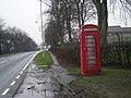 Phone kiosk outside RAF Shawbury - geograph.org.uk - 655587.jpg 640 × 480; 83 KB
-
 RAF Shawbury - geograph.org.uk - 1975787.jpg 640 × 428; 31 KB
-
 RAF Shawbury - geograph.org.uk - 2512841.jpg 4,000 × 3,000; 5.71 MB
-
 RAF Shawbury - geograph.org.uk - 658177.jpg 640 × 480; 59 KB
-
 River Roden - geograph.org.uk - 2448337.jpg 1,200 × 1,600; 903 KB
-
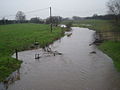 River Roden - geograph.org.uk - 655610.jpg 640 × 480; 57 KB
-
 Shawbury Bridge over the River Roden - geograph.org.uk - 655595.jpg 640 × 480; 63 KB
-
 Shawbury Heath - geograph.org.uk - 6065431.jpg 1,024 × 768; 444 KB
-
 Shawbury Heath woods - all gone^ - geograph.org.uk - 2895359.jpg 1,142 × 857; 357 KB
-
 Shawbury Motor Cross - geograph.org.uk - 5060134.jpg 1,500 × 1,000; 754 KB
-
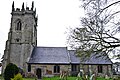 Shawbury, St. Mary's Church - geograph.org.uk - 5776634.jpg 4,614 × 3,080; 3.3 MB
-

-

-

-
-

-
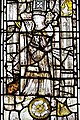
 Shawbury, St. Mary's Church, East window - geograph.org.uk - 5776692.jpg 4,912 × 7,360; 7.02 MB
-
 Shawbury, St. Mary's Church, Nave capital - geograph.org.uk - 5776685.jpg 7,360 × 4,912; 5.15 MB
-

-

-

-

-

-

-
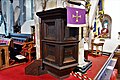 Shawbury, St. Mary's Church, The Jacobean pulpit dated 1612 - geograph.org.uk - 5776670.jpg 7,174 × 4,787; 5.91 MB
-
 Shawbury, St. Mary's Church, The last nave capital - geograph.org.uk - 5776644.jpg 7,094 × 4,735; 5.53 MB
-
-

-

-

-
 Shawbury, St. Mary's Church, The Norman south doorway - geograph.org.uk - 5776707.jpg 4,597 × 6,887; 7.2 MB
-
 Shawbury, St. Mary's Church, The organ - geograph.org.uk - 5776675.jpg 5,717 × 3,815; 3.99 MB
-
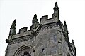 Shawbury, St. Mary's Church, Tower detail 1 - geograph.org.uk - 5776708.jpg 7,360 × 4,912; 4.84 MB
-
 Shawbury, St. Mary's Church, Tower detail 2 - geograph.org.uk - 5776711.jpg 7,360 × 4,912; 5.81 MB
-
 Shawbury, St. Mary's Church, Tower detail 3 - geograph.org.uk - 5776713.jpg 6,750 × 4,505; 7.49 MB
-

-
 South Shawbury - geograph.org.uk - 607879.jpg 640 × 480; 70 KB
-
 Southbound A49 near to Hadnall - geograph.org.uk - 5060521.jpg 640 × 427; 334 KB
-
 The black sheep of the village. - geograph.org.uk - 655597.jpg 640 × 480; 64 KB
-

-
 The Covert cottage - geograph.org.uk - 2895362.jpg 1,142 × 857; 271 KB
-
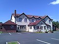
 The Elephant and Castle at Shawbury - geograph.org.uk - 774463.jpg 640 × 426; 74 KB
-
 The Fox and Hounds - geograph.org.uk - 2448238.jpg 1,600 × 1,200; 335 KB
-
 The track alongside Matthew's Coppice - geograph.org.uk - 2895482.jpg 979 × 734; 332 KB
-
 The track towards Heath Farm - geograph.org.uk - 2895376.jpg 1,142 × 857; 399 KB
-
 This Tornado was stored at BAEs plant at Warton for a long time (4567703350).jpg 3,264 × 2,448; 1.74 MB
-
 Tornado GR.4 awaiting scrapping (4567704202).jpg 3,264 × 2,448; 1.9 MB
-
 Tornado GR.4 ZA446 (4567064895).jpg 3,264 × 2,448; 1.17 MB
-
 Tornado GR.4 ZA446 (4567697502).jpg 3,264 × 2,448; 1.67 MB
-
 Tornado GR.4 ZA446 (4567698590).jpg 3,264 × 2,448; 2.08 MB
-
 Track, Shawbury Heath - geograph.org.uk - 6065432.jpg 1,024 × 768; 394 KB
-
 Where has the path gone^ I can't see it. - geograph.org.uk - 774227.jpg 640 × 426; 109 KB
-
 Woodlands Farm - geograph.org.uk - 655602.jpg 640 × 480; 65 KB
-
-

-
 Ditch beside B 5063 - geograph.org.uk - 655605.jpg 640 × 480; 111 KB
-
 Footpath off B 5063 - geograph.org.uk - 655603.jpg 640 × 480; 81 KB
-
 Footpath to Wytheford Heath - geograph.org.uk - 754312.jpg 640 × 480; 114 KB
-
 Hollies Stables - geograph.org.uk - 774457.jpg 640 × 426; 100 KB
-
 Lane to Poynton Grange - geograph.org.uk - 774459.jpg 640 × 426; 105 KB
-
 Mud and Trees - geograph.org.uk - 346517.jpg 640 × 480; 135 KB
-
 Near New Farm - geograph.org.uk - 601539.jpg 640 × 480; 74 KB
-
 Path next to field boundary - geograph.org.uk - 658198.jpg 640 × 480; 116 KB
-
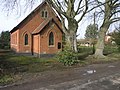 Poynton Wesleyan - geograph.org.uk - 346522.jpg 640 × 480; 125 KB
-
 Road junction by Criftin Coppice - geograph.org.uk - 655590.jpg 640 × 480; 68 KB
-
 Roadsign near Shawbury - geograph.org.uk - 655596.jpg 640 × 480; 59 KB
-
 Short Path - geograph.org.uk - 346531.jpg 640 × 480; 83 KB
-
 Shropshire Way at Great Wytheford - geograph.org.uk - 655606.jpg 640 × 480; 100 KB
-
 Track past Matthew's Coppice - geograph.org.uk - 658184.jpg 640 × 480; 118 KB


.jpg)


_-_geograph.org.uk_-_5776660.jpg)
_-_geograph.org.uk_-_5776665.jpg)


_-_geograph.org.uk_-_5776694.jpg)


_-_geograph.org.uk_-_5776702.jpg)
_-_geograph.org.uk_-_5776704.jpg)


.jpg)
.jpg)
.jpg)
.jpg)
.jpg)


