Category:Shatin Pass Road
Jump to navigation
Jump to search
road in Hong Kong .jpg) | |||||
| Upload media | |||||
| Instance of | |||||
|---|---|---|---|---|---|
| Location |
| ||||
| Length |
| ||||
 | |||||
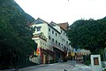
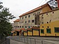
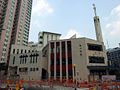
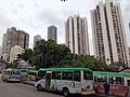
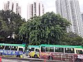
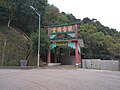
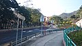
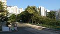
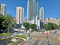
English: Shatin Pass Road is a road in the Wong Tai Sin District of Kowloon, Hong Kong, linking the Wong Tai Sin area in the south to the junction of Fei Ngo Shan Road and Jat's Incline in the north. Along the way, it passes through the Tsz Wan Shan area and Sha Tin Pass.
The northern part of Shatin Pass Road, between Sha Tin Pass and the junction of Fei Ngo Shan Road and Jat's Incline, is part of the Stage 4 of the Wilson Trail and Section 5 of the MacLehose Trail. This section of the road also marks the border between Sha Tin District and Wong Tai Sin District.
The northern part of Shatin Pass Road, between Sha Tin Pass and the junction of Fei Ngo Shan Road and Jat's Incline, is part of the Stage 4 of the Wilson Trail and Section 5 of the MacLehose Trail. This section of the road also marks the border between Sha Tin District and Wong Tai Sin District.
中文:沙田坳道
Subcategories
This category has the following 14 subcategories, out of 14 total.
2
- 2020 in Shatin Pass Road (35 F)
- 2021 in Shatin Pass Road (21 F)
B
C
- Chuk Yuen United Village (5 F)
F
M
- Muk Lun Street Playground (36 F)
N
S
T
- Tiu Tso Ngam (8 F)
V
- Views from Shatin Pass Road (6 F)
W
- Wong Tai Sin Bus Terminus (36 F)
Media in category "Shatin Pass Road"
The following 78 files are in this category, out of 78 total.
-
 070026 ToyotacoasterWK7611,KL18M(1).jpg 3,636 × 2,822; 2.42 MB
-
 070026 ToyotacoasterWK7611,KL18M.jpg 3,008 × 2,256; 1.2 MB
-
 Chuk Un, Hong Kong - panoramio (40).jpg 3,840 × 2,160; 4.1 MB
-
 Fat Jong Temple (Hong Kong).jpg 3,322 × 2,211; 2.11 MB
-
 Fat Jong Temple 01.jpg 4,160 × 3,120; 3.94 MB
-
 Fat Jong Temple 02.jpg 4,160 × 3,120; 4.3 MB
-
 Fat Jong Temple 03.jpg 4,160 × 3,120; 3.92 MB
-
 Fat Jong Temple 04.jpg 4,160 × 3,120; 5.93 MB
-
 HK CCDCDanceCentre.JPG 2,848 × 2,136; 1.71 MB
-
 HK SKH CalvaryChurch.jpg 1,424 × 1,068; 204 KB
-
 HK WTS 黃大仙 Wong Tai Sin 沙田坳道 Shatin Pass Road September 2021 SS2 01.jpg 3,096 × 4,128; 3.7 MB
-
 HK WTS 黃大仙 Wong Tai Sin 沙田坳道 Shatin Pass Road September 2021 SS2 02.jpg 4,128 × 3,096; 3.86 MB
-
 HK WTS 黃大仙 Wong Tai Sin 沙田坳道 Shatin Pass Road September 2021 SS2 03.jpg 4,128 × 3,096; 5.84 MB
-
 HK WTS 黃大仙 Wong Tai Sin 沙田坳道 Shatin Pass Road September 2021 SS2 04.jpg 4,128 × 3,096; 3.65 MB
-
 HK WTS 黃大仙 Wong Tai Sin 沙田坳道 Shatin Pass Road September 2021 SS2 05.jpg 4,128 × 3,096; 3.69 MB
-
 HK WTS 黃大仙 Wong Tai Sin 沙田坳道 Shatin Pass Road September 2021 SS2 06.jpg 4,128 × 3,096; 3.97 MB
-
 HK WTS 黃大仙 Wong Tai Sin 沙田坳道 Shatin Pass Road September 2021 SS2 07.jpg 3,096 × 4,128; 4.22 MB
-
 HK WTS 黃大仙 Wong Tai Sin 沙田坳道 Shatin Pass Road September 2021 SS2 08.jpg 4,128 × 3,096; 3.78 MB
-
 HK WTS 黃大仙 Wong Tai Sin 沙田坳道 Shatin Pass Road September 2021 SS2 09.jpg 4,128 × 3,096; 3.85 MB
-
 HK WTS 黃大仙 Wong Tai Sin 沙田坳道 Shatin Pass Road September 2021 SS2 10.jpg 4,128 × 3,096; 4.1 MB
-
 HK WTS 黃大仙 Wong Tai Sin 沙田坳道 Shatin Pass Road September 2021 SS2 11.jpg 3,096 × 4,128; 3.78 MB
-
 HK WTS 黃大仙 Wong Tai Sin 鳳德道 Fung Tak Road September 2021 SS2 05.jpg 4,128 × 3,096; 2.14 MB
-
 HK WTS 黃大仙 Wong Tai Sin 鳳德道 Fung Tak Road September 2021 SS2 25.jpg 3,096 × 4,128; 3.75 MB
-

-

-

-
 HK WTS 黃大仙 Wong Tai Sin 鳳德道 Fung Tak Road 沙田坳道 Shatin Pass Road September 2021 SS2 01.jpg 4,128 × 3,096; 3.94 MB
-
-
 HK WTS 黃大仙 Wong Tai Sin 鳳德道 Fung Tak Road 沙田坳道 Shatin Pass Road September 2021 SS2 03.jpg 4,128 × 3,096; 4.18 MB
-
 HK WTS 黃大仙 Wong Tai Sin 鳳德道 Fung Tak Road 沙田坳道 Shatin Pass Road September 2021 SS2 04.jpg 4,128 × 3,096; 4.77 MB
-
 HK WTS 黃大仙 Wong Tai Sin 鳳德道 Fung Tak Road 沙田坳道 Shatin Pass Road September 2021 SS2 05.jpg 3,096 × 4,128; 4.09 MB
-
 HK WTS 黃大仙 Wong Tai Sin 鳳德道 Fung Tak Road 沙田坳道 Shatin Pass Road September 2021 SS2 07.jpg 3,096 × 4,128; 4.07 MB
-
 HK WTS 黃大仙 Wong Tai Sin 鳳德道 Fung Tak Road 沙田坳道 Shatin Pass Road September 2021 SS2 08.jpg 4,128 × 3,096; 5.25 MB
-

-

-
 Hong Kong (2017) - 960.jpg 3,000 × 4,000; 2.84 MB
-
 KowloonMinibus18M.JPG 1,069 × 800; 353 KB
-
 KowloonMinibus37B LX6321.jpg 1,182 × 887; 526 KB
-
 KowloonMinibus37M LY6406.jpg 1,115 × 839; 506 KB
-
 KowloonMinibus38M.JPG 1,069 × 800; 413 KB
-
 Kwun Ping Road and Sha Tin Pass Road junction 04-07-2020.jpg 4,032 × 3,024; 4.52 MB
-
 Kwun Yum Temple, Tsz Wan Shan 01.jpg 4,160 × 3,120; 5.29 MB
-
 Kwun Yum Temple, Tsz Wan Shan 06.jpg 4,160 × 3,120; 4.07 MB
-
 LG1644 Kowloon 37M 03-07-2015.jpg 3,264 × 2,448; 2.79 MB
-
 Lions Pavilion, Sha Tin Pass 1.jpg 2,048 × 1,536; 801 KB
-
 Lions Pavilion, Sha Tin Pass 2.jpg 1,536 × 2,048; 1.03 MB
-
 Lions Pavilion, Sha Tin Pass 3.jpg 1,536 × 2,048; 1.03 MB
-
 Ma On Shan Country Park 07.JPG 1,600 × 1,200; 327 KB
-
 Ma On Shan Country Park 08.JPG 1,200 × 1,600; 371 KB
-
 Sha Tin Pass 01.jpg 4,000 × 3,000; 6.54 MB
-
 Sha Tin Pass 02.jpg 2,592 × 1,944; 2.14 MB
-
 Sha Tin Pass 03.jpg 4,160 × 3,120; 6.51 MB
-
 Sha Tin Pass Estate 200905.JPG 2,048 × 1,536; 1.17 MB
-
 Sha Tin Pass Estate 201101.JPG 2,048 × 1,536; 1.17 MB
-
 Sha Tin Pass Estate.JPG 1,898 × 2,530; 3.26 MB
-
 Sha Tin Pass, Hong Kong - panoramio (10).jpg 3,840 × 2,160; 3.48 MB
-
 Sha Tin Pass, Hong Kong - panoramio (2).jpg 4,000 × 2,250; 2.89 MB
-
 Sha Tin Pass, Hong Kong - panoramio (3).jpg 4,000 × 2,250; 2.59 MB
-
 Sha Tin Pass, Hong Kong - panoramio (4).jpg 4,000 × 2,250; 2.13 MB
-
 Sha Tin Pass, Hong Kong - panoramio (5).jpg 4,000 × 2,250; 2.45 MB
-
 Sha Tin Pass, Hong Kong - panoramio (6).jpg 4,000 × 2,250; 3.04 MB
-
 Sha Tin Pass, Hong Kong - panoramio (7).jpg 4,000 × 2,250; 2.56 MB
-
 Shatin Pass Road 01.jpg 4,065 × 3,049; 4.1 MB
-
 Shatin Pass Road 02.jpg 4,160 × 3,120; 4.32 MB
-
 Shatin Pass Road 03.jpg 4,160 × 3,120; 4.91 MB
-
 Shatin Pass Road 04.jpg 4,159 × 3,119; 4.88 MB
-
 Shatin Pass Road 05.jpg 4,159 × 3,119; 4.01 MB
-
 Shatin Pass Road 1.jpg 4,000 × 3,000; 4.74 MB
-
 Shatin Pass Road near Lung Cheung Road (Hong Kong).jpg 3,574 × 2,683; 3.22 MB
-
 Shatin pass road plate.JPG 4,320 × 3,240; 2.1 MB
-
 Shatin Pass Road Road site near Lower Wong Tai Sin Estate part 6 in July 2021.jpg 3,000 × 4,000; 3.39 MB
-
 Tiu Tso Ngam 01.jpg 4,000 × 3,000; 5.35 MB
-
 Wong Tai Sin Police Station 2014.jpg 2,946 × 1,958; 1.96 MB
-
 Wong Tai Sin Police Station and Lions Rise 2014.jpg 1,612 × 2,600; 1.33 MB
-
 Wong Tai Sin Police Station in October 2022.jpg 4,000 × 3,000; 3.61 MB
-
 WongTaiSin PoliceStation.jpg 1,424 × 1,068; 251 KB
-
 彩虹道,沙田拗道 - panoramio.jpg 2,974 × 1,681; 1.34 MB
-
 聖公會聖十字堂 - panoramio.jpg 4,000 × 2,250; 1.93 MB
.jpg)

.jpg)
.jpg)


_-_960.jpg)


.jpg)
.jpg)
.jpg)
.jpg)
.jpg)
.jpg)
.jpg)


