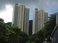
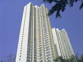
Category:Sha Tin Pass Estate
Jump to navigation
Jump to search
| Object location | | View all coordinates using: OpenStreetMap |
|---|
 | |||||
| Upload media | |||||
| Location | Wong Tai Sin District, Hong Kong, PRC | ||||
|---|---|---|---|---|---|
 | |||||
中文:沙田坳邨
Media in category "Sha Tin Pass Estate"
The following 19 files are in this category, out of 19 total.
-
 Chuk Un, Hong Kong - panoramio (40).jpg 3,840 × 2,160; 4.1 MB
-
 HK ShaTinPassEstate RedevelopmentSite.JPG 1,424 × 1,068; 260 KB
-
 Kwun Yum Temple, Tsz Wan Shan 13.jpg 4,160 × 3,120; 4.79 MB
-
 Sha Tin Pass Estate 200905.JPG 2,048 × 1,536; 1.17 MB
-
 Sha Tin Pass Estate 200910.JPG 1,600 × 1,200; 413 KB
-
 Sha Tin Pass Estate 201005.JPG 2,048 × 1,536; 811 KB
-
 Sha Tin Pass Estate 201006.JPG 2,048 × 1,536; 890 KB
-
 Sha Tin Pass Estate 201008.JPG 2,048 × 1,536; 965 KB
-
 Sha Tin Pass Estate 201011.JPG 2,048 × 1,536; 1.16 MB
-
 Sha Tin Pass Estate 201101.JPG 2,048 × 1,536; 1.17 MB
-
 Sha Tin Pass Estate 201312.jpg 2,048 × 1,536; 651 KB
-
 Sha Tin Pass Estate.JPG 1,898 × 2,530; 3.26 MB
-
 Sha Tin Pass, Hong Kong - panoramio (1).jpg 4,000 × 2,250; 2.61 MB
-
 Shatin Pass Estate Car Park.jpg 5,268 × 3,347; 10.97 MB
-
 Shatin Pass Estate Pebble Walking Trail, Fitness and Children Play Area.jpg 5,953 × 3,935; 16.73 MB
-
 Shatin Pass Estate Spring Rider and Children Play Area (2).jpg 5,175 × 3,288; 11.29 MB
-
 Shatin Pass Estate Unique Shop.jpg 6,000 × 4,000; 13.46 MB
-
 TWS ShaTinPassEst.JPG 1,024 × 768; 482 KB
-
 獅子山.jpg 3,920 × 2,204; 2.8 MB
.jpg)


.jpg)


.jpg)


