Category:Sgarbh Breac
Jump to navigation
Jump to search
Sgarbh Breac is a 364 metres (1,194 ft) mountain located near the northern promontory of Islay, to the south of Cnoc na Faire, on the Sound of Islay. It is the highest of a characteristic trio of peaks in descending order in a southwest to northeast line: Sgarbh Breac, Beinn Thrasda, and Sgarbh Beag, the first two being separated by a pass, Bealach Gaoth' Niar, and the second two by a pass, Bealach Gaoth' Near.
Subcategories
This category has the following 2 subcategories, out of 2 total.
C
- Coir' Odhar (2 F)
G
- Gualann an Sgairbh (2 F)
Media in category "Sgarbh Breac"
The following 26 files are in this category, out of 26 total.
-
 Allt na h-Uamha Mhòire - geograph.org.uk - 990051.jpg 640 × 480; 103 KB
-
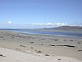
 Ardnave Point - geograph.org.uk - 756684.jpg 640 × 480; 67 KB
-
 Ardnave Point - geograph.org.uk - 756687.jpg 640 × 430; 36 KB
-
 Ardnave View - geograph.org.uk - 1163276.jpg 640 × 394; 70 KB
-
 Bealach Gaoth' Niar - geograph.org.uk - 990069.jpg 640 × 480; 86 KB
-

-
 Bunnahabhain Bay - geograph.org.uk - 1476420.jpg 640 × 427; 57 KB
-
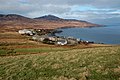 Bunnahabhain View - geograph.org.uk - 1165269.jpg 640 × 426; 107 KB
-
 Bunnahabhainn Bay - geograph.org.uk - 1419397.jpg 640 × 427; 349 KB
-
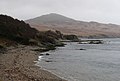
 Coastline near Port an Sruthain - geograph.org.uk - 1365510.jpg 640 × 426; 71 KB
-
 Coir' Odhar - geograph.org.uk - 761492.jpg 640 × 480; 78 KB
-
 Geal Uisge - geograph.org.uk - 760122.jpg 640 × 480; 70 KB
-
 Glac Gille Gun Cheann - geograph.org.uk - 761773.jpg 640 × 480; 68 KB
-
 Killinallan Point - geograph.org.uk - 335081.jpg 640 × 480; 79 KB
-
 Loch Gruinart - geograph.org.uk - 193882.jpg 640 × 480; 72 KB
-
 Loch Gruinart View - geograph.org.uk - 704149.jpg 640 × 464; 80 KB
-
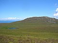 Loch Mhurchaidh and Sgarbh Breac - geograph.org.uk - 592776.jpg 640 × 480; 90 KB
-
 Loch nam Ban, Islay - geograph.org.uk - 341056.jpg 640 × 428; 193 KB
-
 Path to Rubh'a' Mhàil - geograph.org.uk - 989276.jpg 640 × 480; 80 KB
-
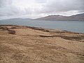
 Rubh'a' Mhàil from Sgarbh Breac - geograph.org.uk - 990420.jpg 640 × 480; 92 KB
-
-
 Sgarbh Breac - geograph.org.uk - 761765.jpg 640 × 480; 83 KB
-
 Sgarbh Breac - geograph.org.uk - 990410.jpg 640 × 480; 99 KB
-
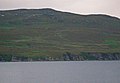
 Sgarbh Breac from Jura - geograph.org.uk - 1016433.jpg 640 × 480; 94 KB
-
 Summit cairn, Sgarbh Breac - geograph.org.uk - 990428.jpg 640 × 480; 100 KB
-
 The shore at Bunnahabhain - geograph.org.uk - 759111.jpg 640 × 430; 53 KB


