Category:Sevington
Jump to navigation
Jump to search
English: Sevington is a small village in the civil parish of Sevington with Finberry to the south-east of Ashford in England, with a population of about 113 in 1872, currently 354.
village in Sevington with Finberry, Ashford, Kent, United Kingdom  | |||||
| Upload media | |||||
| Instance of | |||||
|---|---|---|---|---|---|
| Location | Sevington with Finberry, Ashford, Kent, South East England, England | ||||
 | |||||
Subcategories
This category has the following 2 subcategories, out of 2 total.
A
- Ashford Market (12 F)
M
- St Mary's church, Sevington (22 F)
Media in category "Sevington"
The following 147 files are in this category, out of 147 total.
-
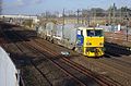
 375627 at Sevington.jpg 4,200 × 2,710; 4.54 MB
-
 375805 at Sevington (1).jpg 4,288 × 2,848; 5.47 MB
-
 375805 at Sevington.jpg 4,288 × 2,848; 5.35 MB
-
 375812 at Sevington (1).jpg 4,194 × 2,700; 5.16 MB
-
 375812 at Sevington.jpg 4,288 × 2,848; 5.61 MB
-
 375914 at Sevington (1).jpg 4,218 × 2,740; 5.21 MB
-
 375914 at Sevington.jpg 4,250 × 2,790; 4.96 MB
-
 395006 at Sevington (1).jpg 4,288 × 2,848; 5.5 MB
-
 395006 at Sevington.jpg 4,288 × 2,848; 5.14 MB
-
 395017 at Sevington (1).jpg 4,144 × 2,614; 5.24 MB
-
 395017 at Sevington.jpg 4,128 × 2,586; 5.19 MB
-
 395027 at Sevington (1).jpg 4,288 × 2,848; 5.6 MB
-
 395027 at Sevington.jpg 4,288 × 2,848; 5.37 MB
-
 395028 at Sevington (1).jpg 4,288 × 2,848; 5.51 MB
-
 395028 at Sevington.jpg 4,174 × 2,664; 5.3 MB
-
 A2070 south Ashford - geograph.org.uk - 3388501.jpg 2,256 × 1,504; 3.42 MB
-
 A2070 Willesborough Road bridge - geograph.org.uk - 1435932.jpg 640 × 480; 60 KB
-
 Access road from Swanton Court - geograph.org.uk - 1898016.jpg 3,072 × 2,304; 1.69 MB
-
 Approaching roundabout to Orbital Park, Ashford - geograph.org.uk - 3390436.jpg 1,600 × 1,077; 248 KB
-
 Ashford Business Park - geograph.org.uk - 4028675.jpg 640 × 382; 50 KB
-
 Ashford, Bad Munstereifel Road - geograph.org.uk - 2601061.jpg 3,648 × 2,736; 2.02 MB
-
 Avocet Way, Finberry housing estate - geograph.org.uk - 5962266.jpg 3,264 × 2,448; 1.82 MB
-
 Avocet Way, Finberry housing estate - geograph.org.uk - 6030657.jpg 3,264 × 2,448; 2.05 MB
-

-
 Bad Munstereifel Road towards Kingsnorth - geograph.org.uk - 1889802.jpg 3,072 × 2,304; 1.62 MB
-
 Bad Munstereifel Road towards M20 Junction 10 - geograph.org.uk - 1889806.jpg 3,072 × 2,304; 1.87 MB
-
 Bad Munstereifel Road, Ashford - geograph.org.uk - 3068414.jpg 2,256 × 1,496; 894 KB
-
 Bad Munstereifel Road, Sevington - geograph.org.uk - 3422342.jpg 2,048 × 1,536; 1.47 MB
-
 Barricaded footpath, Church Road - geograph.org.uk - 5923596.jpg 3,264 × 2,448; 3.86 MB
-
 Barrier, Highfield Lane - geograph.org.uk - 5923579.jpg 3,264 × 2,407; 2.37 MB
-
 Bilham Farmhouse - geograph.org.uk - 6029955.jpg 3,264 × 2,448; 3.94 MB
-
 Bilham Farmhouse and derelict outbuilding, Bilham Farm - geograph.org.uk - 6029986.jpg 3,264 × 2,448; 3.86 MB
-
 Blossom - geograph.org.uk - 5226058.jpg 640 × 373; 45 KB
-
 Brambling Avenue - geograph.org.uk - 5612886.jpg 2,448 × 3,264; 2.13 MB
-
 Brambling Avenue - geograph.org.uk - 5961178.jpg 3,001 × 2,448; 2.2 MB
-
 Brambling Avenue - geograph.org.uk - 5962214.jpg 3,264 × 2,448; 1.97 MB
-
 Bridle gates near Bilham Farm - geograph.org.uk - 1898228.jpg 3,072 × 2,304; 2.51 MB
-
 Bridleway and footpath junction near the A2070 - geograph.org.uk - 1898254.jpg 3,072 × 2,304; 2.87 MB
-

-
 Bridleway to Waterbrook Avenue - geograph.org.uk - 2150584.jpg 3,072 × 2,304; 2.15 MB
-
 Bridleway towards the A2070 - geograph.org.uk - 1898236.jpg 3,072 × 2,304; 3.02 MB
-
 Bus Stop Ashford Market - geograph.org.uk - 1719691.jpg 640 × 427; 44 KB
-
 Car Dealer, Ashford Kent - geograph.org.uk - 1012047.jpg 640 × 480; 74 KB
-
 Cheeseman's Green Lane bridge - geograph.org.uk - 2150649.jpg 3,072 × 2,304; 1.59 MB
-
 Children’s playground, Finberry housing estate - geograph.org.uk - 5962258.jpg 2,903 × 2,428; 1.66 MB
-
 Church Road - geograph.org.uk - 6116201.jpg 3,264 × 2,448; 3.63 MB
-
 Church Road Play Area - geograph.org.uk - 1889787.jpg 3,072 × 2,304; 1.84 MB
-
 Church Road, Sevington - geograph.org.uk - 2077061.jpg 3,488 × 2,616; 2.91 MB
-
 Church Road, Sevington - geograph.org.uk - 5275309.jpg 3,259 × 2,179; 1.3 MB
-

-
 Construction of units, Ashford Business Park, Barrey Road - geograph.org.uk - 4757230.jpg 3,264 × 2,448; 3.93 MB
-
 Contraflow and roadworks, Bad Munstereifel Road (A2070) - geograph.org.uk - 6114312.jpg 3,264 × 2,448; 3.7 MB
-
 Contraflow and roadworks, Bad Munstereifel Road (A2070) - geograph.org.uk - 6309041.jpg 3,264 × 2,448; 2.32 MB
-
 Damara Way - geograph.org.uk - 5611205.jpg 3,264 × 2,448; 1.86 MB
-
 Damara Way - geograph.org.uk - 5612008.jpg 3,264 × 2,448; 2.08 MB
-
 Damara Way - geograph.org.uk - 5961142.jpg 3,264 × 2,448; 2.08 MB
-
 Deer at Deer Park - geograph.org.uk - 400494.jpg 640 × 480; 120 KB
-
 Deer Park - geograph.org.uk - 400493.jpg 640 × 480; 117 KB
-
 Derelict outbuilding, Bilham Farm - geograph.org.uk - 6029977.jpg 3,264 × 2,448; 2.74 MB
-
 Development land, Cheeseman’s Green Lane - geograph.org.uk - 5934140.jpg 3,264 × 2,448; 2.14 MB
-
 Development land, Cheeseman’s Green Lane - geograph.org.uk - 6116207.jpg 3,264 × 2,220; 2.2 MB
-
 Development land, Cheeseman’s Green Lane - geograph.org.uk - 6116212.jpg 3,264 × 2,448; 3.72 MB
-
 DR98921 DR98971 at Sevington (1).jpg 4,260 × 2,804; 5.49 MB
-
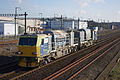 DR98921 DR98971 at Sevington.jpg 4,288 × 2,848; 5.42 MB
-
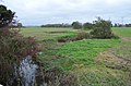 East Stour River - geograph.org.uk - 4229579.jpg 3,696 × 2,448; 2.27 MB
-
 Expansion of the Finberry housing estate - geograph.org.uk - 6340694.jpg 3,264 × 2,448; 3.82 MB
-
 Expansion of the Finberry housing estate - geograph.org.uk - 6340713.jpg 3,264 × 2,448; 3.72 MB
-
 Farmland - geograph.org.uk - 5226055.jpg 640 × 426; 46 KB
-
 Farmland near Ashford - geograph.org.uk - 3226437.jpg 640 × 303; 29 KB
-

-
 Flying geese feature - geograph.org.uk - 4568051.jpg 3,264 × 2,448; 3.74 MB
-
 Footbridge - geograph.org.uk - 411363.jpg 480 × 640; 283 KB
-
 Footbridge towards Sevington - geograph.org.uk - 1889800.jpg 3,072 × 2,304; 1.25 MB
-
 Footpath across Rape field - geograph.org.uk - 412023.jpg 640 × 480; 305 KB
-
 Footpath crosses Highfield Lane - geograph.org.uk - 1889820.jpg 3,072 × 2,304; 1.48 MB
-
 Footpath junction near Sevington Church - geograph.org.uk - 1889815.jpg 3,072 × 2,304; 1.24 MB
-
 Footpath towards Pattison Farm - geograph.org.uk - 1898025.jpg 3,072 × 2,304; 2.25 MB
-
 Gate into building site - geograph.org.uk - 5612040.jpg 3,264 × 2,448; 3.79 MB
-
 Gate into building site - geograph.org.uk - 5612869.jpg 3,264 × 2,448; 2.45 MB
-
 Harrier Drive - geograph.org.uk - 6020578.jpg 3,264 × 2,382; 1.57 MB
-
 Harrier Drive - geograph.org.uk - 6020590.jpg 3,264 × 2,448; 3.72 MB
-
 High Speed 1 - geograph.org.uk - 4028685.jpg 640 × 430; 63 KB
-
 High Speed 1 - geograph.org.uk - 4028687.jpg 640 × 332; 57 KB
-
 Highfield Lane over the Railway - geograph.org.uk - 2150610.jpg 3,072 × 2,304; 1.46 MB
-
 Junction of Highfield Lane with Church Road - geograph.org.uk - 5923583.jpg 3,064 × 2,448; 2.27 MB
-

-
 Linnet Drive - geograph.org.uk - 5961189.jpg 3,264 × 2,448; 1.84 MB
-

-

-
 Panorama off Highfield Lane - geograph.org.uk - 4229670.jpg 7,885 × 1,963; 6.98 MB
-
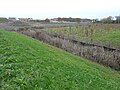
 Path crossing drain - geograph.org.uk - 5611232.jpg 3,264 × 2,448; 2.86 MB
-
 PC World, Ashford Business Park - geograph.org.uk - 4028677.jpg 640 × 430; 58 KB
-
 Pipin Crescent - geograph.org.uk - 5961155.jpg 3,264 × 2,448; 3.81 MB
-
 Pipin Crescent - geograph.org.uk - 5961166.jpg 3,264 × 2,448; 3.58 MB
-
 Pipin Crescent - geograph.org.uk - 6030667.jpg 3,264 × 2,448; 3.76 MB
-
 Pipin Crescent - geograph.org.uk - 6341367.jpg 3,264 × 2,448; 3.85 MB
-
 Pipin Crescent - geograph.org.uk - 6341369.jpg 3,264 × 2,448; 2.18 MB
-
 Possible Toll House^ - geograph.org.uk - 411409.jpg 640 × 480; 226 KB
-
 Railways to Ashford - geograph.org.uk - 2150616.jpg 3,072 × 2,304; 2.28 MB
-
 Railways to Folkestone - geograph.org.uk - 2150626.jpg 3,072 × 2,304; 2.34 MB
-

-

-
 Refurbishment of units, Ashford Business Park, Barrey Road - geograph.org.uk - 4757242.jpg 3,264 × 2,448; 3.92 MB
-
 River Stour - geograph.org.uk - 402222.jpg 640 × 480; 75 KB
-
 Road Bridge over Railway - geograph.org.uk - 1857588.jpg 1,024 × 768; 199 KB
-
 Robin Road - geograph.org.uk - 5612020.jpg 3,264 × 2,448; 3.66 MB
-
 Robin Road - geograph.org.uk - 5961150.jpg 3,264 × 2,448; 1.91 MB
-
 Robin Road - geograph.org.uk - 6340729.jpg 3,264 × 2,448; 3.75 MB
-
 Roundabout on Bad Munstereifel Road, Ashford - geograph.org.uk - 4904006.jpg 2,046 × 1,534; 810 KB
-
 Roundabout, Finberry housing estate - geograph.org.uk - 5612881.jpg 3,264 × 2,423; 2.28 MB
-
 Roundabout, Finberry housing estate - geograph.org.uk - 5962251.jpg 3,126 × 2,448; 1.85 MB
-
 Ruins near Swanton Court - geograph.org.uk - 1898010.jpg 3,072 × 2,304; 2.29 MB
-
 Sevington - geograph.org.uk - 3133122.jpg 3,648 × 2,736; 3.34 MB
-
 Sevington - geograph.org.uk - 3133124.jpg 3,648 × 2,736; 3.31 MB
-
 Sevington windpump - geograph.org.uk - 1138822.jpg 640 × 431; 42 KB
-
 Sevington windpump 2 - geograph.org.uk - 1138829.jpg 640 × 423; 36 KB
-
 Site for development - geograph.org.uk - 5612896.jpg 3,264 × 2,448; 2.12 MB
-
 Swift Avenue - geograph.org.uk - 5962223.jpg 3,264 × 2,448; 1.94 MB
-
 Swift Avenue - geograph.org.uk - 6342182.jpg 3,264 × 2,448; 1.97 MB
-
 Swift Avenue - geograph.org.uk - 6342188.jpg 3,264 × 2,448; 1.91 MB
-
 The most westerly end of Brambling Avenue - geograph.org.uk - 5962202.jpg 3,264 × 2,448; 3.93 MB
-
 The Old Black and White House - geograph.org.uk - 411398.jpg 640 × 480; 309 KB
-
 Track through Oilseed Rape Field - geograph.org.uk - 1857582.jpg 1,024 × 768; 282 KB
-
 Tree clearance, Bad Munstereifel Road - geograph.org.uk - 5736112.jpg 3,264 × 2,448; 3.98 MB
-
 Tree clearance, Church Road - geograph.org.uk - 5736122.jpg 3,264 × 2,448; 3.84 MB
-
 Trees lining the A2070 - geograph.org.uk - 5867020.jpg 1,024 × 681; 144 KB
-
 Trees lining the A2070 - geograph.org.uk - 5867022.jpg 1,024 × 681; 112 KB
-
 Wasteland by the railway line - geograph.org.uk - 2957953.jpg 640 × 430; 34 KB
-
 Wasteland near Sevington - geograph.org.uk - 2703884.jpg 640 × 459; 55 KB
-
 Woodland by the A2070 - geograph.org.uk - 3272013.jpg 640 × 430; 50 KB
-
 Approaching Broad Oak from Aldington - geograph.org.uk - 1801111.jpg 750 × 562; 118 KB
-
 Bank Road , towards Clap Hill - geograph.org.uk - 408854.jpg 640 × 480; 235 KB
-
 Bridge over the railway at Sevington - geograph.org.uk - 414406.jpg 640 × 427; 56 KB
-
 Bridge over the railway at Sevington - geograph.org.uk - 414408.jpg 640 × 427; 82 KB
-
 Car showroom - geograph.org.uk - 404271.jpg 640 × 480; 212 KB
-
 Cottage Hotel - geograph.org.uk - 411403.jpg 640 × 480; 287 KB
-
 Entrance to Conningbrook Quarry - geograph.org.uk - 1435928.jpg 640 × 480; 68 KB
-
 Footpath off Oxenturn Road - geograph.org.uk - 402338.jpg 640 × 480; 62 KB
-
 Goodcheap Farm - geograph.org.uk - 411420.jpg 640 × 480; 161 KB
-
 House being renovated - geograph.org.uk - 411392.jpg 640 × 480; 227 KB
-
 Low moorland by Bockham Lane - geograph.org.uk - 413733.jpg 640 × 480; 93 KB
-
 Monument - geograph.org.uk - 403902.jpg 480 × 640; 251 KB
-
 Oxenturn Road - geograph.org.uk - 402214.jpg 640 × 480; 58 KB
-
 Pheasant Cottage - geograph.org.uk - 411444.jpg 640 × 480; 237 KB
-
 Poultry Farm and Shop - geograph.org.uk - 408836.jpg 640 × 480; 178 KB
-
 Quarrington Wood - geograph.org.uk - 413735.jpg 640 × 480; 114 KB
-
 Row of houses - geograph.org.uk - 411389.jpg 640 × 480; 243 KB

.jpg)

.jpg)

.jpg)

.jpg)

.jpg)

.jpg)

.jpg)


_-_geograph.org.uk_-_6114312.jpg)
_-_geograph.org.uk_-_6309041.jpg)


.jpg)


_-_geograph.org.uk_-_4016670.jpg)


_-_geograph.org.uk_-_3462678.jpg)