Category:September 2010 in Merseyside
Jump to navigation
Jump to search
Ceremonial counties of England: Bedfordshire · Berkshire · Buckinghamshire · Cambridgeshire · Cheshire · Cornwall · Cumbria · Derbyshire · Devon · Dorset · Durham · East Riding of Yorkshire · East Sussex · Essex · Gloucestershire · Greater London · Greater Manchester · Hampshire · Herefordshire · Hertfordshire · Isle of Wight · Kent · Lancashire · Leicestershire · Lincolnshire · Merseyside · Norfolk · North Yorkshire · Northumberland · Nottinghamshire · Oxfordshire · Shropshire · Somerset · Staffordshire · Suffolk · Surrey · Tyne and Wear · Warwickshire · West Midlands · West Sussex · West Yorkshire · Wiltshire · Worcestershire
City-counties: Bristol ·
Former historic counties:
Other former counties:
City-counties: Bristol ·
Former historic counties:
Other former counties:
Deutsch: Bilder, die im September 2010 in Merseyside aufgenommen worden sind. Bitte beachten Sie, dass dies weder das Datum des Uploads noch das Datum des Scannens eines Fotos ist.
English: Images/pictures taken in Merseyside during September 2010. Note this is not the date of the upload, nor the date a photo was scanned.
Español: Fotografías o imágenes tomadas en Merseyside durante septiembre 2010. No es la fecha de subida ni escaneo, sino la fecha en que las fotografías o imágenes se crearon.
Esperanto: Bildoj faritaj en Merseyside en septembro 2010. Tio ne estas la dato, kiam la bildoj estis alŝutitaj aŭ skanitaj.
Français : Photographies ou images prises en Merseyside durant septembre 2010. Ce n'est pas la date du téléchargement ou du scan.
Galego: Fotografías ou imaxes tomadas en Merseyside durante setembro 2010. Non é a data de subida nin escaneamento, senón a data na que se crearon as fotografías ou imaxes.
Italiano: Fotografie o immagini scattate a Merseyside nel settembre 2010. Nota bene: la data non si riferisce né a quella di upload né a quella in cui la foto è stata digitalizzata.
Norsk bokmål: Bilder tatt i Merseyside i løpet av september 2010. Merk at dette ikke er datoen for opplasting, eller når et bilde har blitt skannet.
Norsk nynorsk: Bilete teke i Merseyside i løpet av september 2010. Merk at dette ikkje er datoen for opplasting, eller når eit bilete har vorte skanna.
Русский: Изображения, сделанные в Merseyside в течение сентябрь 2010 (не дата загрузки изображения).
Українська: Зображення, зроблені в Merseyside протягом вересень 2010. Зауважте, що це не дата завантаження чи дата сканування фотографії.
| September 2009 | ← | September 2010 | → | September 2011 | |||||||
| Jan | Feb | Mar | Apr | May | Jun | Jul | Aug | Sep | Oct | Nov | Dec |
| 2 | 1 | 10 | 2 | 1 | 29 | 41 | 12 | 52 | 3 | 20 | 1 |
|---|---|---|---|---|---|---|---|---|---|---|---|
Subcategories
This category has the following 2 subcategories, out of 2 total.
L
Media in category "September 2010 in Merseyside"
The following 50 files are in this category, out of 50 total.
-
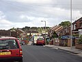
 Stanley Road to Kirkdale Station September 16 2010.jpg 2,304 × 3,072; 1.16 MB
-
 64 & 66 Village Road, Higher Bebington - DSC09315.jpg 3,648 × 2,736; 3.56 MB
-
 Bold Street Pavement Art.JPG 3,872 × 2,592; 2.38 MB
-
 Postbox, Pine Walks, Prenton - DSC09327.JPG 2,736 × 3,648; 3.6 MB
-
 Ferry at Birkenhead and ferry at Pier Head - DSC00659.JPG 1,280 × 960; 486 KB
-
 Layton Avenue, Prenton - DSC09345.JPG 3,648 × 2,736; 3.58 MB
-
 Looking Down Bold Street.JPG 2,592 × 3,872; 2.2 MB
-
 Looking up Bold Street, Liverpool.jpg 2,592 × 3,872; 2.25 MB
-
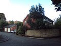
 Manor Hill, Claughton - DSC09374.JPG 3,648 × 2,736; 3.65 MB
-
 Mountwood Road, Prenton - DSC09319.JPG 3,648 × 2,736; 3.52 MB
-
 Mountwood Road, Prenton - DSC09323.JPG 3,648 × 2,736; 3.61 MB
-
 Oulton Close, Prenton - DSC09347.JPG 3,648 × 2,736; 3.64 MB
-
 Oulton Close, Prenton - DSC09348.JPG 3,648 × 2,736; 3.47 MB
-
 Overgrown land, Acres Road, Bebington - DSC09295.JPG 3,648 × 2,736; 3.41 MB
-
 Philharmonic Dining Rooms.jpg 3,872 × 2,592; 2.25 MB
-
 Phone booth, Grosvenor Road, Claughton - DSC09373.JPG 2,736 × 3,648; 3.62 MB
-
 Pipistrelle Rise, Noctorum - DSC09352.jpg 3,648 × 2,736; 3.69 MB
-
 Pipistrelle Rise, Noctorum - DSC09353.jpg 3,648 × 2,736; 3.62 MB
-
 Prenton Water Tower - DSC09331.JPG 3,648 × 2,736; 3.62 MB
-
 Pulford Avenue, Prenton - DSC09341.JPG 3,648 × 2,736; 3.48 MB
-
 Pulford Avenue, Prenton - DSC09342.JPG 3,648 × 2,736; 3.59 MB
-
 Pulford Road, Bebington - DSC09298.JPG 3,648 × 2,736; 3.57 MB
-
 Queens Drive, Prenton - DSC09338.JPG 3,648 × 2,736; 3.58 MB
-
 Reservoir Road, Prenton - DSC09329.JPG 3,648 × 2,736; 3.56 MB
-
 Sandstone cutting, Howbeck Road, Oxton - DSC09367.JPG 3,648 × 2,736; 3.54 MB
-
 Sandy Way, Oxton - DSC09375.JPG 3,648 × 2,736; 3.57 MB
-
 School Lane, Higher Bebington - DSC09312.JPG 3,648 × 2,736; 3.54 MB
-
 Shalem Court, Higher Bebington - DSC09273.JPG 3,648 × 2,736; 3.41 MB
-
 Shallmarsh Road, Higher Bebington - DSC09307.JPG 3,648 × 2,736; 3.57 MB
-
 Shallmarsh Road, Higher Bebington - DSC09309.JPG 3,648 × 2,736; 3.54 MB
-
 Shops, Teehey Lane, Higher Bebington - DSC09272.JPG 3,648 × 2,736; 3.55 MB
-
 Swan Court (rear), Prenton - DSC09346.JPG 3,648 × 2,736; 3.57 MB
-
 Teehey Lane, Higher Bebington - DSC09300.JPG 3,648 × 2,736; 3.65 MB
-
 The Acorn pub, Higher Bebington - DSC09269.JPG 3,648 × 2,736; 3.58 MB
-
 The Links entrance, Howbeck Road, Oxton - DSC09359.JPG 3,648 × 2,736; 3.51 MB
-
 The Links, Howbeck Road, Oxton - DSC09360.JPG 3,648 × 2,736; 3.56 MB
-
 Townfield Health Centre construction site sign, Noctorum - DSC09350.JPG 2,736 × 3,648; 3.46 MB
-
 Townfield Health Centre construction site, Noctorum - DSC09349.JPG 3,648 × 2,736; 3.53 MB
-
 Tree-lined footpath, Higher Bebington Road - DSC09274.JPG 3,648 × 2,736; 3.59 MB
-
 Tree-lined footpath, Higher Bebington Road - DSC09278.JPG 3,648 × 2,736; 3.58 MB
-
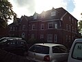
 Trinity with Palm Grove Church, Oxton - DSC09381.JPG 3,648 × 2,736; 3.57 MB
-
 Trinity with Palm Grove Church, Oxton - DSC09383.JPG 2,736 × 3,648; 3.61 MB
-
 United Reformed Church, Higher Bebington Road - DSC09289.JPG 3,648 × 2,736; 3.52 MB
-
 Village Road, Higher Bebington - DSC09313.JPG 3,648 × 2,736; 3.6 MB
-
 Village Road, Higher Bebington - DSC09316.JPG 3,648 × 2,736; 3.59 MB
-
 Waterford Road, Oxton - DSC09355.JPG 3,648 × 2,736; 3.57 MB
-
 Waterpark Road, Prenton - DSC09340.JPG 3,648 × 2,736; 3.5 MB
-
 Wethersfield Road, Noctorum - DSC09351.JPG 3,648 × 2,736; 3.57 MB
-
 Windy Knowe, Waterford Road, Oxton - DSC09356.JPG 3,648 × 2,736; 3.58 MB
-
 Windy Knowe, Waterford Road, Oxton - DSC09357.JPG 3,648 × 2,736; 3.5 MB


,_Prenton_-_DSC09346.JPG)


