Category:September 2007 in Oregon
Jump to navigation
Jump to search
English: Images/pictures taken in Oregon during September 2007. Note this is not the date of the upload, nor the date a photo was scanned.
States of the United States: Alabama · Alaska · Arizona · Arkansas · California · Colorado · Connecticut · Delaware · Florida · Georgia · Hawaii · Illinois · Indiana · Iowa · Kansas · Kentucky · Louisiana · Maine · Maryland · Massachusetts · Michigan · Minnesota · Mississippi · Missouri · Montana · Nebraska · Nevada · New Hampshire · New Jersey · New Mexico · New York · North Carolina · North Dakota · Ohio · Oklahoma · Oregon · Pennsylvania · Rhode Island · South Carolina · South Dakota · Tennessee · Texas · Utah · Vermont · Virginia · Washington · West Virginia · Wisconsin · Wyoming – Washington, D.C.
| September 2006 | ← | September 2007 | → | September 2008 | |||||||||
| Jan | Feb | Mar | Apr | May | Jun | Jul | Aug | Sep | Oct | Nov | Dec | ||
| ← | 18 | 7 | 38 | 28 | 61 | 159 | 69 | 104 | 230 | 31 | 19 | 23 | → |
|---|---|---|---|---|---|---|---|---|---|---|---|---|---|
Subcategories
This category has only the following subcategory.
S
- Stumptown Comics Fest 2007 (11 F)
Media in category "September 2007 in Oregon"
The following 200 files are in this category, out of 229 total.
(previous page) (next page)-
 1stUnitedMethodistSpire.JPG 512 × 640; 27 KB
-
 Abby Sign 1280x800.jpg 1,280 × 800; 518 KB
-
 Adair AFS - 02 (1).jpg 1,000 × 750; 194 KB
-
 Adair AFS - 12 (1).jpg 1,000 × 667; 312 KB
-
 Adair AFS - 13.jpg 1,000 × 750; 138 KB
-
 Adair AFS Sage Blockhouse - 6.jpg 2,000 × 920; 216 KB
-
 Adel Area (Lake County, Oregon scenic images) (lakDA0068).jpg 488 × 324; 25 KB
-
 Andrews School (Harney County, Oregon scenic images) (harDA0166).jpg 488 × 324; 31 KB
-

-
 AstoriaColumn.jpg 1,400 × 3,700; 2.38 MB
-
 Austin House (Grant County, Oregon scenic images) (graDA0137).jpg 488 × 324; 30 KB
-
 Bald Peak forest.JPG 2,112 × 2,816; 2.2 MB
-
 Bald Peak looking southeast.JPG 2,816 × 2,112; 1.89 MB
-
 Bald Peak with Tualatin Valley.JPG 2,816 × 2,112; 1.46 MB
-

-

-
 Beers.JPG 640 × 512; 73 KB
-

-
 Breakfast Frog (1519770264).jpg 2,272 × 1,704; 1.17 MB
-

-
 Bullwinkles Restaurant.JPG 448 × 336; 29 KB
-
 Buttermilk Clouds 2.JPG 3,648 × 2,736; 4.67 MB
-
 Camp Adair - 02.jpg 1,000 × 750; 225 KB
-
 Camp Adair - 03.jpg 874 × 1,000; 157 KB
-
 Camp Adair - 04.jpg 1,000 × 722; 115 KB
-
 Campbell Lake (Lake County, Oregon scenic images) (lakDA0122).jpg 324 × 488; 24 KB
-
 CampPolk Kiosk.jpg 1,000 × 750; 204 KB
-
 Cape Foulweather (1465223588).jpg 1,600 × 1,200; 1.15 MB
-

-

-
 Catlow Valley (Harney County, Oregon scenic images) (harDA0168).jpg 488 × 324; 24 KB
-
 Catlow Valley (Harney County, Oregon scenic images) (harDA0170).jpg 488 × 324; 18 KB
-
 CCC Camp (Lake County, Oregon scenic images) (lakDA0094a).jpg 324 × 488; 36 KB
-

-
-

-

-

-

-

-

-

-
 Clear Lake (Linn County, Oregon scenic images) (linnDA0011).jpg 488 × 324; 38 KB
-
 Clear Lake Dock (Linn County, Oregon scenic images) (linnDA0012).jpg 488 × 324; 32 KB
-

-

-

-

-

-
 Crescent Lake at sunrise.JPG 2,048 × 1,536; 653 KB
-
 Crump Lake (Lake County, Oregon scenic images) (lakDA0081).jpg 324 × 488; 33 KB
-
 Dahlias near Canby Oregon.JPG 2,816 × 1,438; 1.57 MB
-
 Detroit Lake (Marion County, Oregon scenic images) (marDA0005).jpg 488 × 324; 14 KB
-

-

-
 Downtown Burns (Harney County, Oregon scenic images) (harDA0077).jpg 488 × 324; 27 KB
-

-

-

-

-
 Elk Lake (Deschutes County, Oregon scenic images) (desDA0061).jpg 488 × 324; 29 KB
-
 Elk Statue (Deschutes County, Oregon scenic images) (desDA0020).jpg 324 × 488; 43 KB
-
 Escaped Horses In Oregon.jpg 1,067 × 754; 301 KB
-
 FisherSchoolBridge.JPG 640 × 512; 197 KB
-
 Fossil Area (Wheeler County, Oregon scenic images) (wheDA0156).jpg 324 × 488; 25 KB
-

-
-
 Frog Legs (1519770548).jpg 2,272 × 1,704; 1.03 MB
-
 FtClatsop0001.jpg 1,570 × 1,043; 496 KB
-
 FtClatsop0002.jpg 1,568 × 1,096; 418 KB
-
 Galena Area (Grant County, Oregon scenic images) (graDA0146).jpg 488 × 324; 39 KB
-
 Garibaldi Steam Train - panoramio.jpg 999 × 720; 341 KB
-
 GeorgeGay1.JPG 640 × 512; 72 KB
-
 Grazing Cattle (Harney County, Oregon scenic images) (harDA0035).jpg 488 × 324; 47 KB
-
 Guano Valley (Lake County, Oregon scenic images) (lakDA0141).jpg 488 × 324; 27 KB
-
-

-
-
 Hart Lake (Lake County, Oregon scenic images) (lakDA0132).jpg 488 × 324; 32 KB
-
 Hempstalk in Portland, Oregon 2007 Hacky.jpg 1,024 × 786; 644 KB
-
 Heppner Barn (Morrow County, Oregon scenic images) (morDA0212).jpg 488 × 324; 21 KB
-

-
 Highway 140 (Lake County, Oregon scenic images) (lakDA0139).jpg 488 × 324; 31 KB
-
 Highway 207 (Wheeler County, Oregon scenic images) (wheDA0225).jpg 488 × 324; 32 KB
-

-
 Hubbard Oregon watertower.JPG 1,330 × 1,219; 677 KB
-
 ISS015-E-27177 - View of Oregon.jpg 3,032 × 2,008; 1.25 MB
-
 ISS015-E-27181 - View of Oregon.jpg 3,032 × 2,008; 1.13 MB
-
 Jamison Square.jpg 3,462 × 1,945; 1.59 MB
-
 Jason Lee Grave.JPG 222 × 576; 91 KB
-
 JFKHS-MA Sign 1280x800.jpg 800 × 1,280; 462 KB
-
 JFKHS-MA Trojans 1280x800.jpg 1,280 × 800; 315 KB
-
 Keltytent.jpg 1,024 × 768; 223 KB
-
 Lake Penland (Morrow County, Oregon scenic images) (morDA0173).jpg 488 × 324; 31 KB
-
 Lake Penland (Morrow County, Oregon scenic images) (morDA0178).jpg 488 × 324; 37 KB
-
 Lake Penland (Morrow County, Oregon scenic images) (morDA0179).jpg 324 × 488; 45 KB
-
 Lake Penland (Morrow County, Oregon scenic images) (morDA0182).jpg 324 × 488; 24 KB
-
 Lava Lake (Deschutes County, Oregon scenic images) (desDA0070).jpg 488 × 324; 33 KB
-

-

-
 LeeGate.JPG 640 × 512; 40 KB
-
 Lewis&ClarkBridgeSP.jpg 4,593 × 1,200; 2.26 MB
-
 Machinery at Lake Roslyn.JPG 1,388 × 912; 635 KB
-
 Main Street antique store - Aurora Oregon.jpg 2,054 × 1,584; 984 KB
-

-

-

-

-

-
 McCormick Pier Apts and downtown Portland skyline from Broadway Br (2007).jpg 3,412 × 2,270; 1.52 MB
-
 MrsLee.JPG 640 × 512; 73 KB
-
 Mud Lake (Harney County, Oregon scenic images) (harDA00070).jpg 324 × 488; 24 KB
-
 Mud Lake (Harney County, Oregon scenic images) (harDA0059).jpg 488 × 324; 22 KB
-

-

-

-
-
 Old Building (Wheeler County, Oregon scenic images) (wheDA0154).jpg 324 × 488; 31 KB
-
 Old Building (Wheeler County, Oregon scenic images) (wheDA0155).jpg 488 × 324; 29 KB
-
 Old Buildings (Wheeler County, Oregon scenic images) (wheDA0153).jpg 324 × 488; 24 KB
-
 Old Shack (Deschutes County, Oregon scenic images) (desDA0019).jpg 324 × 488; 42 KB
-
 Old Shed (Harney County, Oregon scenic images) (harDA0084).jpg 488 × 324; 32 KB
-

-

-
 Oregon Iron Company furnace 1866.png 2,272 × 1,704; 8.54 MB
-
 Original Niketown store in 2007 during transit mall reconstruction.jpg 3,372 × 2,244; 1.93 MB
-
 OWSCH1.JPG 640 × 512; 71 KB
-

-
 Painted Hills (Wheeler County, Oregon scenic images) (wheDA0012).jpg 324 × 488; 52 KB
-
 Paisley School (Lake County, Oregon scenic images) (lakDA0054).jpg 488 × 324; 30 KB
-
 Paisley School (Lake County, Oregon scenic images) (lakDA0061).jpg 488 × 324; 32 KB
-
 Parrish.JPG 640 × 512; 74 KB
-
 ParrishHouse.JPG 496 × 608; 81 KB
-
 Paulina Lake.JPG 692 × 519; 33 KB
-
 Pelicans (Harney County, Oregon scenic images) (harDA0066).jpg 488 × 324; 35 KB
-
 Pelicans (Harney County, Oregon scenic images) (harDA0068).jpg 324 × 488; 27 KB
-
 Peter DeFazio (2142430328).jpg 800 × 600; 62 KB
-
-

-

-

-
 Philippi Road (Gilliam County, Oregon scenic images) (gilDA0199).jpg 324 × 488; 26 KB
-
 Philippi Road (Gilliam County, Oregon scenic images) (gilDA0200).jpg 488 × 324; 25 KB
-
 Pittock Block from the northwest in 2007 - Portland, Oregon.jpg 3,486 × 2,320; 1.91 MB
-
 Plush Barn (Lake County, Oregon scenic images) (lakDA0135).jpg 488 × 324; 27 KB
-
 Polson Logging No. 90 in Garibaldi, Oregon - September 2007.jpg 1,024 × 768; 358 KB
-
 Prairie City (Grant County, Oregon scenic images) (graDA0128).jpg 324 × 488; 43 KB
-
 PratumElev.1.JPG 640 × 512; 124 KB
-
 PratumSchool.1.JPG 640 × 512; 166 KB
-
 Pumice Plateau.jpg 1,600 × 1,200; 1.52 MB
-
 RiverPlace Marina and Marquam Bridge in 2007.jpg 3,372 × 1,956; 1.51 MB
-
 Rock Formation (Lake County, Oregon scenic images) (lakDA0138).jpg 324 × 488; 47 KB
-
 Rock Formations (Grant County, Oregon scenic images) (graDA0143).jpg 324 × 488; 43 KB
-

-
 Rogerlake.JPG 640 × 480; 93 KB
-

-
 Rusted Equipment (Lake County, Oregon scenic images) (lakDA0072).jpg 488 × 324; 42 KB
-
 Sahalie Falls (Linn County, Oregon scenic images) (linnDA0021).jpg 324 × 488; 41 KB
-
 Samtrak caboose 2007.jpg 2,048 × 1,536; 719 KB
-
 Samtrak engine 2007.jpg 2,592 × 1,944; 2.17 MB
-
 Seneca School (Grant County, Oregon scenic images) (graDA0097).jpg 488 × 324; 23 KB
-
 Septemberhoodoo.jpg 3,872 × 2,592; 1.86 MB
-

-

-
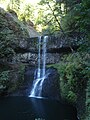 Silver Falls State Park - Lower South Falls.jpg 1,728 × 2,304; 567 KB
-
 Silver Falls State Park - Middle North Falls.jpg 1,728 × 2,304; 638 KB
-
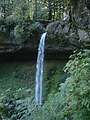 Silver Falls State Park - North Falls.jpg 1,728 × 2,304; 648 KB
-
 Silver Falls State Park - South Falls.jpg 1,728 × 2,304; 632 KB
-
 Silver Falls State Park - trail.jpg 2,304 × 1,728; 1.64 MB
-
 Silver Falls State Park - Upper North Falls.jpg 2,304 × 1,728; 1.74 MB
-
 Silver Lake Area (Lake County, Oregon scenic images) (lakDA0034).jpg 324 × 488; 44 KB
-
 Silver Lake Area (Lake County, Oregon scenic images) (lakDA0035).jpg 488 × 324; 35 KB
-

-

-
 Simon Benson House - Sep 2007.jpg 3,406 × 2,266; 2.58 MB
-

-
 Smith & Bybee Lakes (13764431235).jpg 2,592 × 3,888; 4.71 MB
-
 Smith & Bybee Lakes (13764444353).jpg 2,592 × 3,888; 5.2 MB
-
 Smith & Bybee Lakes (13764799494).jpg 3,888 × 2,592; 6.68 MB
-
 Smith & Bybee Lakes (13764800924).jpg 2,592 × 3,888; 5.75 MB
-
 Smith & Bybee Lakes (13764802904).jpg 3,888 × 2,592; 6.91 MB
-
 Smith & Bybee Lakes (15316889493).jpg 1,704 × 2,272; 1.77 MB
-
 Smith & Bybee Lakes (15749087728).jpg 1,704 × 2,272; 1.39 MB
-
 Smith & Bybee Lakes (15749089008).jpg 2,272 × 1,704; 1.23 MB
-
 Smith & Bybee Lakes (15750482289).jpg 1,704 × 2,272; 1.28 MB
-
 Smith & Bybee Lakes (15750483269).jpg 1,704 × 2,272; 1.51 MB
-
 Smith & Bybee Lakes (15910720606).jpg 1,704 × 2,272; 1.3 MB
-
 Smith Lake (1518912833).jpg 2,272 × 1,704; 1.11 MB
-
 Smith Lake (1518913119).jpg 1,704 × 2,272; 1.33 MB
-
 Smith Lake (1518913301).jpg 2,272 × 1,704; 708 KB
-
 Smith Lake (1519769934).jpg 2,272 × 1,704; 690 KB
-
 Smith Lake (1519770034).jpg 2,272 × 1,704; 428 KB
-
 Smith Lake (1519770720).jpg 1,704 × 2,272; 846 KB
-
 Smith Lake (1519770878).jpg 2,272 × 1,704; 789 KB
-
 South Twin Lake, Oregon.jpg 6,540 × 2,147; 1.34 MB
-

-
 Spencer Butte summit.jpg 3,545 × 2,373; 688 KB
-

-

-


.jpg)
.jpg)


_(lakDA0068).jpg)
_(harDA0166).jpg)
_(gilDA0001).jpg)
_(graDA0137).jpg)


_(gilDA0164).jpg)
_(croDA0055).jpg)

_(desDA0085).jpg)
.jpg)
_(croDA0070).jpg)


_(lakDA0122).jpg)

.jpg)
_(desDA0121).jpg)
_(desDA0126).jpg)
_(harDA0168).jpg)
_(harDA0170).jpg)
_(lakDA0094a).jpg)
_(marDA0016b).jpg)
_(wheDA0091).jpg)
_(wheDA0096).jpg)
_(wheDA0098).jpg)
_(wheDA0105).jpg)
_(wheDA0110).jpg)
_(wheDA0114).jpg)
_(wheDA0115).jpg)
_(wheDA0124).jpg)
_(gilDA0175).jpg)
_(wheDA0130).jpg)
_(wheDA0136).jpg)
_(desDA0045).jpg)
_(desDA0046).jpg)

_(lakDA0081).jpg)

_(marDA0005).jpg)
_(desDA0056a).jpg)
_(harDA0019).jpg)
_(harDA0077).jpg)
_(wheDA0141).jpg)
_(wheDA0144).jpg)
_(graDA0130).jpg)
_(desDA0083).jpg)
_(desDA0061).jpg)
_(desDA0020).jpg)


_(wheDA0156).jpg)
_(wheDA0142).jpg)
_(harDA0011).jpg)
.jpg)


_(graDA0146).jpg)


_(harDA0035).jpg)
_(lakDA0141).jpg)
_(gilDA0177).jpg)
_(morDA0223).jpg)
_(morDA0222a).jpg)
_(lakDA0132).jpg)

_(morDA0212).jpg)
_(gilDA0189).jpg)
_(lakDA0139).jpg)
_(wheDA0225).jpg)
_(wheDA0151).jpg)


_(morDA0173).jpg)
_(morDA0178).jpg)
_(morDA0179).jpg)
_(morDA0182).jpg)
_(desDA0070).jpg)
_(desDA0074).jpg)
_(desDA0071).jpg)


_(harDA0014).jpg)
_(graDA0131).jpg)
_(gilDA0161).jpg)
_(gilDA0163).jpg)
_(gilDA0158).jpg)
.jpg)

_(harDA00070).jpg)
_(harDA0059).jpg)
_(umaDA0159).jpg)
_(umaDA0160).jpg)
_(graDA0162).jpg)
_(umaDA0157).jpg)
_(wheDA0154).jpg)
_(wheDA0155).jpg)
_(wheDA0153).jpg)
_(desDA0019).jpg)
_(harDA0084).jpg)
_(harDA0050).jpg)
_(harDA0056).jpg)


_(wheDA0011a).jpg)
_(wheDA0012).jpg)
_(lakDA0054).jpg)
_(lakDA0061).jpg)


_(harDA0066).jpg)
_(harDA0068).jpg)
.jpg)
_(harDA0025).jpg)
_(harDA0027).jpg)
_(harDA0032).jpg)
_(harDA0041).jpg)
_(gilDA0199).jpg)
_(gilDA0200).jpg)

_(lakDA0135).jpg)

_(graDA0128).jpg)


_(lakDA0138).jpg)
_(graDA0143).jpg)
_(morDA0197).jpg)

_(harDA0037).jpg)
_(lakDA0072).jpg)
_(linnDA0021).jpg)


_(graDA0097).jpg)

_(wheDA0148).jpg)
_(wheDA0149).jpg)


_(lakDA0034).jpg)
_(lakDA0035).jpg)
_(lakDA0036).jpg)
_(lakDA0038).jpg)

_(marDA0005d).jpg)
.jpg)
.jpg)
.jpg)
.jpg)
.jpg)
.jpg)
.jpg)
.jpg)
.jpg)
.jpg)
.jpg)
.jpg)
.jpg)
.jpg)
.jpg)
.jpg)
.jpg)
.jpg)
_(desDA0054a).jpg)

_(marDA0014b).jpg)
_(harDA0158).jpg)
_(harDA0188).jpg)
_(linnDA0011).jpg)
_(linnDA0012).jpg)