Category:See Atlas 1906
Jump to navigation
Jump to search
Pages in category "See Atlas 1906"
This category contains only the following page.
Media in category "See Atlas 1906"
The following 20 files are in this category, out of 20 total.
-
 1906 Antarctica map (cropped).jpg 1,820 × 2,277; 1.58 MB
-
 Nord Ostsee Hafen.jpg 4,563 × 3,956; 6.89 MB
-
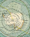
 Antarctica map.jpg 4,549 × 3,973; 6.18 MB
-
 Arctic Ocean.jpg 4,555 × 3,974; 6.66 MB
-
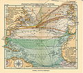
 Atlantik Suez Panama.jpg 3,979 × 4,543; 6.84 MB
-
 Chinese South Sea.jpg 3,961 × 4,549; 6.06 MB
-
 Elbe weser mündung.jpg 4,572 × 3,956; 6.37 MB
-
 Mediterranean Indian Seaports.jpg 4,550 × 3,950; 6.85 MB
-
 Mittelmeer ost.jpg 4,564 × 3,948; 6.08 MB
-
 Mittelmeer west.jpg 4,570 × 3,940; 6.29 MB
-
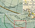 Nimrod Gruppe 1906.jpg 750 × 600; 520 KB
-
 Nordatlantik hafen.jpg 4,563 × 3,957; 6.55 MB
-
 Nordatlantik.jpg 4,555 × 3,974; 7.33 MB
-
 Nordsee.jpg 4,004 × 4,549; 6.09 MB
-
 Ost see.jpg 4,555 × 3,965; 6.72 MB
-
 Pacific ocean seaports 1906.jpg 4,572 × 3,973; 6.75 MB
-
 Singapore Strait 1906 map, from- Chinese South Sea (cropped).jpg 1,768 × 1,283; 863 KB
-
 Stiller ozean.jpg 4,555 × 3,956; 7.07 MB
-
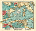
 Westindien.jpg 4,540 × 3,950; 6.46 MB
-
 Yokohama 1906 map, from- Chinese South Sea (cropped).jpg 795 × 1,033; 326 KB
.jpg)


.jpg)


.jpg)