Category:Sectional aeronautical charts
Type of aeronautical map in the United States  | |||||
| Upload media | |||||
| Subclass of |
| ||||
|---|---|---|---|---|---|
| Location |
| ||||
| |||||
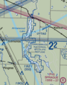
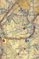
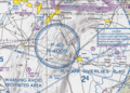
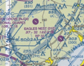
Sectional Aeronautical Charts, frequently referred to as "sectionals", are the primary navigational reference medium used by the VFR pilot community. The 1:500,000 scale Sectional Aeronautical Chart Series is designed for visual navigation of slow to medium-speed aircraft. The topographic information featured consists of the relief and a judicious selection of visual checkpoints used for flight under visual flight rules. The checkpoints include populated places, drainage patterns, roads, railroads, and other distinctive landmarks. The aeronautical information on Sectional Charts includes visual and radio aids to navigation, airports, controlled airspace, restricted areas, obstructions, and related data. These charts are updated every 56 days.
The latest can be retrieved from VFR Raster Charts
Subcategories
This category has the following 2 subcategories, out of 2 total.
Media in category "Sectional aeronautical charts"
The following 14 files are in this category, out of 14 total.
-
 34th Edition - NARA - 140696296.jpg 22,053 × 8,256; 44.01 MB
-
 Arrowwood National Wildlife Refuge on sectional aeronautical charts.png 796 × 1,006; 1.09 MB
-
 Detroit SEC.tif 17,925 × 12,380; 68.61 MB
-
 FAA SectionalSEZ Narrow.gif 674 × 1,029; 500 KB
-
 ICAO, Sectional Aeronautical Chart, San Francisco, 2008.jpg 3,612 × 2,544; 2.17 MB
-
 LAN Capital Region International Airport Sectional Chart.jpg 202 × 202; 20 KB
-
 Prohibited Area P-40 Camp David.png 1,002 × 719; 408 KB
-
 QuartzHill CA 49FebSect.jpg 293 × 279; 20 KB
-
 Twin Cities SEC.tif 17,920 × 12,357; 58.7 MB
-

-
 VOR on sectional.gif 462 × 374; 215 KB
-
 VORstefan4A.jpg 812 × 836; 200 KB
-
 Warren Grove New Jersey restricted airspace.png 434 × 343; 99 KB
-
 Washington SEC.tif 16,708 × 12,341; 54.69 MB


