Category:Scraptoft
Jump to navigation
Jump to search
English: Scraptoft is a village in Leicestershire, England that is effectively a suburb of Leicester. It has a population of about 1,500. It lies north of the A47 road out east of Leicester, and runs directly into the built up area of Thurnby and Bushby to the south. For local government the village forms part of the district of Harborough, and constitutes a civil parish.
village in Leicestershire, England, UK | |||||
| Upload media | |||||
| Instance of | |||||
|---|---|---|---|---|---|
| Location | Harborough, Leicestershire, East Midlands, England | ||||
| Population |
| ||||
| Area |
| ||||
 | |||||
Subcategories
This category has the following 3 subcategories, out of 3 total.
Media in category "Scraptoft"
The following 185 files are in this category, out of 185 total.
-

-
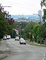
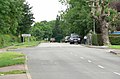 Approaching Scraptoft, near Leicester - geograph.org.uk - 470976.jpg 640 × 420; 99 KB
-
 Aqueduct across the cutting - geograph.org.uk - 2485468.jpg 2,399 × 1,884; 2 MB
-
 Atop Square Spinney Tunnel - geograph.org.uk - 2485489.jpg 2,448 × 3,264; 2.8 MB
-
 Autumn colours along Keyham Lane - geograph.org.uk - 3236467.jpg 3,791 × 2,672; 2.06 MB
-

-
 Aylestone St James Rugby Football Club - geograph.org.uk - 4314919.jpg 1,600 × 1,217; 471 KB
-
 Barkford Close, Nether Hall - geograph.org.uk - 3291074.jpg 1,024 × 768; 166 KB
-
 Beeby Road - geograph.org.uk - 5734932.jpg 1,280 × 960; 433 KB
-
 Beeby Road north of Scraptoft - geograph.org.uk - 4304816.jpg 1,600 × 1,057; 461 KB
-
 Beeby Road towards Beeby - geograph.org.uk - 3350021.jpg 640 × 470; 40 KB
-
 Beeby Road towards Scraptoft - geograph.org.uk - 3350022.jpg 640 × 454; 56 KB
-
 Beeby Road, Scraptoft - geograph.org.uk - 472570.jpg 537 × 640; 98 KB
-
 Bench mark, All Saints Church, Scraptoft - geograph.org.uk - 5735346.jpg 1,280 × 960; 577 KB
-
 Bench mark, Maomyo, Main Street, Scraptoft - geograph.org.uk - 5735116.jpg 960 × 1,280; 427 KB
-
 Bus shelter on Netherhall Road - geograph.org.uk - 4118418.jpg 1,600 × 1,212; 332 KB
-
 Bus stop on Church Hill, Scraptoft - geograph.org.uk - 3296176.jpg 1,024 × 768; 209 KB
-
 Bushby Brook - geograph.org.uk - 5099286.jpg 640 × 460; 154 KB
-

-
 Bushby Brook by Fernvale Primary School - geograph.org.uk - 5099288.jpg 640 × 379; 118 KB
-
 Bushby Brook downstream - geograph.org.uk - 5099289.jpg 640 × 469; 119 KB
-
 Bushby Brook downstream - geograph.org.uk - 5099290.jpg 640 × 476; 129 KB
-
 Church Hill - geograph.org.uk - 3487611.jpg 640 × 472; 44 KB
-
 Church of All Saints, Scraptoft - geograph.org.uk - 5735337.jpg 1,280 × 960; 389 KB
-
 Church of All Saints, Scraptoft - geograph.org.uk - 5735345.jpg 1,280 × 941; 359 KB
-
-

-
 Construction work at Briarfield Drive - geograph.org.uk - 3274763.jpg 2,934 × 2,029; 862 KB
-

-

-
 Covert Lane eastwards - geograph.org.uk - 3487650.jpg 640 × 470; 68 KB
-
 Covert Lane heading towards Scraptoft - geograph.org.uk - 4314954.jpg 1,600 × 1,098; 500 KB
-
 Covert Lane in Scraptoft - geograph.org.uk - 3274967.jpg 2,295 × 2,113; 1.55 MB
-

-

-
 Covert Lane towards Scraptoft - geograph.org.uk - 3487639.jpg 640 × 470; 67 KB
-
 Covert Lane westwards - geograph.org.uk - 3487649.jpg 640 × 489; 72 KB
-

-

-

-

-
 Driveway to Wayside Lodge - geograph.org.uk - 3487640.jpg 640 × 467; 58 KB
-
 Edith Cole Memorial Park, Scraptoft - geograph.org.uk - 5735347.jpg 1,280 × 960; 441 KB
-

-
 Entrance to Scraptoft Golf Club - geograph.org.uk - 6214235.jpg 3,776 × 2,520; 2.98 MB
-
 Entrance to Scraptoft Water Booster - geograph.org.uk - 3487642.jpg 640 × 467; 43 KB
-
 Farmland east of Scraptoft - geograph.org.uk - 4314950.jpg 1,600 × 1,200; 712 KB
-
 Farmland near Square Spinney - geograph.org.uk - 2485478.jpg 2,407 × 1,728; 1.73 MB
-
 Farmland north of Covert Lane - geograph.org.uk - 5473619.jpg 600 × 800; 122 KB
-
 Farmland to the south of Covert Lane - geograph.org.uk - 1261174.jpg 640 × 480; 69 KB
-
 Field and hedge east of Scraptoft - geograph.org.uk - 2485773.jpg 3,264 × 2,448; 3.92 MB
-
 Field boundary along Bushby Brook - geograph.org.uk - 5099316.jpg 640 × 493; 78 KB
-
 Fields by Beeby Road - geograph.org.uk - 3350023.jpg 640 × 470; 63 KB
-

-
 Footpath across the meadow - geograph.org.uk - 2485793.jpg 2,448 × 3,264; 3.66 MB
-

-

-

-

-

-

-

-
 Footpath from Hamilton Lane - geograph.org.uk - 5386033.jpg 1,200 × 1,600; 657 KB
-
 Footpath from Hamilton Lane to Scraptoft Lane - geograph.org.uk - 5379607.jpg 1,600 × 1,200; 672 KB
-

-
 Footpath from Scraptoft to Keyham - geograph.org.uk - 5896374.jpg 4,000 × 3,000; 3.66 MB
-
 Footpath next to flood relief basin - geograph.org.uk - 5099303.jpg 640 × 503; 187 KB
-

-
 Footpath through Square Spinney - geograph.org.uk - 2485782.jpg 3,264 × 2,448; 3.7 MB
-
 Footpath to Keyham - geograph.org.uk - 2485811.jpg 2,434 × 1,841; 2.04 MB
-

-
 Footpath towards Keyham - geograph.org.uk - 5735087.jpg 1,280 × 960; 362 KB
-
 Footpath towards Scraptoft - geograph.org.uk - 5099322.jpg 640 × 474; 68 KB
-
 Former aqueduct - geograph.org.uk - 3217072.jpg 640 × 424; 370 KB
-
 Former estate cottages, Main Street, Scraptoft - geograph.org.uk - 5735122.jpg 1,280 × 960; 350 KB
-
 Former GNR railway - geograph.org.uk - 3217070.jpg 640 × 424; 361 KB
-
 Gate along the footpath to Keyham - geograph.org.uk - 2485823.jpg 2,725 × 1,863; 1.96 MB
-
 Gate on the footpath to Scraptoft - geograph.org.uk - 2485762.jpg 2,222 × 2,758; 2.95 MB
-
 Gate onto farmland along Covert Lane - geograph.org.uk - 4314940.jpg 1,600 × 1,117; 649 KB
-

-
 Goodridge housing development, Scraptoft - geograph.org.uk - 6214251.jpg 3,776 × 2,520; 3.26 MB
-
 Grassy area along Keyham Lane West - geograph.org.uk - 3274896.jpg 2,820 × 1,733; 1.74 MB
-
 Grazing sheep, Beeby Road - geograph.org.uk - 5734926.jpg 1,280 × 960; 497 KB
-
 Grotto, The Mound, Scraptoft - geograph.org.uk - 5734947.jpg 1,280 × 960; 573 KB
-
 Grotto, The Mound, Scraptoft - geograph.org.uk - 5734949.jpg 1,280 × 960; 557 KB
-
 Hambleton Hall.JPG 1,600 × 1,200; 903 KB
-
 Hamilton Lane heading north - geograph.org.uk - 2962941.jpg 640 × 480; 134 KB
-
 Hamilton Lane in Nether Hall - geograph.org.uk - 3274920.jpg 4,000 × 3,000; 4.6 MB
-
 Hamilton Lane north of Scraptoft - geograph.org.uk - 3296159.jpg 1,024 × 768; 175 KB
-
 Hamilton Lane, Nether Hall - geograph.org.uk - 3291082.jpg 1,024 × 768; 313 KB
-
 Horse near Covert Lane - geograph.org.uk - 3274961.jpg 3,333 × 2,664; 3.07 MB
-

-
 Houses on Nether Hall Road - geograph.org.uk - 2962905.jpg 640 × 480; 76 KB
-
 Houses on Scraptoft Lane - geograph.org.uk - 2962900.jpg 640 × 480; 73 KB
-
 Houses on Stocks Road - geograph.org.uk - 3487613.jpg 640 × 441; 51 KB
-
 Inlet to flood relief basin - geograph.org.uk - 5099305.jpg 640 × 405; 97 KB
-
 Keyham Lane East towards Keyham - geograph.org.uk - 3350040.jpg 640 × 476; 69 KB
-
 Keyham Lane East towards Scraptoft - geograph.org.uk - 3350041.jpg 640 × 473; 62 KB
-
 Keyham Lane leading right off Keyham Lane East - geograph.org.uk - 6221305.jpg 3,776 × 2,520; 4.01 MB
-
 Keyham Lane West eastwards - geograph.org.uk - 3487600.jpg 640 × 480; 64 KB
-

-
 Keyham Lane West towards Humberstone - geograph.org.uk - 3487622.jpg 640 × 450; 55 KB
-

-
 Leticia Avenue in Scraptoft - geograph.org.uk - 5473601.jpg 800 × 532; 118 KB
-
 Long Tom at Scraptoft - geograph.org.uk - 5735350.jpg 1,280 × 960; 468 KB
-
 Main Street, Scraptoft - geograph.org.uk - 5735089.jpg 1,280 × 960; 334 KB
-
 Malsbury Avenue in Scraptoft, Leicester - geograph.org.uk - 5473607.jpg 800 × 493; 101 KB
-
 Medieval cross, Church of All Saints, Scraptoft - geograph.org.uk - 5735340.jpg 1,280 × 1,280; 415 KB
-
 Mitchell Grove Open Space and Play Area, Scraptoft - geograph.org.uk - 6214257.jpg 3,776 × 2,520; 3.12 MB
-
 Muddy path to Scraptoft Golf Club - geograph.org.uk - 3274766.jpg 2,938 × 2,287; 2.16 MB
-
 Nether Hall Road heading west - geograph.org.uk - 2962911.jpg 640 × 480; 61 KB
-
 Nether Hall, Scraptoft - geograph.org.uk - 5735105.jpg 1,280 × 960; 371 KB
-
 New housing development, Beeby Road, Scraptoft - geograph.org.uk - 5734938.jpg 1,280 × 960; 381 KB
-
 New housing development, Beeby Road, Scraptoft - geograph.org.uk - 5734941.jpg 1,280 × 960; 466 KB
-
 New housing development, Beeby Road, Scraptoft - geograph.org.uk - 5734943.jpg 1,280 × 960; 407 KB
-
 New housing development, Beeby Road, Scraptoft - geograph.org.uk - 5734945.jpg 1,280 × 960; 483 KB
-
 New Romney Crescent approaching Hamilton Lane, Leicester - geograph.org.uk - 6214472.jpg 3,776 × 2,520; 4.03 MB
-
 New Romney Crescent in Nether Hall - geograph.org.uk - 3274928.jpg 2,628 × 2,173; 1.26 MB
-
 Off Beeby Road - geograph.org.uk - 5734930.jpg 1,280 × 960; 427 KB
-
 Path to Hamilton College - geograph.org.uk - 5498298.jpg 800 × 461; 77 KB
-
 Path towards Scraptoft Golf Club - geograph.org.uk - 2962938.jpg 640 × 480; 160 KB
-
 Pavilion Road, Scraptoft - geograph.org.uk - 5734936.jpg 1,280 × 960; 290 KB
-
 Pear Tree Stores and Rose Cottage, Scraptoft - geograph.org.uk - 5735093.jpg 1,280 × 960; 341 KB
-
 Pear Tree Stores – datestone - geograph.org.uk - 5735094.jpg 1,280 × 960; 488 KB
-
 Pillar topping - geograph.org.uk - 3487614.jpg 640 × 556; 63 KB
-
 Pool near Scraptoft Hall - geograph.org.uk - 5856449.jpg 640 × 502; 131 KB
-
 Preaching cross - geograph.org.uk - 2238536.jpg 426 × 640; 75 KB
-
 Pulford Drive eastwards - geograph.org.uk - 5099306.jpg 640 × 466; 69 KB
-
 Pulford Drive westwards - geograph.org.uk - 5099307.jpg 640 × 454; 56 KB
-
 Sanitised footpath - geograph.org.uk - 5734940.jpg 1,280 × 960; 715 KB
-
 Scraptoft Brook - geograph.org.uk - 3274932.jpg 2,975 × 2,960; 3.08 MB
-
 Scraptoft Gorse - geograph.org.uk - 3487651.jpg 640 × 473; 100 KB
-
 Scraptoft Hall gates - geograph.org.uk - 5735140.jpg 1,280 × 960; 504 KB
-
 Scraptoft Hall gates and screen - geograph.org.uk - 5735144.jpg 1,280 × 960; 530 KB
-
 Scraptoft Hall, gates and screen - geograph.org.uk - 5735146.jpg 1,280 × 960; 294 KB
-
 Scraptoft Hall, main front - geograph.org.uk - 5735142.jpg 1,280 × 960; 350 KB
-
 Scraptoft Lane heading west - geograph.org.uk - 2962890.jpg 640 × 480; 90 KB
-
 Scraptoft Lane heading west - geograph.org.uk - 2962902.jpg 640 × 480; 76 KB
-
 Scraptoft signs along Beeby Road - geograph.org.uk - 4304821.jpg 1,600 × 1,000; 549 KB
-
 Scraptoft Student Union.JPG 1,600 × 1,200; 966 KB
-
 Scraptoft village sign - geograph.org.uk - 4314878.jpg 1,461 × 1,600; 486 KB
-
 Scraptoft village sign along Scraptoft Lane - geograph.org.uk - 4314858.jpg 1,600 × 1,190; 652 KB
-
 Scraptoft Water Booster - geograph.org.uk - 3487643.jpg 640 × 467; 70 KB
-
 Scraptoft Water Booster - geograph.org.uk - 3487644.jpg 640 × 476; 33 KB
-

-
 Sign at entrance to Scraptoft Hall - geograph.org.uk - 3487618.jpg 640 × 570; 104 KB
-
 Sign at entrance to Scraptoft Hall - geograph.org.uk - 3487619.jpg 640 × 504; 59 KB
-
 Sign at Scraptoft Water Booster - geograph.org.uk - 3487645.jpg 640 × 334; 36 KB
-
 Sign for Wayside Lodge - geograph.org.uk - 3487646.jpg 622 × 640; 71 KB
-

-
 Small footbridge along the footpath to Keyham - geograph.org.uk - 2485857.jpg 2,436 × 2,007; 1.85 MB
-
 Small green space on Bowhill Grove - geograph.org.uk - 5932044.jpg 640 × 346; 83 KB
-
 Sports field, Scraptoft - geograph.org.uk - 5735082.jpg 1,280 × 960; 415 KB
-
 Steep side of the railway cutting - geograph.org.uk - 2485481.jpg 3,229 × 2,046; 2.85 MB
-
 The Cottage, Hamilton Lane, Scraptoft - geograph.org.uk - 5735099.jpg 1,280 × 960; 396 KB
-
 The Cottage, Hamilton Lane, Scraptoft – detail - geograph.org.uk - 5735102.jpg 1,280 × 960; 512 KB
-
 The Cottage, Hamilton Lane, Scraptoft – detail - geograph.org.uk - 5735108.jpg 960 × 1,280; 356 KB
-
 The former Scraptoft Hall - geograph.org.uk - 5473588.jpg 800 × 618; 150 KB
-
 The former Scraptoft Hall - geograph.org.uk - 5856482.jpg 640 × 412; 70 KB
-
 The Vicarage, Scraptoft - geograph.org.uk - 5735342.jpg 1,280 × 1,280; 433 KB
-
 The White House in Scraptoft - geograph.org.uk - 3274941.jpg 3,280 × 2,578; 2.38 MB
-
 The White House, Scraptoft - geograph.org.uk - 5030162.jpg 640 × 480; 62 KB
-
 Top of Church Hill, Scraptoft - geograph.org.uk - 3296169.jpg 1,024 × 768; 239 KB
-
 Track through Scraptoft Golf Course - geograph.org.uk - 5735349.jpg 1,280 × 838; 565 KB
-
 Trailer next to the footpath - geograph.org.uk - 2485802.jpg 2,751 × 2,378; 2.51 MB
-
 View of Keyham across the fields - geograph.org.uk - 2485833.jpg 2,654 × 2,291; 2.21 MB
-
 View west along Scraptoft Lane - geograph.org.uk - 4314842.jpg 1,600 × 1,267; 598 KB
-
 Welcome to the Jimmies - geograph.org.uk - 3487648.jpg 640 × 473; 42 KB
-
 A view from Covert Lane, Scraptoft - geograph.org.uk - 470979.jpg 640 × 565; 134 KB
-
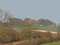 Across the fields to Ingarsby Hall - geograph.org.uk - 369017.jpg 640 × 480; 35 KB
-
 Brook Farm Cottage - geograph.org.uk - 518740.jpg 640 × 476; 95 KB
-
 Disused railway bridge - geograph.org.uk - 518717.jpg 640 × 577; 178 KB
-
 Hills and Hollows - geograph.org.uk - 369022.jpg 640 × 480; 39 KB
-
 Ingarsby Lane Junction - geograph.org.uk - 518732.jpg 640 × 480; 141 KB
-
 Ingarsby Lane near Old Ingarsby - geograph.org.uk - 518730.jpg 640 × 480; 114 KB
-
 Keyham Lane West, Nether Hall - geograph.org.uk - 472578.jpg 551 × 640; 113 KB
-
 Leicester Nuffield Hospital - geograph.org.uk - 470848.jpg 640 × 631; 135 KB
-
 Main Street, Scraptoft near Leicester - geograph.org.uk - 100428.jpg 640 × 427; 89 KB
-
 Old Ingarsby, Leicestershire - geograph.org.uk - 518728.jpg 640 × 480; 155 KB
-
 Public Bridleway - geograph.org.uk - 470999.jpg 640 × 480; 120 KB
-

-
 Scraptoft Lane, Leicester - geograph.org.uk - 470975.jpg 555 × 640; 111 KB
-
 Scraptoft Lane, Leicester - geograph.org.uk - 470977.jpg 491 × 640; 99 KB
-
 The White House, Scraptoft - geograph.org.uk - 470978.jpg 640 × 456; 133 KB
-


