Category:Schloss Interlaken
Jump to navigation
Jump to search
| Object location | | View all coordinates using: OpenStreetMap |
|---|
church building ensemble in Interlaken in the canton Bern, Switzerland _047.JPG) | |||||
| Upload media | |||||
| Instance of | |||||
|---|---|---|---|---|---|
| Part of | |||||
| Location | Interlaken, Interlaken-Oberhasli administrative district, Oberland administrative region, Bern, Switzerland | ||||
| Street address |
| ||||
| Heritage designation | |||||
 | |||||
Media in category "Schloss Interlaken"
The following 7 files are in this category, out of 7 total.
-
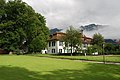
 2011-07-21-Interlaken (Foto Dietrich Michael Weidmann) 047.JPG 3,872 × 2,592; 4.12 MB
-
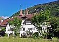
 2011-07-21-Interlaken (Foto Dietrich Michael Weidmann) 050.JPG 3,872 × 2,592; 4.41 MB
-
 6-85 Thunersee.JPG 2,272 × 1,704; 772 KB
-
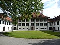
 CH-BE-Schloss 9 Interlaken (4b).jpg 3,524 × 2,519; 3.48 MB
-
 CH-BE-Schloss N.N. - Mauer südlich (1b).jpg 4,195 × 3,245; 6.12 MB
-
 Oktober 1974 in Interlaken 02.JPG 2,138 × 1,484; 640 KB
-
 Schloss Interlaken 1379.jpg 4,896 × 3,672; 3.71 MB
_050.JPG)

.jpg)
.jpg)

