Category:Schiahorn
Jump to navigation
Jump to search
| Object location | | View all coordinates using: OpenStreetMap |
|---|
mountain of the Plessur Alps  | |||||
| Upload media | |||||
| Instance of | |||||
|---|---|---|---|---|---|
| Part of |
| ||||
| Location | Grisons, Switzerland | ||||
| Mountain range | |||||
| Topographic prominence |
| ||||
| Topographic isolation |
| ||||
| Elevation above sea level |
| ||||
| Parent peak | |||||
 | |||||
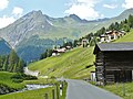
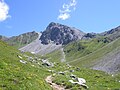
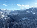
Media in category "Schiahorn"
The following 14 files are in this category, out of 14 total.
-

-
 Davos mountain panorama.jpg 5,610 × 1,035; 1.53 MB
-
 Dischmabach im Dischmatal - panoramio.jpg 3,072 × 2,304; 3.68 MB
-
 Gross und Chlein Schiahorn.jpg 2,121 × 1,056; 426 KB
-
 Haupter Tälli Strelapass2.jpg 3,072 × 2,304; 7.49 MB
-
 Mount Schiahorn.jpg 4,608 × 3,456; 4.11 MB
-
 Schanfigg as seen from Fülian (Brambrüesch) 1.jpg 3,264 × 2,448; 3.37 MB
-
 Schanfigg as seen from Fülian (Brambrüesch) 2.jpg 3,264 × 2,448; 1.31 MB
-
 Schiahorn 4.jpg 4,899 × 1,644; 11.11 MB
-
 Schiahorn 5.jpg 5,323 × 1,766; 11.74 MB
-
 Schiahorn aus Südost.jpg 1,344 × 988; 486 KB
-
 Schiahorn, Weissfluh, Weissfluhjoch and Schwarzhorn as seen from Büelenhorn (Davos).jpg 5,184 × 3,888; 4.34 MB
-
 Schiahorn1 Davos04.jpg 1,260 × 839; 532 KB
-
 Schiahorn3.jpg 2,048 × 1,536; 3.03 MB


_1.jpg)
_2.jpg)

.jpg)

