Category:Satellite pictures of volcanoes in New Zealand
Jump to navigation
Jump to search
Subcategories
This category has the following 25 subcategories, out of 25 total.
*
A
R
T
W
Media in category "Satellite pictures of volcanoes in New Zealand"
The following 4 files are in this category, out of 4 total.
-
 Lake Pupuke - satellite photo.jpg 157 × 203; 23 KB
-
 Lake Taupo landsat -square crop.jpg 776 × 776; 160 KB
-
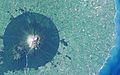 Mt. Taranaki, New Zealand.jpg 2,048 × 1,280; 1,001 KB
-
 Tongariro NP satellite.jpg 656 × 692; 348 KB


