Category:Satellite pictures of volcanoes in Japan
Jump to navigation
Jump to search
Subcategories
This category has the following 7 subcategories, out of 7 total.
Media in category "Satellite pictures of volcanoes in Japan"
The following 20 files are in this category, out of 20 total.
-
 Akan volcano meakan-dake hokkaido japan space shot.jpg 928 × 780; 209 KB
-
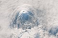 Clouds circling Mount Yōtei.jpg 1,920 × 1,280; 317 KB
-
 Eruption of Kuchinoerabu-jima 2015.jpg 600 × 400; 29 KB
-
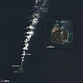
 Growth of Nishino-shima Volcanic Island.jpg 720 × 480; 111 KB
-
 Ito eruption Aira Caldera Japan.jpg 1,500 × 1,650; 370 KB
-
 Ito Ignimbrite Aira Caldera Kyushu Japan.jpg 1,630 × 1,446; 444 KB
-
 Izu Toshima ASTER.jpg 508 × 348; 35 KB
-
 Kazan-retto.jpg 1,000 × 657; 69 KB
-
 Lake ice in Kussharo and Mashū Calderas.jpg 3,840 × 2,560; 3.2 MB
-
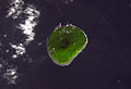
 Landsat Aogashima Island.jpg 250 × 197; 72 KB
-
 Landsat IzuOshima Island.jpg 600 × 830; 197 KB
-
 Landsat Toshima Island.jpg 112 × 140; 15 KB
-
 Mount Omuro 2004-04-29.jpg 1,944 × 1,458; 2.03 MB
-
 Mt. Aso, Japan.jpg 2,048 × 1,280; 1.1 MB
-
 New Island in Volcanic Island arc, near Japan..jpg 720 × 480; 92 KB
-
 Nishinoshima ali 2013342 lrg.jpg 1,440 × 1,440; 278 KB
-
 Nishinoshima ali 2013358.jpg 720 × 480; 29 KB
-
 Nishinoshima oli 2014089.jpg 720 × 720; 138 KB
-
 Shimabara Peninsula, Japan.jpg 2,048 × 1,280; 620 KB
-
 Shinmoe-dake Volcano Erupts on Kyushu Feb 2011.jpg 2,604 × 2,287; 1.62 MB


