Category:Satellite pictures of the Prince Edward Islands
Jump to navigation
Jump to search
Media in category "Satellite pictures of the Prince Edward Islands"
The following 17 files are in this category, out of 17 total.
-
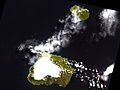
 Cloud Patterns Over the Prince Edward Islands.jpg 2,400 × 3,200; 954 KB
-
 ISS006-E-40208 - View of the Prince Edward Islands.jpg 3,032 × 2,064; 742 KB
-
 ISS006-E-40209 - View of the Prince Edward Islands.jpg 3,032 × 2,064; 743 KB
-
 ISS006-E-40210 - View of the Prince Edward Islands.jpg 3,032 × 2,064; 835 KB
-
 ISS006-E-40211 - View of the Prince Edward Islands.jpg 3,032 × 2,064; 838 KB
-
 ISS006-E-40212 - View of the Prince Edward Islands.jpg 3,032 × 2,064; 803 KB
-
 ISS006-E-40213 - View of the Prince Edward Islands.jpg 3,032 × 2,064; 828 KB
-
 ISS006-E-40214 - View of the Prince Edward Islands.jpg 3,032 × 2,064; 828 KB
-
 ISS006-E-40215 - View of the Prince Edward Islands.jpg 3,032 × 2,064; 905 KB
-
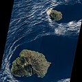
 ISS026-E-9452 - View of South Africa.jpg 4,288 × 2,929; 819 KB
-
 ISS028-E-31932 - View of Earth.jpg 4,288 × 2,848; 1.08 MB
-
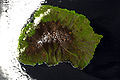 Marion Island ASTER.jpg 1,200 × 795; 261 KB
-
 Marion Island, South Africa, EO-1 ALI satellite image, 5 May 2009.jpg 3,058 × 2,222; 1.85 MB
-
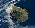
 Prince Edward Island ASTER.jpg 1,100 × 660; 188 KB
-
 Prince Edward Island, South Africa, EO-1 ALI satellite image, 5 May 2009.jpg 1,455 × 1,137; 429 KB
-
 Prince Edward Islands ASTER.jpg 1,200 × 903; 277 KB
-
 Prince Edward Islands, EO-1 ALI satellite image, 5 May 2009.jpg 5,000 × 5,000; 5.18 MB


