Category:Satellite pictures of the Palestinian territories
Jump to navigation
Jump to search
Subcategories
This category has only the following subcategory.
Media in category "Satellite pictures of the Palestinian territories"
The following 12 files are in this category, out of 12 total.
-
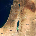
 Aerial jordan.jpg 248 × 479; 37 KB
-
 Al-Lajat (Traconitide argob trachonities).png 1,394 × 1,775; 3.48 MB
-
 Gaza International Airport NASA.JPG 624 × 693; 133 KB
-
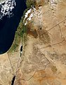
 MiddleEast A2003031 0820 250m without lines.jpg 2,200 × 2,800; 1.7 MB
-
 MiddleEast.A2003031.0820.250m (cropped-01).jpg 826 × 1,754; 662 KB
-
 MiddleEast.A2003031.0820.250m (cropped-02).jpg 549 × 635; 191 KB
-
 MiddleEast.A2003031.0820.250m.jpg 2,200 × 2,800; 1.19 MB
-
 Modis near east.jpg 540 × 540; 80 KB
-
 Near east lrg.jpg 2,987 × 3,967; 2.62 MB
-
 Satellite picture of the Palestinian territories.jpg 292 × 557; 24 KB
-
 West Bank July 2008 CIA remote-sensing map 3000px.jpg 3,000 × 4,198; 10.39 MB
-
 West Bank July 2008 CIA remote-sensing map.jpg 10,984 × 15,369; 45.83 MB

.png)


.jpg)
.jpg)


