Category:Satellite pictures of the Himalayas
Jump to navigation
Jump to search
Subcategories
This category has the following 6 subcategories, out of 6 total.
Media in category "Satellite pictures of the Himalayas"
The following 74 files are in this category, out of 74 total.
-
 2020-10-14-00 00 2020-10-14-23 59 Sentinel-2 L2A 1 TRUE COLOR.jpg 442 × 228; 53 KB
-
 A land cover map of the HKH region was developed using Landsat 30-meter data..png 1,859 × 1,050; 3.29 MB
-
 AS07-07-1748.jpg 4,096 × 4,096; 2.75 MB
-
 AS09-20-3173 (21750445008).jpg 4,400 × 4,600; 859 KB
-
 ASTER Views the Himalaya.jpg 3,648 × 3,648; 3.73 MB
-
 Attabad Lake 2011-09-04.jpg 720 × 360; 188 KB
-
 China satellite.png 1,278 × 956; 2.02 MB
-
 Climate Change threatens glaciers in the Himalayas.jpg 4,410 × 2,540; 6.04 MB
-
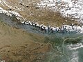
 Earth from Space- A veil of haze and smoke ESA25954650.jpg 4,627 × 5,524; 22.67 MB
-
 Earth from Space- A veil of haze and smoke ESA25954650.tiff 4,627 × 5,524; 185.61 MB
-
 Envisat's MERIS image over the Himalayas ESA226457.jpg 1,069 × 1,069; 1.66 MB
-
 Envisat's MERIS image over the Himalayas ESA226457.tiff 1,069 × 1,069; 3.28 MB
-
 EverestMosaic.jpg 10,800 × 2,780; 2.74 MB
-
 Glacial lakes, Bhutan.jpg 3,000 × 1,665; 1.98 MB
-
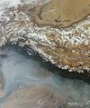
 Haze along the Himalaya - NASA Earth Observatory.jpg 720 × 480; 139 KB
-
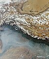
 Haze along the Himalayas (MODIS 2024-04-26).jpg 5,891 × 4,415; 3.29 MB
-
 High Asia Mountain Ranges.jpg 5,600 × 4,400; 10.79 MB
-
 Highestmtns.jpg 2,999 × 2,249; 654 KB
-
 Himalaya 85.30820E 32.11063N.jpg 1,280 × 958; 293 KB
-
 Himalaya composite.jpg 1,947 × 981; 659 KB
-
 Himalaya Mosaik.jpg 1,263 × 325; 99 KB
-
 Himalayan foreland basin.png 3,389 × 1,966; 5.91 MB
-
 Himalayan Glacier, Southern China 2009-12-25. lrg.jpg 3,000 × 3,000; 4.41 MB
-
 Himalayan Glacier, Southern China 2009-12-25.jpg 720 × 720; 355 KB
-
 Himalayan Mountains - Envisat.jpg 2,241 × 2,241; 1.43 MB
-
 Himalayan Mountains ESA231048.tiff 2,241 × 2,241; 14.39 MB
-
 Himalayas (4404818798).jpg 7,281 × 7,273; 17.53 MB
-
 Himalayas 2017 01 11 (32249124115).jpg 9,632 × 5,191; 10.95 MB
-

-
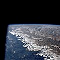
 Himalayas from ISS.jpg 800 × 530; 164 KB
-
 Himalayas landsat 7.png 990 × 609; 1.17 MB
-
 Himalayas Mountain Range & Mahalangur Himal, Nepal - Tibet (China) (34954655592).jpg 25,386 × 26,207; 74.16 MB
-
 Himalayas with territorial boundaries.png 990 × 609; 1.19 MB
-
 Hindu Kush and Karakoram peaks annotated (NASA satellite Terra MODIS).png 1,181 × 606; 1.42 MB
-
 Hindu Kush satellite image.jpg 5,600 × 4,400; 5.01 MB
-
 Hunza Valley Landslide Lake (cropped).jpg 2,400 × 1,704; 2.11 MB
-
 Hunza Valley Landslide Lake.jpg 2,400 × 3,600; 4.24 MB
-
 Hymalayas 86.15103E 31.99726N.jpg 1,280 × 958; 288 KB
-
 ISS-43 Himalaya range near the China–India border.jpg 4,928 × 3,280; 5.09 MB
-
 ISS-44 Himalayas.jpg 4,928 × 3,280; 2.1 MB
-
 ISS-46 Lake Rakshastal, Tibet.jpg 1,600 × 1,065; 458 KB
-
 ISS-47 Himalaya Mountains.jpg 3,280 × 4,928; 4.76 MB
-
 ISS-53 Himalayan mountain range.jpg 4,928 × 3,280; 4.23 MB
-
 ISS-54 Nepal and the Himalayan mountain range.jpg 5,568 × 3,712; 4.19 MB
-
 ISS-57 Himalayan mountain range.jpg 2,768 × 4,928; 1.67 MB
-
 ISS-64 India, the Himalayas and China.jpg 5,568 × 3,712; 1.88 MB
-
 ISS-64 The Himalayas separating China from India and Nepal.jpg 3,712 × 5,568; 2.55 MB
-
 ISS-Karakoram.JPG 2,992 × 1,974; 2.82 MB
-
 ISS031-E-67020 Himalayas.jpeg 4,288 × 2,848; 1.37 MB
-
 ISS053-E-317703 - View of Nepal.jpg 5,568 × 3,712; 2.37 MB
-
 Iss068e044967.jpeg 5,568 × 3,712; 2.28 MB
-
 Iss068e047345.jpeg 4,928 × 2,768; 1.44 MB
-
 Iss068e047346.jpeg 4,928 × 2,768; 1.1 MB
-
 Iss068e051118.jpg 720 × 480; 237 KB
-
 Iss070e091714.jpg 3,712 × 5,568; 3.12 MB
-
 Iss070e097638.jpg 5,568 × 3,712; 3.47 MB
-
 Karakoram Nasa.JPG 540 × 405; 67 KB
-
 Karakorum (Satellite picture) - 2.jpg 5,568 × 3,712; 2.94 MB
-
 Karakorum (Satellite picture).jpg 5,568 × 3,712; 2.89 MB
-
 Kathmandu, Nepal ESA367157.jpg 6,084 × 7,665; 75.8 MB
-
 L9 himalaya hyperwall rgb nolabels.jpg 5,760 × 3,240; 14.28 MB
-
 Landslide Lake in Northwest Pakistan (cropped).jpg 1,416 × 931; 724 KB
-
 Landslide Lake in Northwest Pakistan.jpg 2,000 × 3,000; 2.96 MB
-
 Mount Makalu, Himalayas ESA395402.jpg 4,056 × 3,362; 3.17 MB
-
 Mount Makalu, Himalayas ESA395402.tiff 4,056 × 3,362; 30.51 MB
-
 Mount-Imeon.PNG 2,800 × 2,200; 6.64 MB
-
 Mt Kailash sat.jpg 1,152 × 828; 652 KB
-
 NASA-Himalaya-Tibet.jpg 686 × 524; 432 KB
-
 Nepal Himalaya peaks annotated (NASA satellite Terra MODIS).png 1,204 × 666; 1.47 MB
-
 North Col of Mount Everest.jpg 720 × 480; 165 KB
-

-
 Snow Across the Himalayas and Kunlun Mountains (MODIS).jpg 6,098 × 4,676; 4.37 MB
-
-
 TibetplateauA2002144.0440.500m.jpg 2,100 × 1,600; 1,002 KB


.jpg)


.jpg)


.jpg)
.jpg)


_(34954655592).jpg)

.png)

.jpg)


_-_2.jpg)
.jpg)


.jpg)


.png)


.jpg)
_show_the_high,_arid,_Tibetan_Plateau_in_Asia._Tibet_lies_north_of_the_Himalaya_Mountains_in_Nepal---Tibet.A2002343.0445.1km.jpg)
