Category:Satellite pictures of oil spills
Jump to navigation
Jump to search
Subcategories
This category has only the following subcategory.
Media in category "Satellite pictures of oil spills"
The following 28 files are in this category, out of 28 total.
-
 1 mark (40105133330).jpg 3,669 × 2,062; 4.71 MB
-
 2 mark (28041842068).jpg 1,834 × 1,031; 740 KB
-
 Arctic Circle oil spill ESA22056844.gif 1,059 × 1,059; 2.01 MB
-
 Close-up of Lake Maracaibo, Venezuela.jpg 2,040 × 2,172; 3.32 MB
-
 Cyprus coastline threatened by an oil spill (Copernicus).jpg 4,000 × 2,540; 8.22 MB
-

-
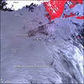
 Diesel oil spill in Arctic Circle.jpg 3,508 × 2,533; 9.35 MB
-
 Diesel oil spill in the Arctic Circle – Update September 2020.jpg 4,790 × 2,535; 4.79 MB
-
 Guimaras oil spill map with labels.jpg 540 × 540; 113 KB
-
 Guimaras oil spill map.jpg 2,015 × 2,015; 1.57 MB
-
 Jiyyeh oil spill 2006 NASA ASTER.jpg 3,000 × 4,000; 3.17 MB
-
 Jiyyeh oil spill Lebanon 2006 NASA MODIS.jpg 752 × 1,332; 714 KB
-

-
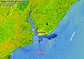
 Mauritius oil spill ESA22170164.jpeg 1,222 × 1,144; 1.64 MB
-
 Norilsk oil spill may 31 2020 sentinel-2 esa.jpg 1,200 × 675; 178 KB
-
 Oil Slick in the Timor Sea September-2009.jpg 4,448 × 2,224; 3.1 MB
-

-
 Oil Spill in Mauritius (New Image of 16 August).jpg 3,538 × 2,540; 845 KB
-
 Oil Spill in Mauritius.jpg 3,508 × 2,540; 1.69 MB
-
 Oil spill in the Morrocoy National Park - Venezuela.jpg 3,508 × 2,592; 3.51 MB
-
 Philippines Sunken Tanker (2023-03-29-01-19-42 UMBRA-04).tiff 6,754 × 6,754, 5 pages; 66.51 MB
-
 Philippines Sunken Tanker (ed280b5b-834b-4ad8-8c8a-eb14a007deac).tiff 6,690 × 6,691, 5 pages; 66.51 MB
-
 Sentinel balikpapan oil spill.jpg 960 × 679; 232 KB
-
 Sentinel-1 (IW-VVVH) image on 2020-08-11 (1).jpg 944 × 314; 118 KB
-
 Sentinel-1 (IW-VVVH) image on 2020-08-11.jpg 944 × 314; 165 KB
-
 Sentinel-2 L1C image on 2020-08-09 (2).jpg 944 × 314; 40 KB
-
 Sentinel-2 L1C image on 2020-10-23.jpg 944 × 314; 118 KB
-
 Tobago oil spill ESA25487958.gif 1,920 × 1,440; 7.25 MB
.jpg)
.jpg)


.jpg)
.jpg)


.jpg)


.jpg)
_image_on_2020-08-11_(1).jpg)
_image_on_2020-08-11.jpg)
.jpg)