Category:Satellite pictures of Nouvelle-Aquitaine
Jump to navigation
Jump to search
Administrative regions and territorial collectivity of Metropolitan France (‡ since start of 2016):
Auvergne-Rhône-Alpes‡ · Bourgogne-Franche-Comté‡ · Brittany · Centre-Val de Loire · Corsica · Grand Est‡ · Hauts-de-France‡ · Île-de-France · Normandy‡ · New Aquitaine‡ · Occitania‡ · Pays de la Loire · Provence-Alpes-Côte d'Azur
Former administrative regions of Metropolitan France (until end of 2015):
Alsace
Overseas departments and regions: Guadeloupe · Martinique · French Guiana · Réunion · Mayotte
Overseas collectivities: Saint Barthélemy · Saint-Martin · Saint Pierre and Miquelon · French Polynesia · Wallis and Futuna · French Southern and Antarctic Lands+
Sui generis territories: New Caledonia · Clipperton Island+
Subcategories
This category has the following 3 subcategories, out of 3 total.
C
Media in category "Satellite pictures of Nouvelle-Aquitaine"
The following 9 files are in this category, out of 9 total.
-
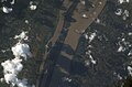
 ISS016-E-9626 - View of France.jpg 3,032 × 2,008; 942 KB
-
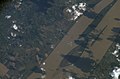
 ISS016-E-9627 - View of France.jpg 3,032 × 2,008; 954 KB
-
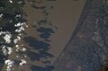
 ISS016-E-9628 - View of France.jpg 3,032 × 2,008; 898 KB
-
 ISS016-E-9629 - View of France.jpg 3,032 × 2,008; 948 KB
-
 ISS016-E-9630 - View of France.jpg 3,032 × 2,008; 1,003 KB
-
 ISS016-E-9631 - View of France.jpg 3,032 × 2,008; 997 KB
-
 ISS016-E-9632 - View of France.jpg 3,032 × 2,008; 971 KB
-
 ISS018-E-15674 - View of France.jpg 3,072 × 2,040; 539 KB
-
 Vue aérienne du lac de Caussade (Pinel-Hauterive, Lot et Garonne, France).png 1,141 × 671; 1.06 MB


.png)