Category:Satellite pictures of North America
Jump to navigation
Jump to search
Satellite pictures of the continent of North America (or major features there of) and adjacent island nations, plus satellite pictures of individual countries in their respective sub-categories.
Subcategories
This category has the following 45 subcategories, out of 45 total.
!
+
- Satellite pictures of Guadeloupe (88 F)
A
B
- Satellite pictures of Barbados (57 F)
C
D
- Satellite pictures of Dominica (18 F)
G
- Landsat images of Greenland (18 F)
- Satellite pictures of Grenada (14 F)
H
M
- Satellite pictures of Martinique (23 F)
N
P
S
- Satellite pictures of Saba (4 F)
T
U
Media in category "Satellite pictures of North America"
The following 97 files are in this category, out of 97 total.
-
 1024px-Antichthon.jpg 2,048 × 2,048; 729 KB
-
 2009 Christmas Storm 12-24.jpg 3,124 × 2,387; 839 KB
-
 2021 JTWC 01E IR satellite imagery.jpg 1,024 × 1,024; 791 KB
-
 A Satellite View of a Back-door Cold Front (14295309881).jpg 3,600 × 3,000; 1.54 MB
-
 Amerikanisches Mittelmeer NASA World Wind Globe.jpg 1,600 × 1,050; 753 KB
-
 Beardmore Relics (map).jpg 974 × 740; 427 KB
-
 Blue Marble.jpg 1,600 × 1,200; 275 KB
-
 Boucle GOES8-1998-01 07-09.gif 400 × 300; 1.01 MB
-
 Canada–US heatwave (51283106611).jpg 1,920 × 1,358; 2.73 MB
-
 Carbon monoxide from fires in Canada ESA24926246.jpg 1,920 × 1,618; 2.79 MB
-
 Caribbean satellite view 2.png 1,527 × 970; 1.27 MB
-
 Caribbean satellite view.png 1,527 × 970; 1.02 MB
-
 Comparison of Earth and Moon size experiments 2.jpg 2,050 × 2,050; 602 KB
-
 Debby 12-06-24 overview.jpg 1,500 × 800; 1.25 MB
-
 DSCOVR 2021-09-26.png 2,048 × 2,048; 3.3 MB
-
 Earth June Solstice 2022.jpg 10,848 × 10,848; 109.53 MB
-
 Earth on April 21 2023.png 4,096 × 2,048; 16.88 MB
-
 Earth on August 7, 2022.png 2,048 × 2,048; 3.15 MB
-
 Earth viewed by GOES-16 2023-03-11 1700Z.jpg 10,848 × 10,848; 127.79 MB
-
 Earthatnight.jpg 640 × 480; 69 KB
-
 Earthobservatory Mexico.JPG 1,001 × 523; 49 KB
-
 Fiona, Gaston, Hermine and 09L on September 23, 2022.png 6,670 × 4,170; 53.35 MB
-
 GOES 16 1750z 2021-06-15.jpg 10,848 × 10,848; 85.54 MB
-
 GOES 16 2021-08-25 2010Z.jpg 12,428 × 6,518; 13.69 MB
-
 GOES 16 2021-10-18 1630Z.jpg 10,848 × 10,848; 86.43 MB
-
 GOES 16 2021-11-01 1440Z.jpg 10,848 × 10,848; 81.66 MB
-
 GOES 16 2022-12-01 1600Z.jpg 10,848 × 10,848; 115.05 MB
-
 GOES 16 Advanced Baseline Imager multi-channel of North America 20170115 1807.png 2,406 × 1,526; 4.3 MB
-
 GOES 16 Full Western Hemisphere 20170115 1807.jpg 10,848 × 10,824; 26.89 MB
-
 GOES 16 on August 21 2017.jpg 10,848 × 10,848; 140.99 MB
-
 GOES East Captures View of Vernal Equinox (47418902822).jpg 1,920 × 1,080; 262 KB
-
 GOES East Coast View March 6, 2010 (4410346285).jpg 3,600 × 3,000; 1.65 MB
-
 GOES Satellites 2021-11-06 1540Z.jpg 2,047 × 1,415; 694 KB
-
 GOES US East Coast View March 9, 2010 (4420032720).jpg 3,600 × 3,000; 1.45 MB
-
 GOES-11 Sees Approaching Rainmaker to Add to Snowmelt on Columbia River (5754836133).jpg 3,600 × 3,000; 1.64 MB
-
 Goes-16-ir-with--source-s-logo.png 5,833 × 5,768; 48.17 MB
-
 GOES-17 Imagery from all 16 of the Advanced Baseline Imager's Channels (43904871081).gif 1,926 × 1,206; 1.39 MB
-
 Great Lakes ESA357715.jpg 2,481 × 2,162; 1.47 MB
-
 Great Lakes Region Slammed By Severe Winter Storm (49305407947).jpg 1,920 × 1,080; 1.42 MB
-
 Hudson Bay from space.png 1,527 × 970; 1.63 MB
-
 Ice storm Wv loop.gif 602 × 400; 1.79 MB
-
 Idalia and Franklin 2023-08-29 1630Z.jpg 3,000 × 3,000; 9.79 MB
-
 Image of San Francisco, CA from Umbra space radar.tif 13,166 × 13,168, 6 pages; 228.77 MB
-
 Incendi.jpg 1,100 × 880; 261 KB
-
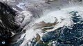
 Intense snowfall gripped North America.jpg 4,410 × 2,540; 5.45 MB
-
 ISS047-E-96688 - View of Earth.jpg 4,928 × 3,280; 2.3 MB
-
 Lake Michigan and Jupiter on November 14, 1969, cropped from AS12-50-7325.png 3,816 × 1,241; 26.69 MB
-
 Lake St Clair ESA21485544.jpeg 1,647 × 1,280; 3.14 MB
-
 Lake St Clair ESA21485544.tiff 10,980 × 8,534; 268.12 MB
-
 MAP.USA Relief east.jpg 202 × 242; 33 KB
-
 MAP.USA Relief middle.jpg 162 × 242; 30 KB
-
 MAP.USA Relief west.jpg 195 × 198; 45 KB
-
 Mesoamerica satellite image.jpg 1,578 × 1,158; 213 KB
-
 Mexicali 2017 03 12 (33296255591).jpg 3,200 × 3,328; 2.74 MB
-
 Monster snowstorm hits Chicago (5410244219).jpg 1,652 × 976; 327 KB
-
 Mundo Maya, Meso-America.png 1,793 × 1,488; 4.76 MB
-
 N. Am. frm space.PNG 535 × 535; 287 KB
-
 NASA Satellite Gives a Clear View for NASA's LADEE Launch (9685915701).jpg 3,600 × 3,000; 1.62 MB
-

-
 NASA.EOS.79810.Suomi NPP night bakken.vir 2012317.jpg 720 × 480; 153 KB
-
 Noord-Amerika reliëf.jpg 9,600 × 7,240; 53.49 MB
-
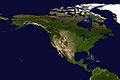
 North America satellite globe.jpg 686 × 800; 94 KB
-
 North America satellite orthographic.jpg 1,624 × 1,748; 474 KB
-
 North America from low orbiting satellite Suomi NPP.jpg 8,000 × 8,000; 16.43 MB
-
 North America on April 16, 1972, cropped from AS16-118-18878.png 10,647 × 7,234; 421.83 MB
-
 North America on April 16, 1972, cropped from AS16-118-18879.png 12,000 × 8,000; 307.18 MB
-
 North America on April 16, 1972, cropped from AS16-118-18880.png 10,843 × 8,874; 552.34 MB
-
 North America on July 26, 1971, cropped from AS15-91-12344.png 3,377 × 3,377; 61.15 MB
-
 North America satellite globe Pacific Coast Ranges.jpg 514 × 599; 77 KB
-
 North America satellite.jpg 900 × 900; 513 KB
-
 North America topic image Satellite image.jpg 5,665 × 3,777; 6.77 MB
-
 North American ice storm 2017-01-15 (cropped).jpg 1,041 × 513; 546 KB
-
 North American ice storm 2017-01-15.jpg 5,200 × 3,580; 14.63 MB
-
 North hemisphere on June 15, 2017.png 2,036 × 1,389; 2.7 MB
-
 Northa America satellite globe 2.jpg 800 × 657; 79 KB
-
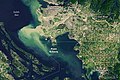
 Pointrobertswide oli 2020210 lrg.jpg 2,695 × 1,797; 5.68 MB
-
 Pointrobertswide oli 2020210.jpg 720 × 480; 508 KB
-
 Pointrobertszm oli 2020210.jpg 720 × 600; 368 KB
-
 Satellite Image of January 27th Snowstorm (5395334509).jpg 3,000 × 2,500; 4.36 MB
-

-
 Satellite Super Outbreak 1974-04-03 21 GMT.gif 650 × 483; 252 KB
-
 Satellite View of Eastern US on Feb. 2, 2014 (12270676485).jpg 3,600 × 3,000; 1.44 MB
-
 Snow in the Rockies (6460593469).jpg 4,400 × 5,600; 5.79 MB
-
 Spac0571 - Flickr - NOAA Photo Library.jpg 2,500 × 1,875; 474 KB
-
 Spac0575 - Flickr - NOAA Photo Library.jpg 1,280 × 960; 213 KB
-
 Spac0585 - Flickr - NOAA Photo Library.jpg 1,920 × 1,080; 578 KB
-
 Strong Extratropical Cyclone Over the US Midwest (5124467559).jpg 1,211 × 862; 875 KB
-
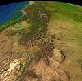 The Rocky Mountains.jpg 954 × 941; 150 KB
-
 Two Large Winter Storms to Wallop Parts of the U.S.jpg 1,920 × 1,080; 1.94 MB
-
 Unprecedented smoke cloud over the US West Coast and Pacific Ocean.jpg 3,514 × 2,547; 1.64 MB
-

-

-

-
 USA-satellite.jpg 1,082 × 675; 391 KB
-
 West Coast of North America satellite orthographic.jpg 384 × 1,000; 91 KB
-
 West Coast of North America satellite orthographic.png 383 × 1,000; 467 KB
-
 Worldview Tour- Atmospheric Rivers (SVS5180 - Worldview AtmosphericRivers).png 3,548 × 1,822; 7.99 MB


.jpg)

.jpg)


.jpg)


.jpg)
.jpg)

.jpg)
.jpg)
.gif)

.jpg)


.jpg)
.jpg)


.jpg)


.jpg)


.jpg)
.jpg)


.jpg)


.png)
.jpg)