Category:Satellite pictures of Lake Malawi
Jump to navigation
Jump to search
Media in category "Satellite pictures of Lake Malawi"
The following 17 files are in this category, out of 17 total.
-
 Biomass Burning, Southern Africa.JPG 4,256 × 2,832; 4.84 MB
-
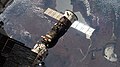
 ISS-60 Progress MS-11 shortly before undocking, crop.jpg 2,516 × 1,523; 571 KB
-
 ISS-60 Progress MS-11 shortly before undocking.jpg 4,928 × 2,768; 1.85 MB
-
 ISS063-E-95854 - View of Earth.jpg 5,568 × 3,712; 3.73 MB
-
 ISS063-E-95855 - View of Earth.jpg 5,568 × 3,712; 3.74 MB
-
 ISS063-E-95856 - View of Earth.jpg 5,568 × 3,712; 3.76 MB
-
 ISS063-E-95857 - View of Earth.jpg 5,568 × 3,712; 3.77 MB
-
 Lake Malawai (MODIS 2019-11-01).jpg 4,198 × 3,327; 3.9 MB
-
 Lake Malawi 34.60837E 11.93308S.jpg 1,280 × 958; 151 KB
-
 Lake Malawi park.jpg 301 × 158; 8 KB
-
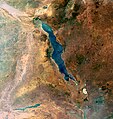
 Lake Malawi seen from orbit.jpg 2,778 × 3,628; 3.24 MB
-
 Lake Malawi, Great Rift Valley ESA205475.tiff 3,293 × 3,482; 39.15 MB
-
 Lake Malawi, Great Rift Valley.jpg 3,293 × 3,482; 12.78 MB
-
 Lake Nyasa from Orbit , Dec 1993.jpg 5,304 × 5,258; 9.72 MB
-
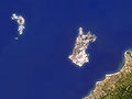 Likoma (satellite).jpg 800 × 600; 172 KB
-
 Likoma sentinel2 (airport).jpg 524 × 1,135; 84 KB
-
 Likoma sentinel2.jpg 3,847 × 5,025; 1.44 MB


.jpg)


.jpg)
.jpg)
