Category:Satellite pictures of Hurricane Charley
Jump to navigation
Jump to search
Media in category "Satellite pictures of Hurricane Charley"
The following 25 files are in this category, out of 25 total.
-
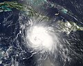 Charley 2004-08-11 1815Z.jpg 6,000 × 4,800; 4.37 MB
-
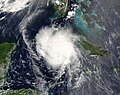 Charley 2004-08-12 1555Z.jpg 6,600 × 5,200; 5.71 MB
-
 Charley 2004-08-13 1210Z.jpg 1,000 × 750; 284 KB
-
 Charley 2004-08-13 1621Z.jpg 720 × 635; 158 KB
-
 Charley 2004-08-13 1630Z.png 1,050 × 1,400; 2.31 MB
-
 Charley 2004-08-13 1635Z (cropped).jpg 4,000 × 4,000; 2.36 MB
-
 Charley 2004-08-13 1635Z.jpg 4,800 × 6,400; 4.95 MB
-
 Charley 2004-08-13 1745Z.jpg 1,920 × 1,200; 350 KB
-
 Charley 2004-08-13 1815Z.png 1,800 × 1,800; 3.53 MB
-
 Charley 2004-08-13 1932Z.jpg 720 × 506; 144 KB
-
 Charley 2004-08-13 1940Z.jpg 720 × 527; 173 KB
-
 Charley 2004-08-13 2140Z.jpg 720 × 506; 141 KB
-
 Charley 2004-08-13 Landfall.gif 600 × 436; 8.11 MB
-
 Charley 2004-08-14 1445Z.jpg 700 × 452; 95 KB
-
 Charley IR loop.gif 360 × 270; 1.23 MB
-
 Charley Landfall.gif 360 × 270; 779 KB
-
 Charley Rapid Deepening.jpg 1,920 × 1,200; 234 KB
-
 Charley VIS loop.gif 360 × 270; 2.8 MB
-
 CharleyGOES12.gif 640 × 480; 74 KB
-
 Charleymontage.jpg 800 × 600; 449 KB
-
 CharleyNOAA16.gif 640 × 480; 114 KB
-
 CharleyTERRA.gif 640 × 480; 90 KB
-
 Hurricane Charley IR.jpg 161 × 293; 13 KB
-
 HurricaneCharley1.JPG 1,919 × 1,199; 217 KB
-
 Tropical Cyclones Bonnie and Charley (2004).jpg 1,920 × 1,200; 333 KB


.jpg)


.jpg)