Category:Sark Lighthouse
Jump to navigation
Jump to search
| Object location | | View all coordinates using: OpenStreetMap |
|---|
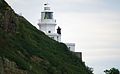
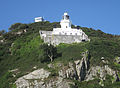
English: Sark Lighthouse
lighthouse at Point Robert, Sark, Guernsey .jpg) | |||||
| Upload media | |||||
| Instance of | |||||
|---|---|---|---|---|---|
| Location | Sark, Guernsey | ||||
| Located in or next to body of water | |||||
| Inception |
| ||||
| Significant event |
| ||||
 | |||||
Media in category "Sark Lighthouse"
The following 7 files are in this category, out of 7 total.
-
 Faro de Sark.jpg 3,456 × 5,184; 3.92 MB
-
 Lighthouse at Point Robert, Sark - geograph.ci - 63.jpg 640 × 422; 60 KB
-
 Point Robert, Sèr.jpg 3,671 × 2,265; 623 KB
-
 Sark July 2011 29.jpg 3,093 × 1,921; 3.83 MB
-
 Sark July 2011 31.jpg 3,677 × 2,684; 7.99 MB
-
 Sark July 2011 33.jpg 3,500 × 2,248; 5.18 MB
-
 SarkLighthouse (35308477483).jpg 4,320 × 3,240; 2.96 MB


